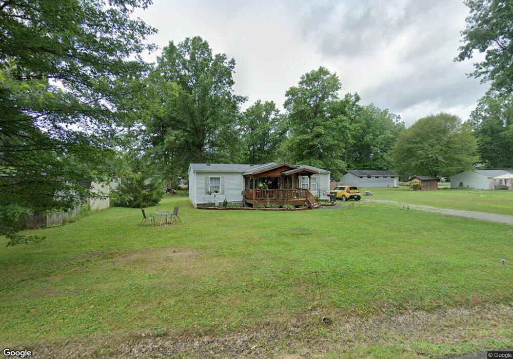
14584 Ardmore Dr NE Alliance, OH 44601
Estimated Value: $103,000 - $129,000
3
Beds
2
Baths
1,120
Sq Ft
$107/Sq Ft
Est. Value
About This Home
This home is located at 14584 Ardmore Dr NE, Alliance, OH 44601 and is currently estimated at $120,000, approximately $107 per square foot. 14584 Ardmore Dr NE is a home located in Stark County with nearby schools including Marlington High School and Regina Coeli/St Joseph School.
Ownership History
Date
Name
Owned For
Owner Type
Purchase Details
Closed on
Mar 4, 2009
Sold by
Secretary Of Housing & Urban Development
Bought by
Myers Cheryl A
Current Estimated Value
Purchase Details
Closed on
Jan 4, 2008
Sold by
Difloure Brenda L and Difloure William F
Bought by
Hud
Purchase Details
Closed on
Mar 2, 2006
Sold by
Ritenour Brad A and Ritenour Mindy S
Bought by
Difloure William F and Difloure Brenda L
Home Financials for this Owner
Home Financials are based on the most recent Mortgage that was taken out on this home.
Original Mortgage
$58,758
Interest Rate
6.2%
Mortgage Type
FHA
Purchase Details
Closed on
Feb 14, 2005
Sold by
Federal Home Loan Mortgage Corporation
Bought by
Ritenour Brad A and Ritenour Mindy S
Home Financials for this Owner
Home Financials are based on the most recent Mortgage that was taken out on this home.
Original Mortgage
$44,143
Interest Rate
5.83%
Mortgage Type
Purchase Money Mortgage
Purchase Details
Closed on
Jul 2, 2004
Sold by
Mitchell Jesse A and Mitchell Darra
Bought by
Federal Home Loan Mortgage Corporation
Create a Home Valuation Report for This Property
The Home Valuation Report is an in-depth analysis detailing your home's value as well as a comparison with similar homes in the area
Home Values in the Area
Average Home Value in this Area
Purchase History
| Date | Buyer | Sale Price | Title Company |
|---|---|---|---|
| Myers Cheryl A | $16,000 | Lakeside Title & Escrow Agen | |
| Hud | $50,000 | None Available | |
| Difloure William F | $59,300 | The Talon Group | |
| Ritenour Brad A | -- | -- | |
| Federal Home Loan Mortgage Corporation | $50,000 | -- |
Source: Public Records
Mortgage History
| Date | Status | Borrower | Loan Amount |
|---|---|---|---|
| Previous Owner | Difloure William F | $58,758 | |
| Previous Owner | Ritenour Brad A | $44,143 |
Source: Public Records
Tax History Compared to Growth
Tax History
| Year | Tax Paid | Tax Assessment Tax Assessment Total Assessment is a certain percentage of the fair market value that is determined by local assessors to be the total taxable value of land and additions on the property. | Land | Improvement |
|---|---|---|---|---|
| 2025 | -- | $30,910 | $8,720 | $22,190 |
| 2024 | -- | $30,910 | $8,720 | $22,190 |
| 2023 | $1,052 | $18,800 | $3,260 | $15,540 |
| 2022 | $985 | $18,800 | $3,260 | $15,540 |
| 2021 | $1,046 | $18,800 | $3,260 | $15,540 |
| 2020 | $654 | $16,070 | $2,800 | $13,270 |
| 2019 | $650 | $16,070 | $2,800 | $13,270 |
| 2018 | $651 | $16,070 | $2,800 | $13,270 |
| 2017 | $699 | $16,140 | $1,470 | $14,670 |
| 2016 | $699 | $16,140 | $1,470 | $14,670 |
| 2015 | $736 | $17,780 | $1,470 | $16,310 |
| 2014 | $696 | $15,370 | $1,300 | $14,070 |
| 2013 | $347 | $15,370 | $1,300 | $14,070 |
Source: Public Records
Map
Nearby Homes
- 14422 Sturbridge Rd NE
- 14723 Bolton St NE
- 0 Johnson Ave NE Unit 5142926
- 0 Homestead Ave NE
- 0 Klinger Ave NE
- 0 Meadowbrook Ave
- 000 Klinger Ave
- 11480 Aebi Ave NE
- 432 Johnson Ave
- 15520 Coalbank St NE
- 11344 Walnut Ave NE
- 511 W Ely St
- 0 Knoll St NE
- 13109 Edison St NE
- 124 E Wayne St
- 505 N Union Ave
- 15832 Waverly St NE
- 15995 Elbrook St NE
- 710 N Freedom Ave
- 15789 Coalbank St NE
- 14596 Ardmore Dr NE
- 14573 Spruce Dr NE
- 14595 Ardmore Dr NE
- 12032 Mercer Rd NE
- 14585 Spruce Dr NE
- 12034 Mercer Rd NE
- 14621 Ardmore Dr NE
- 14550 Spruce Dr NE
- 14566 Spruce Dr NE
- 11991 Mercer Rd NE
- 11931 Northside Rd NE
- 14578 Spruce Dr NE
- 12037 Mercer Rd NE
- 14633 Ardmore Dr NE
- 11950 Northside Rd NE
- 14600 Spruce Dr NE
- 14600 Spruce Dr NE
- 14485 Spruce Dr NE
- 14491 Gaskill Dr NE
- 14502 Spruce Dr NE