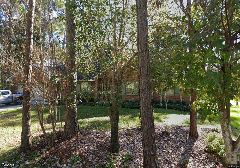
1459 Manatee Cove Dr Fleming Island, FL 32003
Estimated Value: $452,826 - $476,000
3
Beds
2
Baths
2,070
Sq Ft
$223/Sq Ft
Est. Value
About This Home
This home is located at 1459 Manatee Cove Dr, Fleming Island, FL 32003 and is currently estimated at $462,457, approximately $223 per square foot. 1459 Manatee Cove Dr is a home located in Clay County with nearby schools including Robert M. Paterson Elementary School, Fleming Island High School, and Green Cove Springs Junior High School.
Ownership History
Date
Name
Owned For
Owner Type
Purchase Details
Closed on
Aug 29, 2019
Sold by
Jones Brian J and Jones Kristin L
Bought by
Nix Jay D and Nix Samantha L
Current Estimated Value
Home Financials for this Owner
Home Financials are based on the most recent Mortgage that was taken out on this home.
Original Mortgage
$275,500
Outstanding Balance
$242,298
Interest Rate
3.8%
Mortgage Type
New Conventional
Estimated Equity
$220,159
Purchase Details
Closed on
Jun 1, 2016
Bought by
Jones Brian J and Jones Kristin L
Create a Home Valuation Report for This Property
The Home Valuation Report is an in-depth analysis detailing your home's value as well as a comparison with similar homes in the area
Home Values in the Area
Average Home Value in this Area
Purchase History
| Date | Buyer | Sale Price | Title Company |
|---|---|---|---|
| Nix Jay D | $290,000 | Attorney | |
| Jones Brian J | $240,000 | -- |
Source: Public Records
Mortgage History
| Date | Status | Borrower | Loan Amount |
|---|---|---|---|
| Open | Nix Jay D | $275,500 |
Source: Public Records
Tax History Compared to Growth
Tax History
| Year | Tax Paid | Tax Assessment Tax Assessment Total Assessment is a certain percentage of the fair market value that is determined by local assessors to be the total taxable value of land and additions on the property. | Land | Improvement |
|---|---|---|---|---|
| 2024 | $3,060 | $226,251 | -- | -- |
| 2023 | $3,060 | $219,662 | $0 | $0 |
| 2022 | $2,855 | $213,265 | $0 | $0 |
| 2021 | $2,842 | $207,054 | $0 | $0 |
| 2020 | $2,745 | $204,196 | $0 | $0 |
| 2019 | $2,569 | $190,803 | $0 | $0 |
| 2018 | $2,361 | $187,245 | $0 | $0 |
| 2017 | $2,348 | $183,394 | $0 | $0 |
| 2016 | $4,192 | $262,736 | $0 | $0 |
| 2015 | $4,070 | $247,078 | $0 | $0 |
| 2014 | $2,021 | $155,829 | $0 | $0 |
Source: Public Records
Map
Nearby Homes
- 0 Pine Ave Unit 2103228
- 1853 Weston Cir
- 1813 Weston Cir
- 5640 Starlight Ln
- 5625 Silkwood Ln
- 523 Pine Forest Dr S
- 1837 Weston Cir
- 426 Harvest Bend Dr
- 2134 Hawkeye Place
- 2113 Hawkeye Place
- 182 Malley Cove Ln
- 393 River Reach Rd
- 5914 Orchard Pond Dr
- 6066 Antigua Ct
- 2153 Eagle Talon Cir
- 132 Malley Cove Ln
- 149 Riverwood Dr
- 234 Eventide Dr
- 239 River Reach Rd
- 1820 Copper Stone Dr Unit D
- 5675A Pine Ave
- 0 Pine Ave Unit 1025166
- 0 Pine Ave Unit 613380
- 6094 Pine Ave
- 0 Pine Ave
- 1801 Weston Cir
- 1615 Dragonfly Point
- 5409-B Pine Ave
- 00-Lot 8C Pine Ave
- 0-Lot 8A Pine Ave
- 1453 Manatee Cove Dr
- 384 N Ridge Dr
- 1865 Weston Cir
- 384 R N Ridge Dr
- 1803 Weston Cir
- 362 N Ridge Dr
- 5720 Pine Ave
- 5673 Pine Ave
- 1863 Weston Cir
- 5684 Welaka Ct