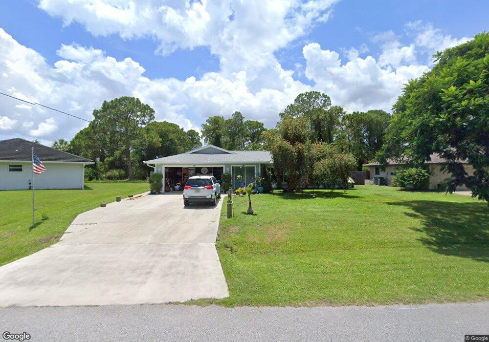
1459 Sargent St North Port, FL 34287
Estimated Value: $273,000 - $292,000
3
Beds
2
Baths
1,310
Sq Ft
$216/Sq Ft
Est. Value
About This Home
This home is located at 1459 Sargent St, North Port, FL 34287 and is currently estimated at $282,905, approximately $215 per square foot. 1459 Sargent St is a home located in Sarasota County with nearby schools including North Port High School, Cranberry Elementary School, and Heron Creek Middle School.
Ownership History
Date
Name
Owned For
Owner Type
Purchase Details
Closed on
Jun 22, 2011
Sold by
Dixon William J and Dixon Teresa
Bought by
Stroud Arthur R and Stroud Tammy J
Current Estimated Value
Purchase Details
Closed on
Sep 21, 2001
Sold by
Steinmyer Gordon E
Bought by
Dixon William J and Dixon Teresa
Home Financials for this Owner
Home Financials are based on the most recent Mortgage that was taken out on this home.
Original Mortgage
$118,044
Interest Rate
6.97%
Mortgage Type
FHA
Purchase Details
Closed on
Apr 29, 1996
Sold by
Steinmeyer Patrice D and Jones Patrice D
Bought by
Steinmeyer Gordon R
Purchase Details
Closed on
Dec 22, 1994
Sold by
Aubin J Edward and Aubin Catherine L
Bought by
Steinmeyer Gordon R and Steinmeyer Patrice D
Create a Home Valuation Report for This Property
The Home Valuation Report is an in-depth analysis detailing your home's value as well as a comparison with similar homes in the area
Home Values in the Area
Average Home Value in this Area
Purchase History
| Date | Buyer | Sale Price | Title Company |
|---|---|---|---|
| Stroud Arthur R | $84,800 | North Port Title Llc | |
| Dixon William J | $119,900 | -- | |
| Steinmeyer Gordon R | $33,000 | -- | |
| Steinmeyer Gordon R | $71,900 | -- |
Source: Public Records
Mortgage History
| Date | Status | Borrower | Loan Amount |
|---|---|---|---|
| Previous Owner | Dixon William J | $118,044 |
Source: Public Records
Tax History Compared to Growth
Tax History
| Year | Tax Paid | Tax Assessment Tax Assessment Total Assessment is a certain percentage of the fair market value that is determined by local assessors to be the total taxable value of land and additions on the property. | Land | Improvement |
|---|---|---|---|---|
| 2024 | $2,639 | $169,354 | -- | -- |
| 2023 | $2,639 | $164,421 | $0 | $0 |
| 2022 | $2,510 | $159,632 | $0 | $0 |
| 2021 | $2,285 | $142,264 | $0 | $0 |
| 2020 | $2,264 | $140,300 | $9,400 | $130,900 |
| 2019 | $2,214 | $137,817 | $0 | $0 |
| 2018 | $1,938 | $127,400 | $8,200 | $119,200 |
| 2017 | $2,355 | $114,200 | $0 | $0 |
| 2016 | $2,262 | $112,100 | $5,900 | $106,200 |
| 2015 | $2,107 | $96,200 | $5,900 | $90,300 |
| 2014 | $1,946 | $78,900 | $0 | $0 |
Source: Public Records
Map
Nearby Homes
- 1340 Papillon St
- 0 Patio Terrace Unit C7244221
- 3745 Woodbridge Ave
- 4268 Mulgrave Ave
- 1041 S Salford Blvd
- 4221 Ulster Ave
- LOTS 30 & 31 Nemo Ave
- 3991 Nemo Ave
- 3514 Laslo Ave
- 4145 W Price Blvd
- 0 Cloras St
- 4305 Sandune Ave
- 0 SyMcO Ave
- 0 Bendix Terrace Unit MFRN6137152
- 1177 Petronia St
- 4474 Ozark Ave
- 3475 W Price Blvd
- 0 Watova Ave Unit MFRC7505703
- 3378 Escobar Ln
- 3387 Tupelo Ave