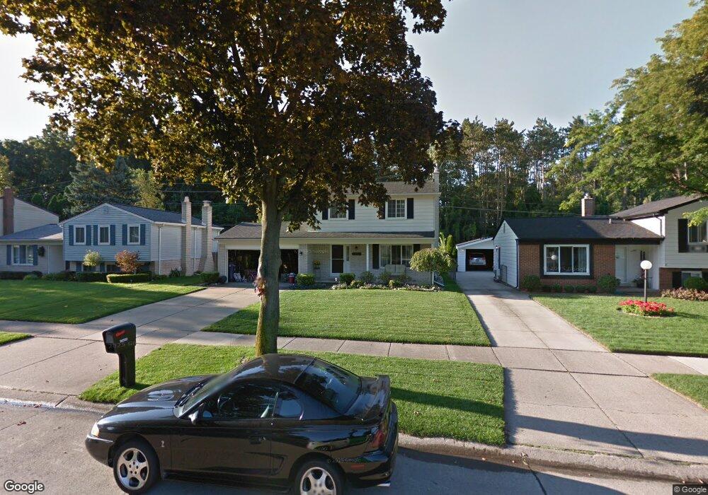
14592 Debbie Dr Unit Bldg-Unit Sterling Heights, MI 48313
Estimated Value: $325,000 - $350,517
--
Bed
2
Baths
1,386
Sq Ft
$245/Sq Ft
Est. Value
About This Home
This home is located at 14592 Debbie Dr Unit Bldg-Unit, Sterling Heights, MI 48313 and is currently estimated at $339,129, approximately $244 per square foot. 14592 Debbie Dr Unit Bldg-Unit is a home located in Macomb County with nearby schools including Graebner Elementary School, Bemis Junior High School, and Henry Ford II High School.
Ownership History
Date
Name
Owned For
Owner Type
Purchase Details
Closed on
Jul 24, 2024
Sold by
Hall Eric
Bought by
Feinstein Jennifer and Feinstein Lawrence S
Current Estimated Value
Home Financials for this Owner
Home Financials are based on the most recent Mortgage that was taken out on this home.
Original Mortgage
$210,659
Outstanding Balance
$208,084
Interest Rate
6.87%
Mortgage Type
New Conventional
Estimated Equity
$131,045
Purchase Details
Closed on
Jul 30, 2018
Sold by
Tillman Daniel E and Tillman Cynthia Y
Bought by
Hall Eric
Home Financials for this Owner
Home Financials are based on the most recent Mortgage that was taken out on this home.
Original Mortgage
$176,000
Interest Rate
4.5%
Mortgage Type
New Conventional
Purchase Details
Closed on
Sep 1, 2011
Sold by
Luczak Joseph and Luczak Marcia K
Bought by
Mery Danielle and Tillman Daniel E
Create a Home Valuation Report for This Property
The Home Valuation Report is an in-depth analysis detailing your home's value as well as a comparison with similar homes in the area
Home Values in the Area
Average Home Value in this Area
Purchase History
| Date | Buyer | Sale Price | Title Company |
|---|---|---|---|
| Feinstein Jennifer | $351,099 | Visionary Title | |
| Hall Eric | $220,000 | Partners Title | |
| Mery Danielle | $134,900 | Attorneys Title Agency Llc |
Source: Public Records
Mortgage History
| Date | Status | Borrower | Loan Amount |
|---|---|---|---|
| Open | Feinstein Jennifer | $210,659 | |
| Previous Owner | Hall Eric | $176,000 |
Source: Public Records
Tax History Compared to Growth
Tax History
| Year | Tax Paid | Tax Assessment Tax Assessment Total Assessment is a certain percentage of the fair market value that is determined by local assessors to be the total taxable value of land and additions on the property. | Land | Improvement |
|---|---|---|---|---|
| 2025 | $4,092 | $142,300 | $0 | $0 |
| 2024 | $3,742 | $135,700 | $0 | $0 |
| 2023 | $3,533 | $122,200 | $0 | $0 |
| 2022 | $3,683 | $108,800 | $0 | $0 |
| 2021 | $3,607 | $100,600 | $0 | $0 |
| 2020 | $3,217 | $96,600 | $0 | $0 |
| 2019 | $3,296 | $90,500 | $0 | $0 |
| 2018 | $2,574 | $83,400 | $0 | $0 |
| 2017 | $2,457 | $81,000 | $13,500 | $67,500 |
| 2016 | $2,374 | $81,000 | $0 | $0 |
| 2015 | -- | $75,600 | $0 | $0 |
| 2014 | -- | $64,400 | $0 | $0 |
Source: Public Records
Map
Nearby Homes
- 40779 Cascade Dr
- 14554 Alma Dr
- 40703 Olympia Dr
- 14239 Alpena Dr
- 14160 Alpena Dr
- 14942 Congress Dr
- 14289 Hope Dr
- 41558 Harvard Dr
- 13980 Amanda Dr
- 40206 Ashland Dr
- 41225 Greenspire Dr
- 13689 Ridgepoint Dr
- 14941 Loyola Dr
- 13722 Diversion Dr
- 41381 Clayton St
- 13762 Halleck Dr
- 13936 Grove Park Dr
- 40883 Highpointe Dr Unit 40
- 13431 Melanie Dr
- 39563 Heatherheath Dr
- 14592 Debbie Dr
- 14604 Debbie Dr
- 14580 Debbie Dr
- 14616 Debbie Dr
- 14568 Debbie Dr
- 14628 Debbie Dr
- 14556 Debbie Dr
- 14599 Debbie Dr
- 14587 Debbie Dr
- 14611 Debbie Dr
- 14575 Debbie Dr
- 14623 Debbie Dr
- 40852 Cascade Dr
- 14640 Debbie Dr
- 14563 Debbie Dr
- 14544 Debbie Dr Unit Bldg-Unit
- 14544 Debbie Dr
- 14635 Debbie Dr
- 40851 Cascade Dr
- 14551 Debbie Dr