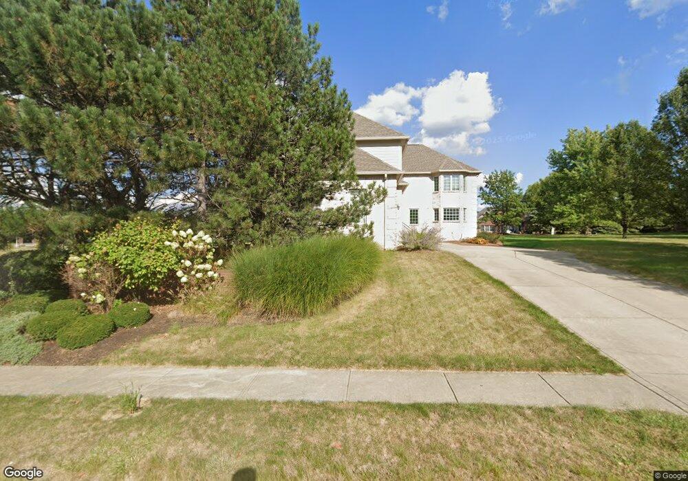
14595 Jason St Carmel, IN 46033
East Carmel NeighborhoodEstimated Value: $673,000 - $813,313
4
Beds
5
Baths
5,556
Sq Ft
$133/Sq Ft
Est. Value
About This Home
This home is located at 14595 Jason St, Carmel, IN 46033 and is currently estimated at $738,828, approximately $132 per square foot. 14595 Jason St is a home located in Hamilton County with nearby schools including Cherry Tree Elementary School, Clay Middle School, and Carmel High School.
Ownership History
Date
Name
Owned For
Owner Type
Purchase Details
Closed on
Jan 7, 2009
Sold by
Wells Fargo Bank Na
Bought by
Veros Michael J and Veros Wendy L
Current Estimated Value
Home Financials for this Owner
Home Financials are based on the most recent Mortgage that was taken out on this home.
Original Mortgage
$226,400
Outstanding Balance
$143,180
Interest Rate
5.19%
Mortgage Type
Purchase Money Mortgage
Estimated Equity
$595,648
Purchase Details
Closed on
Sep 21, 2006
Sold by
Reynolds Kenneth
Bought by
Wells Fargo Bank Na
Purchase Details
Closed on
Oct 26, 2004
Sold by
Springmill Builders Inc
Bought by
Reynolds Kenneth
Home Financials for this Owner
Home Financials are based on the most recent Mortgage that was taken out on this home.
Original Mortgage
$500,000
Interest Rate
7.37%
Mortgage Type
Purchase Money Mortgage
Create a Home Valuation Report for This Property
The Home Valuation Report is an in-depth analysis detailing your home's value as well as a comparison with similar homes in the area
Home Values in the Area
Average Home Value in this Area
Purchase History
| Date | Buyer | Sale Price | Title Company |
|---|---|---|---|
| Veros Michael J | -- | Investors Titlecorp | |
| Wells Fargo Bank Na | $470,000 | None Available | |
| Reynolds Kenneth | -- | -- |
Source: Public Records
Mortgage History
| Date | Status | Borrower | Loan Amount |
|---|---|---|---|
| Open | Veros Michael J | $226,400 | |
| Previous Owner | Reynolds Kenneth | $500,000 |
Source: Public Records
Tax History Compared to Growth
Tax History
| Year | Tax Paid | Tax Assessment Tax Assessment Total Assessment is a certain percentage of the fair market value that is determined by local assessors to be the total taxable value of land and additions on the property. | Land | Improvement |
|---|---|---|---|---|
| 2024 | $6,018 | $527,200 | $115,500 | $411,700 |
| 2023 | $5,945 | $537,400 | $115,500 | $421,900 |
| 2022 | $3,912 | $342,900 | $93,400 | $249,500 |
| 2021 | $3,429 | $303,300 | $93,400 | $209,900 |
| 2020 | $3,320 | $294,200 | $93,400 | $200,800 |
| 2019 | $3,271 | $292,600 | $91,300 | $201,300 |
| 2018 | $3,270 | $294,900 | $91,300 | $203,600 |
| 2017 | $3,100 | $282,800 | $91,300 | $191,500 |
| 2016 | $3,033 | $277,100 | $91,300 | $185,800 |
| 2014 | $2,689 | $261,000 | $85,300 | $175,700 |
| 2013 | $2,689 | $262,900 | $85,300 | $177,600 |
Source: Public Records
Map
Nearby Homes
- 14610 Village Park Dr E
- 14906 Mia Dr
- 14928 Oak Rd
- 14554 Taylor Trace Dr
- 2636 E Mae Cir
- 14901 Windmill Dr
- 2410 E Silver Ct
- 3172 Smokey Ridge Ln
- 2945 Millgate Dr
- 15003 Oak Hollow Ln W
- 14980 Oak Hollow Ln E
- 3248 Smokey Ridge Way
- 14011 Grisham Dr
- 2913 Twain Dr
- 15297 Maple Ridge Dr
- 15276 Maple Ridge Dr
- 1504 Dorchester Place
- 211 John St
- 1483 Spruce Dr
- 14737 Setters Rd
- 14581 Jason St
- 14588 Jaytee Dr
- 14567 Jason St
- 14580 Jaytee Dr
- 14596 Jason St
- 14580 Jason St
- 14453 Jason St
- 14572 Jaytee Dr
- 14575 Jaytee Dr
- 14562 Jason St
- 2934 Jason St
- 14589 Jaytee Dr
- 2960 Jason St
- 2889 Jason St
- 14544 Jason St
- 2986 Jason St
- 14591 Jaytee Dr
- 3012 Jason St
- 14526 Jeremy Dr
- 2883 Jason St