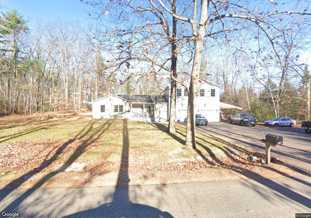
146 Buck St Gorham, ME 04038
Estimated Value: $505,000 - $603,000
4
Beds
2
Baths
1,888
Sq Ft
$291/Sq Ft
Est. Value
About This Home
This home is located at 146 Buck St, Gorham, ME 04038 and is currently estimated at $548,501, approximately $290 per square foot. 146 Buck St is a home with nearby schools including Great Falls Elementary School, Gorham High School, and Standish Baptist Academy.
Ownership History
Date
Name
Owned For
Owner Type
Purchase Details
Closed on
Aug 9, 2024
Sold by
Douglass John A and Douglass Peggy A
Bought by
Douglass John A and Douglass Peggy A
Current Estimated Value
Home Financials for this Owner
Home Financials are based on the most recent Mortgage that was taken out on this home.
Original Mortgage
$205,000
Outstanding Balance
$202,716
Interest Rate
6.95%
Mortgage Type
Purchase Money Mortgage
Estimated Equity
$345,785
Purchase Details
Closed on
Apr 22, 2009
Sold by
Englander Alison C
Bought by
Douglass John A and Douglass Peggy A
Create a Home Valuation Report for This Property
The Home Valuation Report is an in-depth analysis detailing your home's value as well as a comparison with similar homes in the area
Home Values in the Area
Average Home Value in this Area
Purchase History
| Date | Buyer | Sale Price | Title Company |
|---|---|---|---|
| Douglass John A | -- | None Available | |
| Douglass John A | -- | None Available | |
| Douglass John A | -- | -- | |
| Douglass John A | -- | -- |
Source: Public Records
Mortgage History
| Date | Status | Borrower | Loan Amount |
|---|---|---|---|
| Open | Douglass John A | $205,000 | |
| Closed | Douglass John A | $205,000 | |
| Previous Owner | Douglass John A | $50,000 |
Source: Public Records
Tax History Compared to Growth
Tax History
| Year | Tax Paid | Tax Assessment Tax Assessment Total Assessment is a certain percentage of the fair market value that is determined by local assessors to be the total taxable value of land and additions on the property. | Land | Improvement |
|---|---|---|---|---|
| 2024 | $6,037 | $410,700 | $96,400 | $314,300 |
| 2023 | $5,647 | $410,700 | $96,400 | $314,300 |
| 2022 | $5,277 | $410,700 | $96,400 | $314,300 |
| 2021 | $4,617 | $238,000 | $71,900 | $166,100 |
| 2020 | $4,518 | $237,800 | $71,700 | $166,100 |
| 2019 | $4,506 | $237,800 | $71,700 | $166,100 |
| 2018 | $4,328 | $237,800 | $71,700 | $166,100 |
| 2017 | $4,066 | $237,800 | $71,700 | $166,100 |
| 2016 | $4,044 | $237,900 | $71,800 | $166,100 |
| 2015 | $3,878 | $237,900 | $71,800 | $166,100 |
| 2014 | $3,922 | $225,400 | $76,700 | $148,700 |
| 2013 | $3,899 | $225,400 | $76,700 | $148,700 |
Source: Public Records
Map
Nearby Homes
- 135 Buck St
- 116 Dingley Spring Rd
- 183 Buck St
- 56 Hay Field Dr
- 21 Alexander Dr
- 14 Patrick Dr
- 697 Fort Hill Rd
- 00 Ossipee Trail E
- 66 Ossipee Trail East Trail E
- 63 Ossipee Trail E
- 68 Woodbrey Ln
- 66 Woodbrey Ln
- TBD Fort Hill Rd
- 41 Shaws Mill Rd
- LOT #34 Woodbrey Ln
- 27 Ossipee Trail E Unit 1
- 54 Woodbrey Ln
- 46 Woodbrey Ln
- 22 Finn Parker Rd
- LOT #14 Eastern Ln
- 152 Buck St
- 65 Shaws Mill Rd
- 59 Shaws Mill Rd
- 32 Shaws Mill Rd
- 153 Buck St
- 69 Shaws Mill Rd
- 62 Shaws Mill Rd
- 139 Buck St
- 53 Shaws Mill Rd
- 60 Shaws Mill Rd
- 58 Shaws Mill Rd
- 157 Buck St
- 137 Buck St
- 73 Shaws Mill Rd
- 72 Shaws Mill Rd
- 56 Boulder Dr
- 47 Shaws Mill Rd
- 56 Shaws Mill Rd
- 75 Shaws Mill Rd
- 51 Shaws Mill Rd