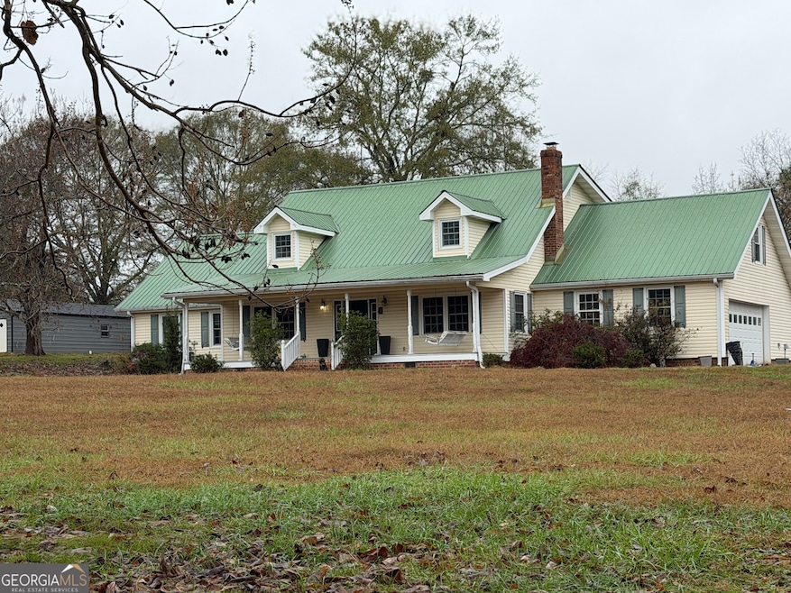
146 Burkett Rd Thomaston, GA 30286
Estimated payment $3,220/month
Highlights
- Barn
- Wood Flooring
- Sun or Florida Room
- In Ground Pool
- Main Floor Primary Bedroom
- Great Room
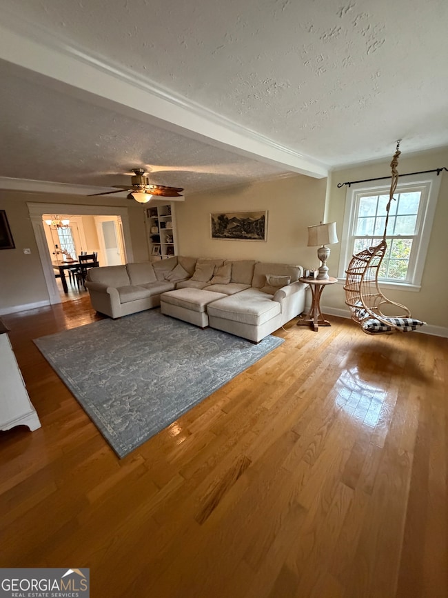
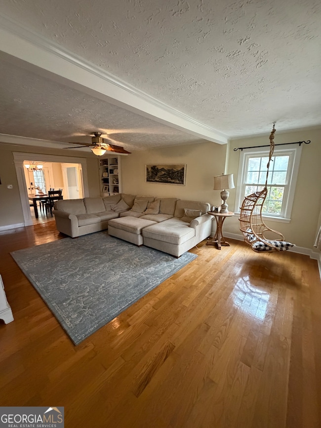
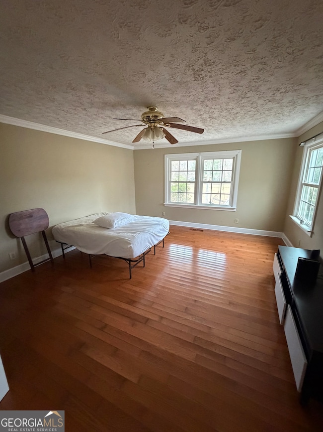
About This Home
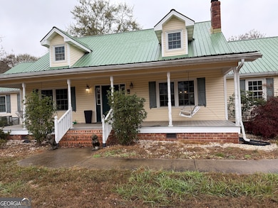
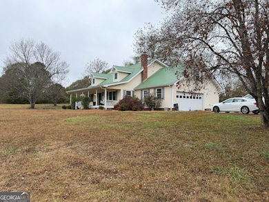
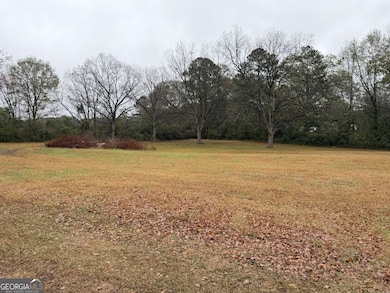
Welcome to your country oasis! This beautiful property sits on nearly 6 acres of flat, cleared land in a quiet and highly desirable area of Upson County. The home features 6 generously sized bedrooms and 3 full bathrooms, with the master suite conveniently located on the main level, complete with an updated and oversized master bathroom. One of the standout features of this home is the great family room, perfectly connected to the kitchen-an ideal setup for hosting gatherings, celebrations, and everyday family life. From the family room, you'll enjoy views of the custom-designed pool, creating the perfect backdrop for relaxation and entertainment. Outside, the property includes a 30x30 shop equipped with power and its own water source. This versatile building can be finished out and transformed into the perfect in-law suite, guest house, workshop, or hobby space. This one-of-a-kind property truly has everything you need for peaceful country living with room to grow.
Home Details
Home Type
- Single Family
Est. Annual Taxes
- $3,917
Year Built
- Built in 1980 | Remodeled
Lot Details
- 5.66 Acre Lot
- Back Yard Fenced
- Level Lot
- Open Lot
- Cleared Lot
Home Design
- Bungalow
- Pillar, Post or Pier Foundation
- Metal Roof
- Vinyl Siding
Interior Spaces
- 3,786 Sq Ft Home
- 2-Story Property
- Bookcases
- Double Pane Windows
- Family Room with Fireplace
- Great Room
- Combination Dining and Living Room
- Breakfast Room
- Game Room
- Sun or Florida Room
- Crawl Space
- Laundry closet
Kitchen
- Country Kitchen
- Walk-In Pantry
- Oven or Range
- Dishwasher
- Kitchen Island
Flooring
- Wood
- Laminate
- Vinyl
Bedrooms and Bathrooms
- 6 Bedrooms | 2 Main Level Bedrooms
- Primary Bedroom on Main
- Walk-In Closet
- Bathtub Includes Tile Surround
Outdoor Features
- In Ground Pool
- Shed
Schools
- Upson-Lee Elementary School
- Upson Lee Middle School
- Upson Lee High School
Farming
- Barn
Utilities
- Central Heating and Cooling System
- Well
- Septic Tank
Community Details
- No Home Owners Association
Listing and Financial Details
- Tax Lot 58
Map
Home Values in the Area
Average Home Value in this Area
Tax History
| Year | Tax Paid | Tax Assessment Tax Assessment Total Assessment is a certain percentage of the fair market value that is determined by local assessors to be the total taxable value of land and additions on the property. | Land | Improvement |
|---|---|---|---|---|
| 2024 | $3,856 | $149,156 | $17,918 | $131,238 |
| 2023 | $3,785 | $141,754 | $17,918 | $123,836 |
| 2022 | $3,011 | $110,575 | $9,516 | $101,059 |
| 2021 | $2,626 | $101,648 | $9,516 | $92,132 |
| 2020 | $2,662 | $96,355 | $8,573 | $87,782 |
| 2019 | $2,755 | $89,917 | $8,573 | $81,344 |
| 2018 | $2,545 | $82,999 | $8,573 | $74,426 |
| 2017 | $2,111 | $64,801 | $8,536 | $56,265 |
| 2016 | $1,820 | $55,241 | $7,114 | $48,127 |
| 2015 | $1,817 | $55,137 | $7,114 | $48,024 |
| 2014 | $1,891 | $57,219 | $9,105 | $48,114 |
Purchase History
| Date | Type | Sale Price | Title Company |
|---|---|---|---|
| Warranty Deed | $230,000 | -- |
Mortgage History
| Date | Status | Loan Amount | Loan Type |
|---|---|---|---|
| Open | $225,834 | FHA |
Source: Georgia MLS
MLS Number: 10656054
APN: 031-018
Disclaimer: Certain information contained herein is derived from information provided by parties other than Homes.com. All information provided is deemed reliable, but is not guaranteed to be accurate and should be independently verified.
![]() The data relating to real estate for sale on this web site comes in part from the Broker Reciprocity Program of Georgia MLS. Real estate listings held by brokerage firms other than Redfin are marked with the Broker Reciprocity logo and detailed information about them includes the name of the listing brokers. Information deemed reliable but not guaranteed. Copyright 2025 Georgia MLS. All rights reserved.
The data relating to real estate for sale on this web site comes in part from the Broker Reciprocity Program of Georgia MLS. Real estate listings held by brokerage firms other than Redfin are marked with the Broker Reciprocity logo and detailed information about them includes the name of the listing brokers. Information deemed reliable but not guaranteed. Copyright 2025 Georgia MLS. All rights reserved.
- 2037 Jeff Davis Rd
- 686 Burkett Rd
- 575 Skelton Rd
- 0 Hamp Smith Rd Unit 10626396
- 2540 Hannahs Mill Rd
- 6 Thompson Ln
- 8 Thompson Ln
- 47 Hill Crest Dr
- 0 Barouche Dr Unit 10597016
- 305 Jeff Davis Rd
- 412 Denham St
- 735 Firetower Rd
- 1600 Firetower Rd
- 318 North St
- 36 ACRES Firetower Rd
- 328 Rain Valley Cir
- 325 Rain Valley Cir
- 306 Garner St
- 307 W County Rd
- 205 Willow Rd
- 305 Jeff Davis Rd
- 320 Veterans Dr
- 406 Brookwood Dr
- 6 Maple St
- 101 Owens Ln
- 2101 Williamson Rd
- 1764 Cheryl Ave
- 1763 Park Ct
- 600 S Pine Hill Rd
- 1802 Carrington Dr
- 1751 Carrington Dr
- 701 Carver Rd
- 657 Carver Rd
- 1030 S Hill St
- 308 Wynterhall Dr
- 139 Hunts Mill Cir
- 116 Pointe Ct
- 325 Camp Ground Rd
- 1119 George Cir
- 708 S Hill St Unit APARTMENT
