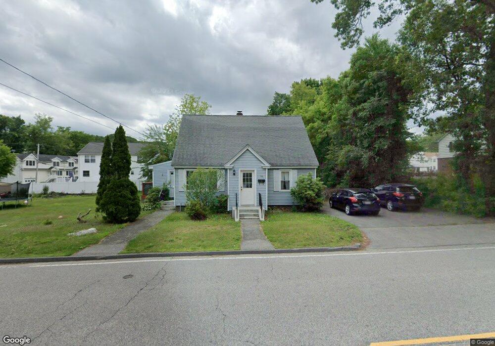
146 Commonwealth Ave Worcester, MA 01604
Grafton Hill NeighborhoodEstimated Value: $424,000 - $495,000
4
Beds
2
Baths
1,584
Sq Ft
$285/Sq Ft
Est. Value
About This Home
This home is located at 146 Commonwealth Ave, Worcester, MA 01604 and is currently estimated at $451,777, approximately $285 per square foot. 146 Commonwealth Ave is a home located in Worcester County with nearby schools including Roosevelt Elementary School, Jacob Hiatt Magnet School, and Chandler Magnet.
Ownership History
Date
Name
Owned For
Owner Type
Purchase Details
Closed on
Aug 31, 2010
Sold by
Litchfield Inv Llc and Litchfield Stephen
Bought by
Healy Michael P
Current Estimated Value
Home Financials for this Owner
Home Financials are based on the most recent Mortgage that was taken out on this home.
Original Mortgage
$115,500
Outstanding Balance
$76,770
Interest Rate
4.57%
Mortgage Type
Purchase Money Mortgage
Estimated Equity
$375,007
Purchase Details
Closed on
Apr 8, 2010
Sold by
Litchfield Stephen
Bought by
Litchfield Inv Llc and Litchfield Stephen
Purchase Details
Closed on
Mar 5, 2010
Sold by
Wallachia Llc
Bought by
Litchfield Stephen
Purchase Details
Closed on
Jan 13, 2010
Sold by
Powers Lucille
Bought by
Ma Wells Fargo Fncl
Create a Home Valuation Report for This Property
The Home Valuation Report is an in-depth analysis detailing your home's value as well as a comparison with similar homes in the area
Home Values in the Area
Average Home Value in this Area
Purchase History
| Date | Buyer | Sale Price | Title Company |
|---|---|---|---|
| Healy Michael P | $195,500 | -- | |
| Litchfield Inv Llc | -- | -- | |
| Litchfield Stephen | $101,000 | -- | |
| Wallachia Llc | $98,000 | -- | |
| Ma Wells Fargo Fncl | $108,500 | -- |
Source: Public Records
Mortgage History
| Date | Status | Borrower | Loan Amount |
|---|---|---|---|
| Open | Healy Michael P | $115,500 |
Source: Public Records
Tax History
| Year | Tax Paid | Tax Assessment Tax Assessment Total Assessment is a certain percentage of the fair market value that is determined by local assessors to be the total taxable value of land and additions on the property. | Land | Improvement |
|---|---|---|---|---|
| 2025 | $5,095 | $386,300 | $117,800 | $268,500 |
| 2024 | $4,993 | $363,100 | $117,800 | $245,300 |
| 2023 | $4,790 | $334,000 | $102,400 | $231,600 |
| 2022 | $4,394 | $288,900 | $81,900 | $207,000 |
| 2021 | $4,244 | $260,700 | $65,500 | $195,200 |
| 2020 | $4,134 | $243,200 | $65,500 | $177,700 |
| 2019 | $3,929 | $218,300 | $58,900 | $159,400 |
| 2018 | $3,933 | $208,000 | $58,900 | $149,100 |
| 2017 | $3,763 | $195,800 | $58,900 | $136,900 |
| 2016 | $3,708 | $179,900 | $42,900 | $137,000 |
| 2015 | $3,611 | $179,900 | $42,900 | $137,000 |
| 2014 | $3,515 | $179,900 | $42,900 | $137,000 |
Source: Public Records
Map
Nearby Homes
- 143 Commonwealth Ave
- Lot B Crawford St
- 19 Middlesex Ave
- 360 Hamilton St
- 496 Hamilton St
- 143 Dorcester
- 340 Sunderland Rd Unit 28
- 25 Stoneham Rd
- 18 Palisades St
- 330 Sunderland Rd Unit 80
- 330 Sunderland Rd Unit 69
- 83 Massasoit Rd
- 469 Lake Ave
- 62 Allston Ave
- 259 Massasoit Rd
- 80 Delmont Ave
- 20 Brightwood Ave
- 256 Massasoit Rd
- 7 Atlas St
- 266 Massasoit Rd
- Lot A Angelo St
- 29 Joseph St
- 29 Joseph St Unit 29
- 27 Joseph St
- 140 Commonwealth Ave
- 35 Enid St
- 2 Angelo St
- 31 Joseph St
- 25 Joseph St
- 141 Commonwealth Ave
- 135 Commonwealth Ave
- 138 Commonwealth Ave
- 138 Commonwealth Ave
- 138 Commonwealth Ave
- 137A Commonwealth Ave
- 24 Joseph St
- 21 Enid St
- 5 Angelo St
- 26 Joseph St
- 30 Enid St
Your Personal Tour Guide
Ask me questions while you tour the home.