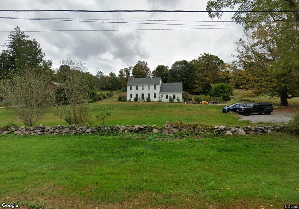
146 Creek Row East Haddam, CT 06423
Estimated Value: $551,869 - $581,000
5
Beds
2
Baths
2,275
Sq Ft
$247/Sq Ft
Est. Value
About This Home
This home is located at 146 Creek Row, East Haddam, CT 06423 and is currently estimated at $561,217, approximately $246 per square foot. 146 Creek Row is a home located in Middlesex County with nearby schools including East Haddam Elementary School, Nathan Hale-Ray Middle School, and Nathan Hale-Ray High School.
Ownership History
Date
Name
Owned For
Owner Type
Purchase Details
Closed on
Feb 12, 2016
Sold by
Donkin Sean and Donkin Samantha
Bought by
Donkin Samantha C and Donkin Sean
Current Estimated Value
Purchase Details
Closed on
Jun 22, 2010
Sold by
Roman Donald and Roman Dawn
Bought by
Donkin Sean and Donkin Samantha
Home Financials for this Owner
Home Financials are based on the most recent Mortgage that was taken out on this home.
Original Mortgage
$248,000
Interest Rate
5.03%
Purchase Details
Closed on
Oct 31, 2002
Sold by
Gometz Ralph
Bought by
Roman Donald M and Jurro Dawn C
Purchase Details
Closed on
Jul 16, 2001
Sold by
Lesick Stanley
Bought by
Gometz Ralph
Create a Home Valuation Report for This Property
The Home Valuation Report is an in-depth analysis detailing your home's value as well as a comparison with similar homes in the area
Home Values in the Area
Average Home Value in this Area
Purchase History
| Date | Buyer | Sale Price | Title Company |
|---|---|---|---|
| Donkin Samantha C | -- | -- | |
| Donkin Sean | $326,000 | -- | |
| Roman Donald M | $278,949 | -- | |
| Gometz Ralph | $48,000 | -- |
Source: Public Records
Mortgage History
| Date | Status | Borrower | Loan Amount |
|---|---|---|---|
| Previous Owner | Gometz Ralph | $248,000 | |
| Previous Owner | Gometz Ralph | $65,000 | |
| Previous Owner | Gometz Ralph | $40,000 | |
| Previous Owner | Gometz Ralph | $53,000 |
Source: Public Records
Tax History Compared to Growth
Tax History
| Year | Tax Paid | Tax Assessment Tax Assessment Total Assessment is a certain percentage of the fair market value that is determined by local assessors to be the total taxable value of land and additions on the property. | Land | Improvement |
|---|---|---|---|---|
| 2025 | $7,338 | $261,520 | $75,110 | $186,410 |
| 2024 | $6,998 | $261,520 | $75,110 | $186,410 |
| 2023 | $6,734 | $261,520 | $75,110 | $186,410 |
| 2022 | $6,260 | $196,910 | $53,900 | $143,010 |
| 2021 | $5,994 | $196,910 | $53,900 | $143,010 |
| 2020 | $5,994 | $196,910 | $53,900 | $143,010 |
| 2019 | $5,994 | $196,910 | $53,900 | $143,010 |
| 2018 | $5,840 | $196,910 | $53,900 | $143,010 |
| 2017 | $5,961 | $201,530 | $57,400 | $144,130 |
| 2016 | $5,915 | $201,530 | $57,400 | $144,130 |
| 2015 | $5,780 | $201,530 | $57,400 | $144,130 |
| 2014 | $5,623 | $201,530 | $57,400 | $144,130 |
Source: Public Records
Map
Nearby Homes
- 10 Orchard Rd
- 2 Morgan Ln
- 6 Landing Hill Rd
- 9 Brooke Hill Rd
- 77 Main St
- 55 Main St
- 00 Mount Parnassus Rd
- 5 Joe Williams Rd
- 45 Alger Rd
- 398 E Haddam Moodus Rd
- 23 Main St
- 2 Norwich Rd
- 55 Bogel Rd
- 0 Plains Rd Unit 24094854
- 40 & 42 Old Cart Rd
- 50 William F Palmer Rd
- 1572 Saybrook Rd
- 94 Little Meadow Rd
- 9 Southwinds Rd
- 195A Injun Hollow Rd