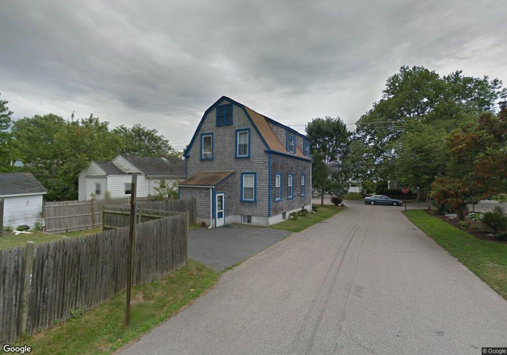
146 Kay St Newport, RI 02840
Eustis-Easton's Pond NeighborhoodEstimated Value: $1,027,000 - $1,192,000
4
Beds
3
Baths
2,115
Sq Ft
$535/Sq Ft
Est. Value
About This Home
This home is located at 146 Kay St, Newport, RI 02840 and is currently estimated at $1,131,190, approximately $534 per square foot. 146 Kay St is a home located in Newport County with nearby schools including Rogers High School, St Michael's Country Day School, and St George's School.
Ownership History
Date
Name
Owned For
Owner Type
Purchase Details
Closed on
Nov 14, 2003
Sold by
Chalfin April
Bought by
Johnson Lorna and Johnson Pierrepont
Current Estimated Value
Purchase Details
Closed on
Jul 31, 2002
Sold by
Mcguire David and Mcguire Nancy
Bought by
Cnalfin April
Home Financials for this Owner
Home Financials are based on the most recent Mortgage that was taken out on this home.
Original Mortgage
$255,500
Interest Rate
6.64%
Purchase Details
Closed on
Jun 29, 2001
Sold by
Adams Russell J and Adams Denise
Bought by
Mcguire David and Mcguire Nancy
Home Financials for this Owner
Home Financials are based on the most recent Mortgage that was taken out on this home.
Original Mortgage
$194,000
Interest Rate
7.14%
Purchase Details
Closed on
Jun 19, 1996
Sold by
Viti Thomas E and Viti Mary
Bought by
Adams Russell J and Adams Denise
Home Financials for this Owner
Home Financials are based on the most recent Mortgage that was taken out on this home.
Original Mortgage
$144,479
Interest Rate
8.21%
Create a Home Valuation Report for This Property
The Home Valuation Report is an in-depth analysis detailing your home's value as well as a comparison with similar homes in the area
Home Values in the Area
Average Home Value in this Area
Purchase History
| Date | Buyer | Sale Price | Title Company |
|---|---|---|---|
| Johnson Lorna | $339,000 | -- | |
| Cnalfin April | $269,000 | -- | |
| Mcguire David | $243,000 | -- | |
| Adams Russell J | $147,000 | -- |
Source: Public Records
Mortgage History
| Date | Status | Borrower | Loan Amount |
|---|---|---|---|
| Previous Owner | Adams Russell J | $255,500 | |
| Previous Owner | Adams Russell J | $194,000 | |
| Previous Owner | Adams Russell J | $162,500 | |
| Previous Owner | Adams Russell J | $144,479 |
Source: Public Records
Tax History Compared to Growth
Tax History
| Year | Tax Paid | Tax Assessment Tax Assessment Total Assessment is a certain percentage of the fair market value that is determined by local assessors to be the total taxable value of land and additions on the property. | Land | Improvement |
|---|---|---|---|---|
| 2025 | $7,930 | $912,700 | $387,600 | $525,100 |
| 2024 | $7,502 | $912,700 | $387,600 | $525,100 |
| 2023 | $5,698 | $574,400 | $232,900 | $341,500 |
| 2022 | $5,520 | $574,400 | $232,900 | $341,500 |
| 2021 | $5,359 | $574,400 | $232,900 | $341,500 |
| 2020 | $4,507 | $438,400 | $197,100 | $241,300 |
| 2019 | $4,507 | $438,400 | $197,100 | $241,300 |
| 2018 | $4,380 | $438,400 | $197,100 | $241,300 |
| 2017 | $4,010 | $357,700 | $115,700 | $242,000 |
| 2016 | $3,910 | $357,700 | $115,700 | $242,000 |
| 2015 | $3,717 | $348,400 | $115,700 | $232,700 |
| 2014 | $4,040 | $335,000 | $107,700 | $227,300 |
Source: Public Records
Map
Nearby Homes
- 36 Kay Blvd
- 7 Caswell Ave
- 103 Champlin Place N
- 78 Ellery Rd
- 198 Gibbs Ave
- 82 Ellery Rd
- 129 Bliss Mine Rd
- 128 Eustis Ave
- 5 Gardiner St
- 19 Princeton St Unit 21
- 78 Rhode Island Ave Unit 6
- 78 Rhode Island Ave Unit 8
- 8 Champlin St
- 1 Shangri-La Ln
- 17 Lincoln St
- 55 Hunter Ave
- 1 Arnold Ave
- 5 Elliot Place
- 4 Newport Ave Unit B2
- 155 Evarts St