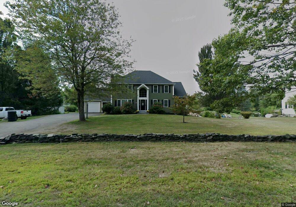
146 Lancaster Ave Lunenburg, MA 01462
Estimated Value: $667,727 - $847,000
4
Beds
4
Baths
3,464
Sq Ft
$224/Sq Ft
Est. Value
About This Home
This home is located at 146 Lancaster Ave, Lunenburg, MA 01462 and is currently estimated at $774,932, approximately $223 per square foot. 146 Lancaster Ave is a home located in Worcester County with nearby schools including Lunenburg Primary School, Lunenburg High School, and St Bernards Elementary School.
Ownership History
Date
Name
Owned For
Owner Type
Purchase Details
Closed on
Sep 13, 2011
Sold by
Meloon Josephine C Est
Bought by
Tapply William C and Tapply Bevin M
Current Estimated Value
Home Financials for this Owner
Home Financials are based on the most recent Mortgage that was taken out on this home.
Original Mortgage
$290,000
Outstanding Balance
$190,910
Interest Rate
3%
Mortgage Type
Purchase Money Mortgage
Estimated Equity
$584,022
Create a Home Valuation Report for This Property
The Home Valuation Report is an in-depth analysis detailing your home's value as well as a comparison with similar homes in the area
Home Values in the Area
Average Home Value in this Area
Purchase History
| Date | Buyer | Sale Price | Title Company |
|---|---|---|---|
| Tapply William C | $150,000 | -- |
Source: Public Records
Mortgage History
| Date | Status | Borrower | Loan Amount |
|---|---|---|---|
| Open | Tapply William C | $290,000 |
Source: Public Records
Tax History
| Year | Tax Paid | Tax Assessment Tax Assessment Total Assessment is a certain percentage of the fair market value that is determined by local assessors to be the total taxable value of land and additions on the property. | Land | Improvement |
|---|---|---|---|---|
| 2025 | $8,695 | $605,500 | $138,200 | $467,300 |
| 2024 | $8,079 | $573,000 | $130,500 | $442,500 |
| 2023 | $7,811 | $534,300 | $118,500 | $415,800 |
| 2022 | $7,514 | $437,100 | $98,900 | $338,200 |
| 2020 | $7,804 | $430,700 | $98,900 | $331,800 |
| 2019 | $6,422 | $343,800 | $93,200 | $250,600 |
| 2018 | $6,552 | $332,600 | $93,200 | $239,400 |
| 2017 | $6,366 | $318,600 | $86,500 | $232,100 |
| 2016 | $5,985 | $305,200 | $82,200 | $223,000 |
| 2015 | $5,458 | $297,900 | $78,000 | $219,900 |
Source: Public Records
Map
Nearby Homes
- 35 Leominster Rd
- 711 Massachusetts Ave Unit 2
- 63 Holman St
- 319 Highland St
- 2 Gabes Place
- 365 Hollis Rd
- 146-148 Kilburn St
- 36 Gilchrest St
- 110 Burrage St
- 77 Electric Ave
- 91 Valley Rd
- 146 Elmwood Rd
- 309 Reservoir Rd
- 795 Leominster Rd
- 80 W Townsend Rd
- 37 Wallis Park
- 12 Cortland Cir Unit 12
- 756 Northfield Rd
- 24 North St
- 50 Old Farm Rd
- 136 Lancaster Ave
- 136 Lancaster Ave Unit 2
- 136 Lancaster Ave Unit 1
- 130 Lancaster Ave
- 154 Lancaster Ave
- 149 Lancaster Ave
- 160 Lancaster Ave
- 0 Confidential Unit 71569455
- 0 Confidential Unit 72097832
- 0 Confidential Unit 73076645
- Lot 3 Butterfly Ln
- 0 Confidential Unit 73061433
- 124 Lancaster Ave
- 116 Lancaster Ave
- 162 Lancaster Ave
- 125 Lancaster Ave
- 32 Rolling Acres Rd
- 32 Rolling Acres Rd Unit 1
- 20 Rolling Acres Rd
- 100 Lancaster Ave
Your Personal Tour Guide
Ask me questions while you tour the home.