Estimated Value: $246,968 - $263,000
3
Beds
2
Baths
1,072
Sq Ft
$239/Sq Ft
Est. Value
About This Home
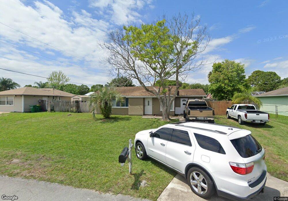
This home is located at 146 Manth Ave, Cocoa, FL 32927 and is currently estimated at $255,742, approximately $238 per square foot. 146 Manth Ave is a home located in Brevard County with nearby schools including Atlantis Elementary School, Space Coast Junior/Senior High School, and East Atlantic Prep of Brevard County.
Ownership History
Date
Name
Owned For
Owner Type
Purchase Details
Closed on
Sep 14, 2012
Sold by
Rhoads James
Bought by
Rhoads James F and James F Rhoads Trust
Current Estimated Value
Purchase Details
Closed on
Mar 15, 2011
Sold by
Aurora Loan Services Llc
Bought by
Rhoads James and Rhoads Claire
Purchase Details
Closed on
Dec 21, 2010
Sold by
Zoldak Edward P and Board Of County Commissioners
Bought by
Aurora Loan Servivces Llc
Create a Home Valuation Report for This Property
The Home Valuation Report is an in-depth analysis detailing your home's value as well as a comparison with similar homes in the area
Home Values in the Area
Average Home Value in this Area
Purchase History
| Date | Buyer | Sale Price | Title Company |
|---|---|---|---|
| Rhoads James F | -- | Attorney | |
| Rhoads James | $25,100 | American Home Title Of Tampa | |
| Aurora Loan Servivces Llc | -- | None Available |
Source: Public Records
Tax History
| Year | Tax Paid | Tax Assessment Tax Assessment Total Assessment is a certain percentage of the fair market value that is determined by local assessors to be the total taxable value of land and additions on the property. | Land | Improvement |
|---|---|---|---|---|
| 2025 | $2,798 | $199,310 | -- | -- |
| 2024 | $2,716 | $200,870 | -- | -- |
| 2023 | $2,716 | $196,650 | $0 | $0 |
| 2022 | $2,358 | $169,420 | $0 | $0 |
| 2021 | $2,126 | $124,120 | $42,000 | $82,120 |
| 2020 | $1,975 | $112,570 | $40,000 | $72,570 |
| 2019 | $1,900 | $107,640 | $35,000 | $72,640 |
| 2018 | $1,580 | $96,880 | $27,000 | $69,880 |
| 2017 | $1,495 | $85,510 | $24,000 | $61,510 |
| 2016 | $1,383 | $70,470 | $18,000 | $52,470 |
| 2015 | $1,313 | $54,290 | $15,000 | $39,290 |
| 2014 | $1,201 | $49,360 | $11,000 | $38,360 |
Source: Public Records
Map
Nearby Homes
- 7400 N Highway 1 Unit 105
- 7470 N Highway 1 Unit 105
- 214 Chase Rd
- 7420 U S Route 1 Unit 106
- 7350 N Highway 1 Unit 201
- 7330 N Highway 1 Unit 206
- 7310 N Highway 1 Unit 201
- 7300 N Highway 1 Unit 104
- 208 Capron Rd
- 873 Dunbar St
- 865 Dunbar St
- 0 Kanawha St
- 7240 N Highway 1 Unit 106
- 361 Payne Ave
- 000 Arabella Ln
- 977 Poinsetta St
- 973 Poinsetta St
- 7050 N Highway 1 Unit BB106
- 7060 N Highway 1 Unit AA206
- 7060 N Highway 1 Unit 205
Your Personal Tour Guide
Ask me questions while you tour the home.