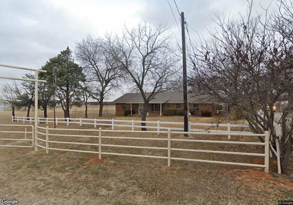
146 Private Road 1123 Decatur, TX 76234
Estimated Value: $348,108 - $523,000
--
Bed
--
Bath
2,224
Sq Ft
$198/Sq Ft
Est. Value
About This Home
This home is located at 146 Private Road 1123, Decatur, TX 76234 and is currently estimated at $441,027, approximately $198 per square foot. 146 Private Road 1123 is a home located in Wise County with nearby schools including Decatur High School and Victory Christian Academy.
Ownership History
Date
Name
Owned For
Owner Type
Purchase Details
Closed on
Apr 15, 2024
Sold by
Roberts Benny
Bought by
Roberts Benny and Barkley Tammy
Current Estimated Value
Purchase Details
Closed on
Mar 21, 2022
Sold by
Ray Roberts Benny
Bought by
Cobb Sharon Ann
Purchase Details
Closed on
Jul 27, 1995
Bought by
Roberts Benny and Roberts Shelba
Purchase Details
Closed on
Jan 1, 1901
Bought by
Roberts Benny and Roberts Shelba
Create a Home Valuation Report for This Property
The Home Valuation Report is an in-depth analysis detailing your home's value as well as a comparison with similar homes in the area
Home Values in the Area
Average Home Value in this Area
Purchase History
| Date | Buyer | Sale Price | Title Company |
|---|---|---|---|
| Roberts Benny | -- | None Listed On Document | |
| Cobb Sharon Ann | -- | None Listed On Document | |
| Roberts Benny | -- | -- | |
| Roberts Benny | -- | -- |
Source: Public Records
Tax History Compared to Growth
Tax History
| Year | Tax Paid | Tax Assessment Tax Assessment Total Assessment is a certain percentage of the fair market value that is determined by local assessors to be the total taxable value of land and additions on the property. | Land | Improvement |
|---|---|---|---|---|
| 2025 | $321 | $256,289 | -- | -- |
| 2024 | $321 | $232,990 | $0 | $0 |
| 2023 | $2,559 | $211,809 | $0 | $0 |
| 2022 | $2,955 | $192,554 | $0 | $0 |
| 2021 | $2,806 | $248,090 | $76,940 | $171,150 |
| 2020 | $2,567 | $216,430 | $52,240 | $164,190 |
| 2019 | $2,486 | $209,030 | $52,240 | $156,790 |
| 2018 | $2,335 | $187,120 | $47,490 | $139,630 |
| 2017 | $2,122 | $141,760 | $28,500 | $113,260 |
| 2016 | $1,929 | $125,490 | $25,650 | $99,840 |
| 2015 | -- | $98,810 | $21,850 | $76,960 |
| 2014 | -- | $99,030 | $20,900 | $78,130 |
Source: Public Records
Map
Nearby Homes
- 380 Private Road 4219
- 400 S Vick St
- 1405 Rodden Dr
- 1172 E Old Chico Rd
- 817 Farm To Market Road 1810
- W W Rose Ave
- 808 Sage Dr
- 1216 Marsha Ln
- 1234 Rockwater Dr
- 1232 Marsha Ln
- 175 County Road 1109
- 1215 Rockwater Dr
- 1 Vista Dr
- 1202 W Thompson St Unit Land
- LEXINGTON Plan at Vista Park
- OXFORD Plan at Vista Park
- NATCHEZ Plan at Vista Park
- KENNEDY Plan at Vista Park
- MACON Plan at Vista Park
- STARKVILLE Plan at Vista Park
- 2820 U S 380
- 2820 US Highway 380 Unit B
- 2820 US Highway 380 Unit A
- 149 Private Road 1123
- 380 Wise Rd
- TBD W Business 380
- 2892 Us Highway 380
- 2892 Us Highway 380
- 210 County Road 3001
- 6.7 Acres Hwy 380
- 6.7Acres Highway 380
- 6.7 Acres Highway 380
- Lot 4 U S 380
- 00 U S 380
- 2958 Us Highway 380
- 2958 Us Highway 380
- 2958 Us Highway 380
- 2211 W Business 380
- 2211 W Us 380
- 2211 Us Highway 380 W