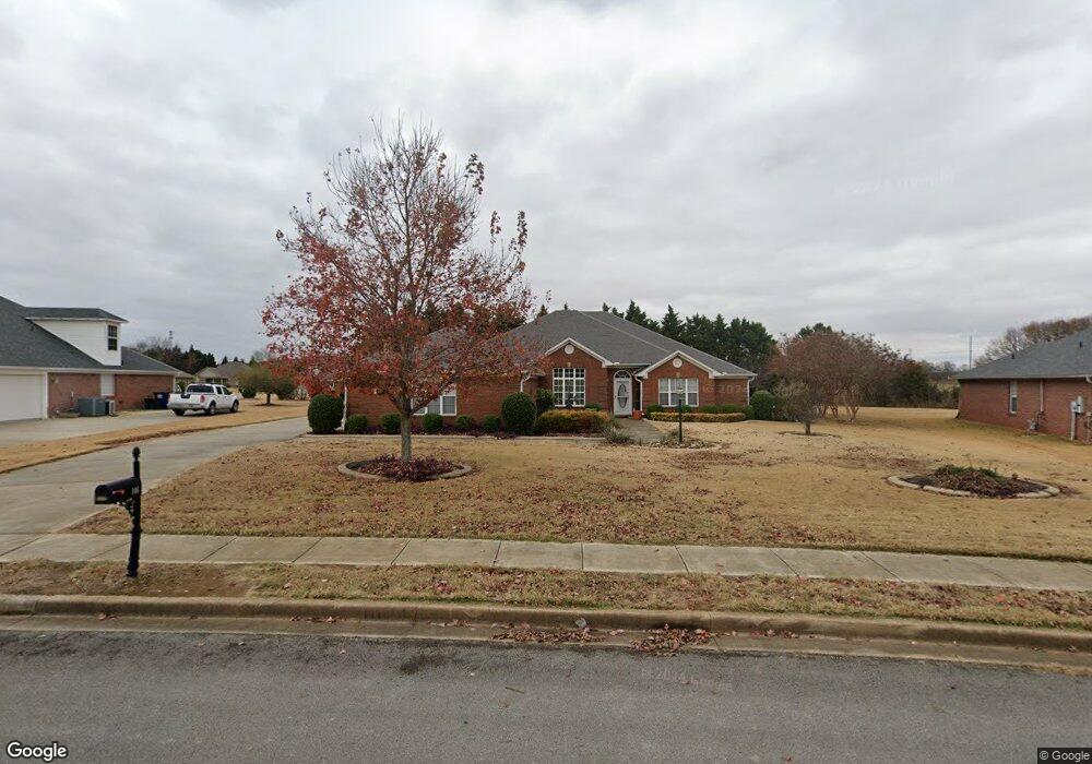
146 Shadow Pointe Cir Huntsville, AL 35806
Research Park NeighborhoodEstimated Value: $444,000 - $500,000
4
Beds
3
Baths
3,108
Sq Ft
$152/Sq Ft
Est. Value
About This Home
This home is located at 146 Shadow Pointe Cir, Huntsville, AL 35806 and is currently estimated at $471,822, approximately $151 per square foot. 146 Shadow Pointe Cir is a home located in Madison County with nearby schools including Monrovia Elementary School, Monrovia Middle School, and Sparkman High School.
Ownership History
Date
Name
Owned For
Owner Type
Purchase Details
Closed on
Jan 22, 2007
Sold by
Dennis Olive Homes Inc
Bought by
Moon Jaffrey N and Moon Donna L
Current Estimated Value
Home Financials for this Owner
Home Financials are based on the most recent Mortgage that was taken out on this home.
Original Mortgage
$232,790
Outstanding Balance
$137,872
Interest Rate
6.05%
Mortgage Type
New Conventional
Estimated Equity
$333,950
Create a Home Valuation Report for This Property
The Home Valuation Report is an in-depth analysis detailing your home's value as well as a comparison with similar homes in the area
Home Values in the Area
Average Home Value in this Area
Purchase History
| Date | Buyer | Sale Price | Title Company |
|---|---|---|---|
| Moon Jaffrey N | -- | -- |
Source: Public Records
Mortgage History
| Date | Status | Borrower | Loan Amount |
|---|---|---|---|
| Open | Moon Jaffrey N | $232,790 |
Source: Public Records
Tax History Compared to Growth
Tax History
| Year | Tax Paid | Tax Assessment Tax Assessment Total Assessment is a certain percentage of the fair market value that is determined by local assessors to be the total taxable value of land and additions on the property. | Land | Improvement |
|---|---|---|---|---|
| 2024 | $1,576 | $45,080 | $7,060 | $38,020 |
| 2023 | $1,576 | $43,400 | $7,060 | $36,340 |
| 2022 | $1,368 | $39,380 | $7,060 | $32,320 |
| 2021 | $1,250 | $35,860 | $3,540 | $32,320 |
| 2020 | $1,123 | $32,360 | $3,530 | $28,830 |
| 2019 | $1,087 | $31,370 | $3,530 | $27,840 |
| 2018 | $1,023 | $29,640 | $0 | $0 |
| 2017 | $1,023 | $29,640 | $0 | $0 |
| 2016 | $1,023 | $29,640 | $0 | $0 |
| 2015 | $1,023 | $29,640 | $0 | $0 |
| 2014 | $1,006 | $29,180 | $0 | $0 |
Source: Public Records
Map
Nearby Homes
- 110 Arrow Path Dr
- 224 Falling Star Walk
- 6210 Taramore Ln NW
- 6212 Taramore Ln NW
- 6216 Taramore Ln NW
- 6215 Taramore Ln NW
- 6213 Taramore Ln NW
- 6209 Taramore Ln NW
- 6219 Taramore Ln NW
- 6207 Taramore Ln NW
- The Sweetwater 1 Plan at Ashton Springs
- The Katelyn 1 Plan at Ashton Springs
- The Scottsdale 1 Plan at Ashton Springs
- The Wallace 1 Plan at Ashton Springs
- The Melody 1 Plan at Ashton Springs
- The Marlin 1 Plan at Ashton Springs
- 229 Kelly Spring Rd
- 7004 Liberty Rose Dr NW
- 7203 Chatfield Way NW
- 6032 Barringer Ct NW
- 148 Shadow Pointe Cir
- 144 Shadow Pointe Cir
- 150 Shadow Pointe Cir
- 142 Shadow Pointe Cir
- 145 Shadow Pointe Cir
- 169 Silver Strand Trail
- 171 Silver Strand Trail
- 149 Shadow Pointe Cir
- 157 Silver Strand Trail
- 151 Shadow Pointe Cir
- 140 Shadow Pointe Cir
- 141 Shadow Pointe Cir
- 165 Silver Strand Trail
- 172 Silver Strand Trail
- 153 Silver Strand Trail
- 138 Shadow Pointe Cir
- 201 Heather Glen Dr
- 139 Shadow Pointe Cir
- 203 Heather Glen Dr
- 170 Silver Strand Trail