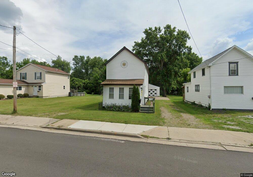
146 Snyder Ave Barberton, OH 44203
East Barberton NeighborhoodEstimated Value: $112,753 - $152,000
3
Beds
2
Baths
1,424
Sq Ft
$90/Sq Ft
Est. Value
About This Home
This home is located at 146 Snyder Ave, Barberton, OH 44203 and is currently estimated at $128,188, approximately $90 per square foot. 146 Snyder Ave is a home located in Summit County with nearby schools including Barberton Middle School, Barberton High School, and St. Francis de Sales School.
Ownership History
Date
Name
Owned For
Owner Type
Purchase Details
Closed on
Jun 25, 2021
Sold by
Double J Investment Group Llc
Bought by
Monzo Carol L
Current Estimated Value
Purchase Details
Closed on
Jun 24, 2021
Sold by
Double J Investment Group Llc
Bought by
Monzo Carol L
Purchase Details
Closed on
Feb 14, 2006
Sold by
Shank Richard L and Donofrio John A
Bought by
Double J Investment Group Llc
Purchase Details
Closed on
Jul 25, 1996
Sold by
Husk Marvin L
Bought by
Shank Richard L
Home Financials for this Owner
Home Financials are based on the most recent Mortgage that was taken out on this home.
Original Mortgage
$31,153
Interest Rate
8.43%
Mortgage Type
New Conventional
Create a Home Valuation Report for This Property
The Home Valuation Report is an in-depth analysis detailing your home's value as well as a comparison with similar homes in the area
Home Values in the Area
Average Home Value in this Area
Purchase History
| Date | Buyer | Sale Price | Title Company |
|---|---|---|---|
| Monzo Carol L | $390,000 | Gill Lance D | |
| Monzo Carol L | $390,000 | Gill Lance D | |
| Double J Investment Group Llc | $16,100 | None Available | |
| Shank Richard L | $16,569 | -- |
Source: Public Records
Mortgage History
| Date | Status | Borrower | Loan Amount |
|---|---|---|---|
| Previous Owner | Shank Richard L | $31,153 |
Source: Public Records
Tax History Compared to Growth
Tax History
| Year | Tax Paid | Tax Assessment Tax Assessment Total Assessment is a certain percentage of the fair market value that is determined by local assessors to be the total taxable value of land and additions on the property. | Land | Improvement |
|---|---|---|---|---|
| 2025 | $1,528 | $27,822 | $7,403 | $20,419 |
| 2024 | $1,528 | $27,822 | $7,403 | $20,419 |
| 2023 | $1,528 | $27,822 | $7,403 | $20,419 |
| 2022 | $1,295 | $20,178 | $5,142 | $15,036 |
| 2021 | $1,193 | $20,178 | $5,142 | $15,036 |
| 2020 | $1,268 | $20,180 | $5,140 | $15,040 |
| 2019 | $1,285 | $18,540 | $4,630 | $13,910 |
| 2018 | $1,267 | $18,540 | $4,630 | $13,910 |
| 2017 | $1,155 | $18,540 | $4,630 | $13,910 |
| 2016 | $1,157 | $17,330 | $4,630 | $12,700 |
| 2015 | $1,155 | $17,330 | $4,630 | $12,700 |
| 2014 | $1,149 | $17,330 | $4,630 | $12,700 |
| 2013 | $1,117 | $17,440 | $4,630 | $12,810 |
Source: Public Records
Map
Nearby Homes
- 64 Diamond Ave
- 43 S Van Buren Ave
- 25 S Van Buren Ave
- 327 Robinson Ave
- 251 Slate Ridge Dr
- 6 5th St NE
- 311 Holly Place
- 414 E Baird Ave
- 673 Wooster Rd W
- 679 Wooster Rd W
- 477 Robinson Ave
- 588 Austin Dr
- 357 E Paige Ave
- 369 Big Bend Cir
- 375 Big Bend Cir
- 564 W Hopocan Ave
- 1110 Mansion Dr
- 349 E Hopocan Ave
- 46 Brown St
- 344 E Huston St
- 150 Snyder Ave
- 142 Snyder Ave
- 154 Snyder Ave
- 162 Snyder Ave
- 166 Snyder Ave
- 170 Snyder Ave
- 122 Snyder Ave
- 118 Snyder Ave
- 178 Snyder Ave
- 112 Snyder Ave
- 0 Dan St Unit 4016074
- 0 Dan St Unit 4356248
- 0 Dan St Unit 4106165
- 0 Dan St Unit 4106164
- 302 S Van Buren Ave
- 308 S Van Buren Ave
- 316 S Van Buren Ave
- 320 S Van Buren Ave
- 210 224 Snyder Ave
- 210 Snyder Ave