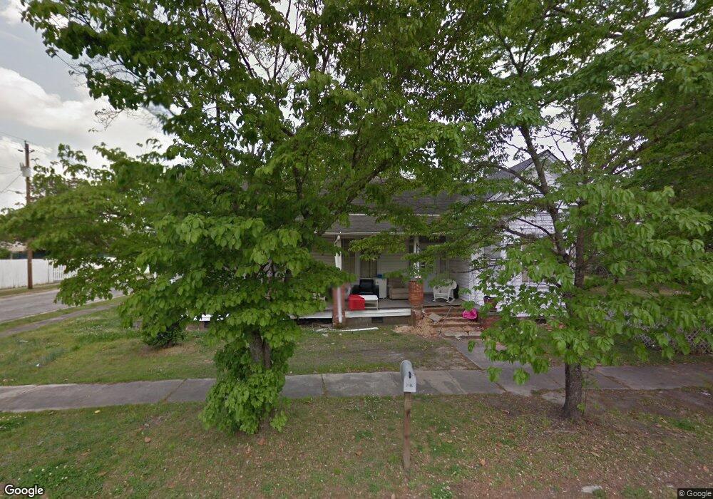
146 W Byrd St Timmonsville, SC 29161
Estimated Value: $53,000 - $187,777
3
Beds
2
Baths
2,197
Sq Ft
$53/Sq Ft
Est. Value
About This Home
This home is located at 146 W Byrd St, Timmonsville, SC 29161 and is currently estimated at $116,694, approximately $53 per square foot. 146 W Byrd St is a home located in Florence County with nearby schools including Brockington Elementary School, Johnson Middle School, and Timmonsville High School.
Ownership History
Date
Name
Owned For
Owner Type
Purchase Details
Closed on
Jun 12, 2025
Sold by
Freeman Lonnie D
Bought by
Hanna Fanontae M
Current Estimated Value
Purchase Details
Closed on
Mar 13, 2015
Sold by
Mcclellan Alfredia F and Mcclellan Charles A
Bought by
Freeman Lonnie D
Purchase Details
Closed on
Jul 2, 2012
Sold by
Cranford Randy
Bought by
Mcclellan Alfredia F and Mcclellan Charles A
Home Financials for this Owner
Home Financials are based on the most recent Mortgage that was taken out on this home.
Original Mortgage
$14,561
Interest Rate
3.79%
Mortgage Type
Seller Take Back
Purchase Details
Closed on
Aug 23, 2006
Sold by
Estate Of Alice Gaynelle Galloway Fleene
Bought by
Cranford Randy
Purchase Details
Closed on
Feb 23, 2005
Sold by
Fleener Lon Anson
Bought by
Fleener Lon Anson
Create a Home Valuation Report for This Property
The Home Valuation Report is an in-depth analysis detailing your home's value as well as a comparison with similar homes in the area
Home Values in the Area
Average Home Value in this Area
Purchase History
| Date | Buyer | Sale Price | Title Company |
|---|---|---|---|
| Hanna Fanontae M | -- | None Listed On Document | |
| Freeman Lonnie D | -- | -- | |
| Mcclellan Alfredia F | $45,000 | -- | |
| Cranford Randy | $14,217 | None Available | |
| Fleener Lon Anson | -- | -- |
Source: Public Records
Mortgage History
| Date | Status | Borrower | Loan Amount |
|---|---|---|---|
| Previous Owner | Mcclellan Alfredia F | $14,561 |
Source: Public Records
Tax History Compared to Growth
Tax History
| Year | Tax Paid | Tax Assessment Tax Assessment Total Assessment is a certain percentage of the fair market value that is determined by local assessors to be the total taxable value of land and additions on the property. | Land | Improvement |
|---|---|---|---|---|
| 2024 | $228 | $2,334 | $506 | $1,828 |
| 2023 | $190 | $1,812 | $506 | $1,306 |
| 2022 | $167 | $1,812 | $506 | $1,306 |
| 2021 | $127 | $1,810 | $0 | $0 |
| 2020 | $202 | $1,810 | $0 | $0 |
| 2019 | $205 | $1,812 | $506 | $1,306 |
| 2018 | $194 | $1,810 | $0 | $0 |
| 2017 | $221 | $1,810 | $0 | $0 |
| 2016 | $852 | $2,720 | $0 | $0 |
| 2015 | $936 | $2,720 | $0 | $0 |
| 2014 | $808 | $0 | $0 | $0 |
Source: Public Records
Map
Nearby Homes
- 100 W Byrd St
- 311 W Byrd St
- 102 W Market St
- 120 W Market St
- 211 N Tanyard St
- 301 W Smith St
- 506 Gregory St
- 506 Gregory St Unit 23 & 24
- 439 N Keith St
- 505 Player St
- 11.31 acres Darlington St
- 2.78 acres Darlington St
- 1148 N Kershaw St
- 4710 Jordan Cir
- 607 Welch Rd
- TBD Southern Aire Rd #9
- TBD Southern Aire Rd #11
- TBD State Road S-21-712
- 4080 Lake Russell Dr
- 4093 Lake Russell Dr