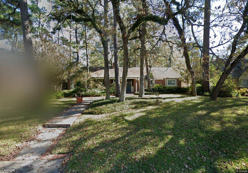
146 Warrenton Dr Houston, TX 77024
Memorial NeighborhoodEstimated Value: $802,000 - $1,486,000
3
Beds
2
Baths
2,350
Sq Ft
$471/Sq Ft
Est. Value
About This Home
This home is located at 146 Warrenton Dr, Houston, TX 77024 and is currently estimated at $1,107,259, approximately $471 per square foot. 146 Warrenton Dr is a home located in Harris County with nearby schools including Frostwood Elementary School, Memorial Middle, and Memorial High School.
Ownership History
Date
Name
Owned For
Owner Type
Purchase Details
Closed on
Jun 20, 2008
Sold by
Afshar Saeed F
Bought by
Miller Gregory Allen and Miller Leslie Alberstadt
Current Estimated Value
Home Financials for this Owner
Home Financials are based on the most recent Mortgage that was taken out on this home.
Original Mortgage
$369,900
Outstanding Balance
$237,727
Interest Rate
6.08%
Mortgage Type
Purchase Money Mortgage
Estimated Equity
$869,532
Create a Home Valuation Report for This Property
The Home Valuation Report is an in-depth analysis detailing your home's value as well as a comparison with similar homes in the area
Home Values in the Area
Average Home Value in this Area
Purchase History
| Date | Buyer | Sale Price | Title Company |
|---|---|---|---|
| Miller Gregory Allen | -- | Alamo Title |
Source: Public Records
Mortgage History
| Date | Status | Borrower | Loan Amount |
|---|---|---|---|
| Open | Miller Gregory Allen | $369,900 |
Source: Public Records
Tax History Compared to Growth
Tax History
| Year | Tax Paid | Tax Assessment Tax Assessment Total Assessment is a certain percentage of the fair market value that is determined by local assessors to be the total taxable value of land and additions on the property. | Land | Improvement |
|---|---|---|---|---|
| 2025 | $13,819 | $928,419 | $737,425 | $190,994 |
| 2024 | $13,819 | $844,711 | $623,975 | $220,736 |
| 2023 | $13,819 | $915,000 | $623,975 | $291,025 |
| 2022 | $17,308 | $810,708 | $623,975 | $186,733 |
| 2021 | $16,431 | $673,000 | $623,975 | $49,025 |
| 2020 | $19,283 | $769,600 | $623,975 | $145,625 |
| 2019 | $19,706 | $752,725 | $623,975 | $128,750 |
| 2018 | $7,540 | $770,300 | $623,975 | $146,325 |
| 2017 | $19,534 | $804,000 | $623,975 | $180,025 |
| 2016 | $17,758 | $804,000 | $623,975 | $180,025 |
| 2015 | $11,736 | $804,000 | $623,975 | $180,025 |
| 2014 | $11,736 | $634,600 | $453,800 | $180,800 |
Source: Public Records
Map
Nearby Homes
- 170 Haversham Dr
- 150 Gessner Rd Unit 5A
- 0 Gessner Rd
- 10 Warrenton Dr
- 8 Woodstone St
- 234 Plantation Rd
- 3 Plantation Rd
- 1 Woodstone St
- 6 Gessner Rd
- 12327 Tunbridge Ln
- 201 Vanderpool Ln Unit 103
- 201 Vanderpool Ln Unit 65
- 201 Vanderpool Ln Unit 64
- 241 Litchfield Ln
- 10010 Bordley Dr
- 318 Knipp Rd
- 354 Tealwood Dr
- 259 Litchfield Ln Unit 66
- 271 Litchfield Ln
- 358 Tealwood Dr
- 150 Warrenton Dr
- 142 Warrenton Dr
- 147 Plantation Rd
- 143 Plantation Rd
- 154 Warrenton Dr
- 151 Plantation Rd
- 147 Warrenton Dr
- 151 Warrenton Dr
- 143 Warrenton Dr
- 158 Warrenton Dr
- 126 Warrenton Dr
- 155 Warrenton Dr
- 155 Plantation Rd
- 135 Plantation Rd
- 127 Warrenton Dr
- 159 Warrenton Dr
- 146 Plantation Rd
- 150 Plantation Rd
- 162 Warrenton Dr
- 142 Plantation Rd