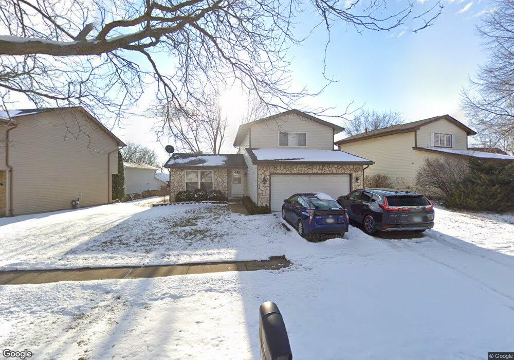
1460 Brookside Dr Hoffman Estates, IL 60169
South Hoffman Estates NeighborhoodEstimated Value: $385,960 - $427,000
3
Beds
2
Baths
1,450
Sq Ft
$276/Sq Ft
Est. Value
About This Home
This home is located at 1460 Brookside Dr, Hoffman Estates, IL 60169 and is currently estimated at $399,740, approximately $275 per square foot. 1460 Brookside Dr is a home located in Cook County with nearby schools including Neil Armstrong Elementary School, Dwight D Eisenhower Junior High School, and Hoffman Estates High School.
Ownership History
Date
Name
Owned For
Owner Type
Purchase Details
Closed on
Jul 24, 1997
Sold by
Buehrer Buehrer and Buehrer Roxanne
Bought by
Patel Amit N and Patel Jagruti A
Current Estimated Value
Home Financials for this Owner
Home Financials are based on the most recent Mortgage that was taken out on this home.
Original Mortgage
$85,200
Outstanding Balance
$10,843
Interest Rate
7.71%
Estimated Equity
$388,897
Purchase Details
Closed on
Feb 18, 1994
Sold by
Ropp Lonnie D and Ropp Kennel
Bought by
Buehrer Bruce A and Buehrer Roxanne
Home Financials for this Owner
Home Financials are based on the most recent Mortgage that was taken out on this home.
Original Mortgage
$109,600
Interest Rate
7.04%
Create a Home Valuation Report for This Property
The Home Valuation Report is an in-depth analysis detailing your home's value as well as a comparison with similar homes in the area
Home Values in the Area
Average Home Value in this Area
Purchase History
| Date | Buyer | Sale Price | Title Company |
|---|---|---|---|
| Patel Amit N | $155,500 | -- | |
| Buehrer Bruce A | $91,333 | -- |
Source: Public Records
Mortgage History
| Date | Status | Borrower | Loan Amount |
|---|---|---|---|
| Open | Patel Amit N | $85,200 | |
| Previous Owner | Buehrer Bruce A | $109,600 |
Source: Public Records
Tax History
| Year | Tax Paid | Tax Assessment Tax Assessment Total Assessment is a certain percentage of the fair market value that is determined by local assessors to be the total taxable value of land and additions on the property. | Land | Improvement |
|---|---|---|---|---|
| 2025 | $8,189 | $36,000 | $8,061 | $27,939 |
| 2024 | $8,189 | $30,000 | $7,328 | $22,672 |
| 2023 | $7,894 | $30,000 | $7,328 | $22,672 |
| 2022 | $7,894 | $30,000 | $7,328 | $22,672 |
| 2021 | $6,994 | $24,206 | $11,541 | $12,665 |
| 2020 | $6,905 | $24,206 | $11,541 | $12,665 |
| 2019 | $6,870 | $26,896 | $11,541 | $15,355 |
| 2018 | $7,132 | $25,308 | $10,076 | $15,232 |
| 2017 | $7,024 | $25,308 | $10,076 | $15,232 |
| 2016 | $6,796 | $25,308 | $10,076 | $15,232 |
| 2015 | $6,410 | $22,580 | $8,793 | $13,787 |
| 2014 | $6,314 | $22,580 | $8,793 | $13,787 |
| 2013 | $6,134 | $22,580 | $8,793 | $13,787 |
Source: Public Records
Map
Nearby Homes
- 2222 Seaver Ln
- 1475 Rebecca Dr Unit 213
- 1880 Bonnie Ln Unit 116
- 1880 Bonnie Ln Unit 112
- 1576 Poplar Creek Dr
- 1800 Monterey Ct
- 1792 Williamsburg Dr
- 1500 Robin Cir Unit 314
- 1975 Windsong Dr Unit 333E1
- 1797 Queensbury Cir Unit 5764
- 1776 Bristol Walk Unit 1776
- 1760 Bristol Walk Unit F
- 2080 Sutherland Place Unit 1
- 1769 Sessions Walk Unit C
- 1722 Fayette Walk Unit E
- 1840 Huntington Blvd Unit BW511
- 1840 Huntington Blvd Unit 203
- 1936 Whitingham Ln Unit 1
- 1836 Stockton Dr Unit 3312
- 1965 Cheltenham Place Unit 2
- 1470 Brookside Dr
- 2040 Greens Ct
- 1440 Brookside Dr
- 1474 Brookside Dr
- 2050 Greens Ct
- 2030 Greens Ct
- 1455 Brookside Dr
- 1465 Brookside Dr
- 1478 Brookside Dr
- 2060 Greens Ct Unit 2
- 1475 Brookside Dr
- 1995 Brookside Ln
- 1482 Brookside Dr
- 2070 Greens Ct
- 1500 Brookside Dr
- 1420 Brookside Dr
- 2039 Greens Ct
- 1486 Brookside Dr Unit 2
- 2049 Greens Ct
- 2069 Greens Ct Unit 2
Your Personal Tour Guide
Ask me questions while you tour the home.