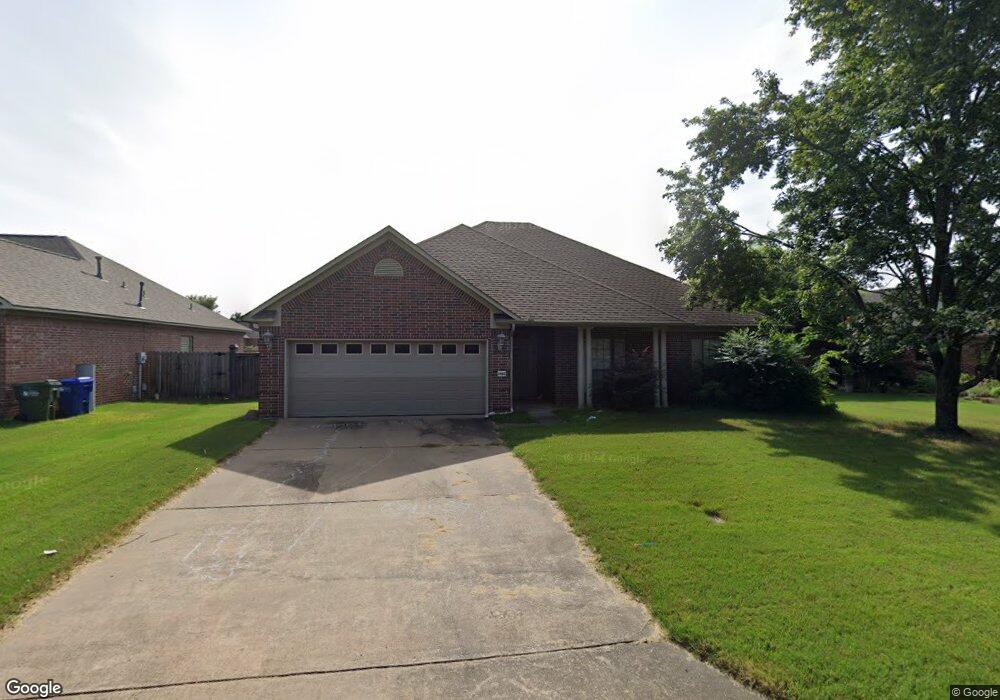
1460 Stone Crest Dr Conway, AR 72034
Estimated Value: $331,000 - $360,000
3
Beds
2
Baths
2,095
Sq Ft
$162/Sq Ft
Est. Value
About This Home
This home is located at 1460 Stone Crest Dr, Conway, AR 72034 and is currently estimated at $339,690, approximately $162 per square foot. 1460 Stone Crest Dr is a home located in Faulkner County with nearby schools including Ellen Smith Elementary School, Bob Courtway Middle School, and Conway Junior High School.
Ownership History
Date
Name
Owned For
Owner Type
Purchase Details
Closed on
May 27, 2016
Sold by
Schultheis Wilfred and Schultheis Annetta
Bought by
Delassus Patrick and Delassus Wendy
Current Estimated Value
Home Financials for this Owner
Home Financials are based on the most recent Mortgage that was taken out on this home.
Original Mortgage
$213,624
Outstanding Balance
$167,276
Interest Rate
3.25%
Mortgage Type
FHA
Estimated Equity
$172,414
Purchase Details
Closed on
May 16, 2011
Sold by
Ammons Jodie and Carroll Theresa
Bought by
Schultheis Wilfred and Schultheis Annetta
Home Financials for this Owner
Home Financials are based on the most recent Mortgage that was taken out on this home.
Original Mortgage
$153,000
Interest Rate
4.91%
Mortgage Type
New Conventional
Purchase Details
Closed on
Aug 25, 2003
Bought by
Ammon
Create a Home Valuation Report for This Property
The Home Valuation Report is an in-depth analysis detailing your home's value as well as a comparison with similar homes in the area
Home Values in the Area
Average Home Value in this Area
Purchase History
| Date | Buyer | Sale Price | Title Company |
|---|---|---|---|
| Delassus Patrick | $221,000 | Faulkner County Title Co | |
| Schultheis Wilfred | $200,000 | -- | |
| Ammon | $167,000 | -- |
Source: Public Records
Mortgage History
| Date | Status | Borrower | Loan Amount |
|---|---|---|---|
| Open | Delassus Patrick | $213,624 | |
| Previous Owner | Schultheis Wilfred | $153,000 |
Source: Public Records
Tax History
| Year | Tax Paid | Tax Assessment Tax Assessment Total Assessment is a certain percentage of the fair market value that is determined by local assessors to be the total taxable value of land and additions on the property. | Land | Improvement |
|---|---|---|---|---|
| 2025 | $2,583 | $64,070 | $8,000 | $56,070 |
| 2024 | $2,466 | $64,070 | $8,000 | $56,070 |
| 2023 | $2,348 | $46,410 | $8,000 | $38,410 |
| 2022 | $1,889 | $46,410 | $8,000 | $38,410 |
| 2021 | $1,787 | $46,410 | $8,000 | $38,410 |
| 2020 | $1,684 | $40,690 | $6,000 | $34,690 |
| 2019 | $1,684 | $40,690 | $6,000 | $34,690 |
| 2018 | $1,709 | $40,690 | $6,000 | $34,690 |
| 2017 | $1,709 | $40,690 | $6,000 | $34,690 |
| 2016 | $1,690 | $40,320 | $6,000 | $34,320 |
| 2015 | $1,593 | $38,400 | $6,000 | $32,400 |
| 2014 | $1,593 | $38,400 | $6,000 | $32,400 |
Source: Public Records
Map
Nearby Homes
- 2930 Shadow Ln
- 2850 Makenzie Dr
- 2800 Wineberry
- 1705 Pecan Creek Dr
- 0000 Nutter Chapel Rd
- 2575 Forest View Dr
- 1310 Josita Cir
- 1320 Andy Dr
- 1450 Ronnie Weaver Dr
- 1630 Jasmine Ln
- 2342 Holly Hill Dr
- 2435 Eighteen Loop
- 1850 Pecan Creek Dr
- 954 Joseph Dr
- 953 Joseph Dr
- 2510 Zoysia Ln
- 2321 Bridgegate Dr
- 2306 Holly Hill Dr
- 2595 Overcup Dr
- 2265 Rosemary Dr
- 2760 Silver Crest Dr
- 1450 Stone Crest Dr
- 1440 Stone Crest Dr
- 1465 Stone Crest Dr
- 1455 Stone Crest Dr
- 1465 Crosspoint Rd
- 1475 Crosspoint Rd
- 1455 Crosspoint Rd
- 1475 Stone Crest Dr
- 2765 Silver Crest Dr
- 1430 Stone Crest Dr
- 1445 Crosspoint Rd
- 1435 Stone Crest Dr
- 2755 Silver Crest Dr
- 2745 Silver Crest Dr
- 1410 Blackwood Cove
- 1420 Blackwood Cove
- 1425 Stone Crest Dr
- 2735 Silver Crest Dr
- 0 Silver Crest
Your Personal Tour Guide
Ask me questions while you tour the home.