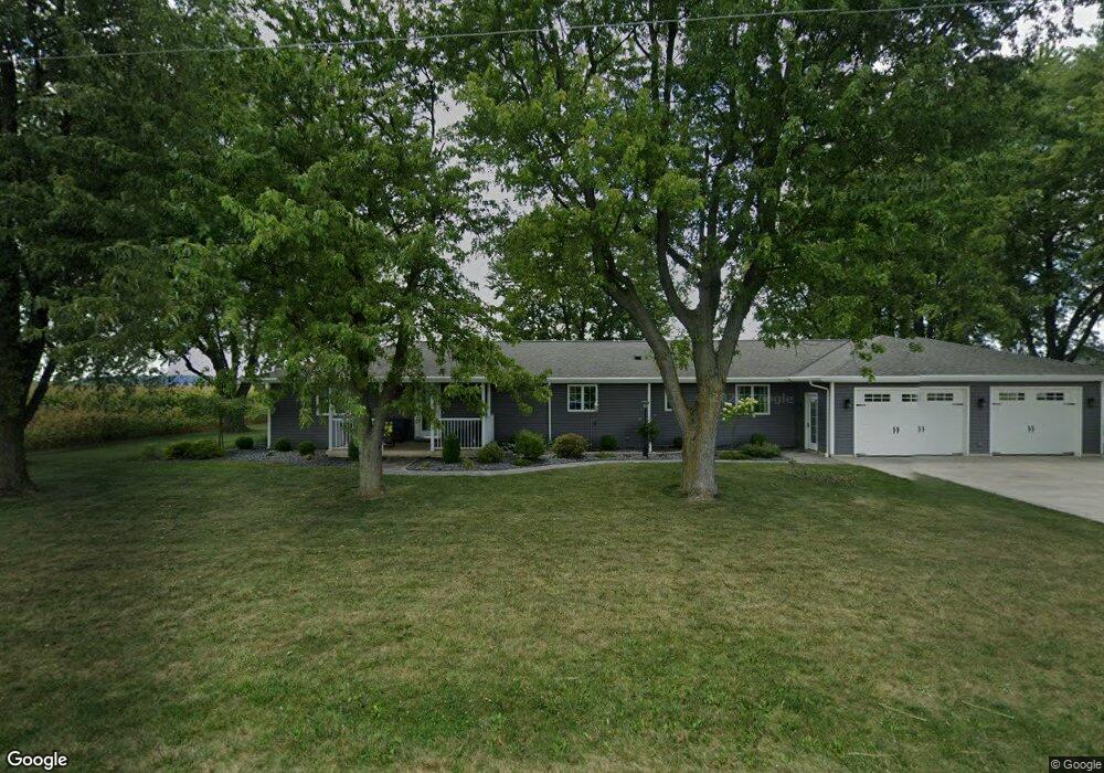
14600 Groff Rd New Weston, OH 45348
Estimated Value: $408,000 - $441,000
5
Beds
4
Baths
3,040
Sq Ft
$141/Sq Ft
Est. Value
About This Home
This home is located at 14600 Groff Rd, New Weston, OH 45348 and is currently estimated at $428,860, approximately $141 per square foot. 14600 Groff Rd is a home located in Darke County with nearby schools including Versailles Elementary School, Versailles Middle School, and Versailles High School.
Ownership History
Date
Name
Owned For
Owner Type
Purchase Details
Closed on
Dec 17, 2020
Sold by
Coby Sherry A and The Shirley A Miller Trust
Bought by
Keller Timothy L and Keller Denise R
Current Estimated Value
Purchase Details
Closed on
May 11, 2010
Sold by
Veloy Michael Imogene and Veloy Michael Imogene
Bought by
Keller Timothy L and Keller Denise R
Home Financials for this Owner
Home Financials are based on the most recent Mortgage that was taken out on this home.
Original Mortgage
$84,000
Interest Rate
5.16%
Mortgage Type
New Conventional
Purchase Details
Closed on
Jan 22, 2009
Sold by
Estate Of Robert Dwight Michael
Bought by
Michael Imogene Veloy
Create a Home Valuation Report for This Property
The Home Valuation Report is an in-depth analysis detailing your home's value as well as a comparison with similar homes in the area
Home Values in the Area
Average Home Value in this Area
Purchase History
| Date | Buyer | Sale Price | Title Company |
|---|---|---|---|
| Keller Timothy L | -- | None Available | |
| Keller Timothy L | $109,000 | Attorney | |
| Michael Imogene Veloy | -- | Attorney |
Source: Public Records
Mortgage History
| Date | Status | Borrower | Loan Amount |
|---|---|---|---|
| Previous Owner | Keller Timothy L | $84,000 |
Source: Public Records
Tax History Compared to Growth
Tax History
| Year | Tax Paid | Tax Assessment Tax Assessment Total Assessment is a certain percentage of the fair market value that is determined by local assessors to be the total taxable value of land and additions on the property. | Land | Improvement |
|---|---|---|---|---|
| 2024 | $4,139 | $128,350 | $6,850 | $121,500 |
| 2023 | $4,144 | $128,350 | $6,850 | $121,500 |
| 2022 | $3,298 | $99,670 | $5,710 | $93,960 |
| 2021 | $3,462 | $99,670 | $5,710 | $93,960 |
| 2020 | $3,480 | $99,670 | $5,710 | $93,960 |
| 2019 | $2,905 | $84,010 | $5,710 | $78,300 |
| 2018 | $2,915 | $84,010 | $5,710 | $78,300 |
| 2017 | $2,510 | $84,010 | $5,710 | $78,300 |
| 2016 | $2,514 | $75,970 | $5,710 | $70,260 |
| 2015 | $2,514 | $75,970 | $5,710 | $70,260 |
| 2014 | $2,639 | $75,970 | $5,710 | $70,260 |
| 2013 | $2,748 | $72,340 | $5,430 | $66,910 |
Source: Public Records
Map
Nearby Homes
- 21 E Star Rd
- 45 Cassella Montezuma Rd
- 63 Cassella-Montezuma Rd
- 4475 Ohio 705
- 159 Mendenhall Rd
- 158 Mendenhall Rd
- 157 Mendenhall Rd
- 140 Liberty Dr
- 139 Liberty Dr
- 136 Liberty Dr
- 137 Liberty Dr
- 141 Liberty Dr
- 138 Liberty Dr
- 142 Liberty Dr
- 144 Liberty Dr
- 135 Veterans Dr
- 143 Liberty Dr
- 155 Liberty Dr
- 147 Veterans Dr
- 146 Liberty Dr
- 14626 Groff Rd
- 14664 Groff Rd
- 14726 Groff Rd
- 6282 State Route 705
- 6080 State Route 705
- 6054 State Route 705
- 6458 State Route 705
- 14599 McClannan Rd
- 14566 State Route 127
- 14544 State Route 127
- 14660 State Route 127 Unit US
- 14509 McClannan Rd
- 14627 State Route 127
- 14855 Groff Rd
- 14577 State Route 127
- 14595 State Route 127
- 14617 State Route 127
- 14547 State Route 127
- 14533 State Route 127
- 14866 Groff Rd