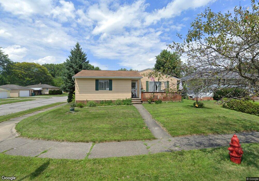
14603 Lisa Dr Maple Heights, OH 44137
Estimated Value: $156,643 - $176,000
3
Beds
2
Baths
1,084
Sq Ft
$150/Sq Ft
Est. Value
About This Home
This home is located at 14603 Lisa Dr, Maple Heights, OH 44137 and is currently estimated at $162,161, approximately $149 per square foot. 14603 Lisa Dr is a home located in Cuyahoga County with nearby schools including Abraham Lincoln Elementary School, Rockside/ J.F. Kennedy School, and Barack Obama School.
Ownership History
Date
Name
Owned For
Owner Type
Purchase Details
Closed on
Aug 23, 1994
Sold by
Monachino Frank T
Bought by
Subwick Robert M
Current Estimated Value
Home Financials for this Owner
Home Financials are based on the most recent Mortgage that was taken out on this home.
Original Mortgage
$84,460
Interest Rate
7.5%
Mortgage Type
VA
Purchase Details
Closed on
Jan 1, 1975
Bought by
Monachino Frank T and Monachino Patricia
Create a Home Valuation Report for This Property
The Home Valuation Report is an in-depth analysis detailing your home's value as well as a comparison with similar homes in the area
Home Values in the Area
Average Home Value in this Area
Purchase History
| Date | Buyer | Sale Price | Title Company |
|---|---|---|---|
| Subwick Robert M | $82,000 | -- | |
| Monachino Frank T | -- | -- |
Source: Public Records
Mortgage History
| Date | Status | Borrower | Loan Amount |
|---|---|---|---|
| Closed | Subwick Robert M | $84,460 |
Source: Public Records
Tax History Compared to Growth
Tax History
| Year | Tax Paid | Tax Assessment Tax Assessment Total Assessment is a certain percentage of the fair market value that is determined by local assessors to be the total taxable value of land and additions on the property. | Land | Improvement |
|---|---|---|---|---|
| 2024 | $3,508 | $49,840 | $9,205 | $40,635 |
| 2023 | $2,467 | $33,110 | $7,840 | $25,270 |
| 2022 | $2,496 | $33,110 | $7,840 | $25,270 |
| 2021 | $2,780 | $33,110 | $7,840 | $25,270 |
| 2020 | $3,302 | $27,160 | $6,440 | $20,720 |
| 2019 | $3,285 | $77,600 | $18,400 | $59,200 |
| 2018 | $3,269 | $27,160 | $6,440 | $20,720 |
| 2017 | $3,162 | $25,550 | $4,550 | $21,000 |
| 2016 | $3,057 | $25,550 | $4,550 | $21,000 |
| 2015 | $3,030 | $25,550 | $4,550 | $21,000 |
| 2014 | $3,030 | $27,480 | $4,900 | $22,580 |
Source: Public Records
Map
Nearby Homes
- 14775 Lisa Dr
- 14917 Summit Ave
- 5843 Dunham Rd
- 14916 Summit Ave
- 6030 Dunham Rd
- 14951 Carol Dr
- 13732 Carpenter Rd
- 14708 Brunswick Ave
- 13835 Milo Rd
- 13804 Rockside Rd
- SL15 Rocky Top Ct
- 6089 Dunham Rd
- 13712 Rockside Rd
- 6318 Valley Ranch Dr
- 14214 Tabor Ave
- 14106 Tabor Ave
- 14500 Tokay Ave
- 15617 Rockside Rd
- 15803 Maplewood Ave
- 6378 Valley Ranch Dr