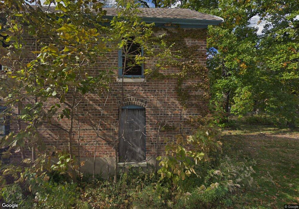
14606 Lincoln Ave Dolton, IL 60419
Estimated Value: $178,342 - $253,000
4
Beds
2
Baths
1,790
Sq Ft
$114/Sq Ft
Est. Value
About This Home
This home is located at 14606 Lincoln Ave, Dolton, IL 60419 and is currently estimated at $204,114, approximately $114 per square foot. 14606 Lincoln Ave is a home located in Cook County with nearby schools including Berger-Vandenberg Elementary School, Creative Communications Academy, and School Of Fine Arts Academy.
Ownership History
Date
Name
Owned For
Owner Type
Purchase Details
Closed on
Jul 17, 2024
Sold by
P & T Property Managent Inc
Bought by
Hyde Kenneth
Current Estimated Value
Purchase Details
Closed on
Jul 10, 2024
Sold by
Giles Cedric
Bought by
Cook County Land Bank Authority and County Of Cook
Purchase Details
Closed on
Mar 16, 2009
Sold by
U S Bank National Association
Bought by
P & T Property Management Inc
Purchase Details
Closed on
Oct 7, 2008
Sold by
Burns Dennis V
Bought by
Mortgge Electronic Registration Systems and Us Bank Na
Create a Home Valuation Report for This Property
The Home Valuation Report is an in-depth analysis detailing your home's value as well as a comparison with similar homes in the area
Home Values in the Area
Average Home Value in this Area
Purchase History
| Date | Buyer | Sale Price | Title Company |
|---|---|---|---|
| Hyde Kenneth | -- | None Listed On Document | |
| Cook County Land Bank Authority | -- | None Listed On Document | |
| P & T Property Management Inc | $10,000 | Ticor Title | |
| Mortgge Electronic Registration Systems | -- | None Available |
Source: Public Records
Tax History Compared to Growth
Tax History
| Year | Tax Paid | Tax Assessment Tax Assessment Total Assessment is a certain percentage of the fair market value that is determined by local assessors to be the total taxable value of land and additions on the property. | Land | Improvement |
|---|---|---|---|---|
| 2024 | $6,874 | $9,002 | $4,502 | $4,500 |
| 2023 | $6,319 | $12,184 | $7,684 | $4,500 |
| 2022 | $6,319 | $8,730 | $6,780 | $1,950 |
| 2021 | $6,012 | $8,729 | $6,780 | $1,949 |
| 2020 | $5,616 | $8,729 | $6,780 | $1,949 |
| 2019 | $7,532 | $10,328 | $6,328 | $4,000 |
| 2018 | $7,500 | $10,328 | $6,328 | $4,000 |
| 2017 | $7,096 | $10,328 | $6,328 | $4,000 |
| 2016 | $5,731 | $8,989 | $5,876 | $3,113 |
| 2015 | $5,535 | $8,989 | $5,876 | $3,113 |
| 2014 | $5,466 | $8,989 | $5,876 | $3,113 |
| 2013 | $5,501 | $9,645 | $5,876 | $3,769 |
Source: Public Records
Map
Nearby Homes
- 14640 Ingleside Ave
- 14644 Ellis Ave
- 14508 Ingleside Ave
- 14526 Cottage Grove Ave
- 14619 Minerva Ave
- 14418 Drexel Ave
- 14647 Greenwood Rd Unit A312
- 14635 Greenwood Rd Unit B103
- 14400 Shepard Dr
- 14708 Shepard Dr
- 14429 Minerva Ave
- 14333 Drexel Ave
- 14534 Woodlawn Ave
- 14447 University Ave
- 14720 Shepard Dr
- 14325 Ingleside Ave
- 14820 Cottage Grove Ave
- 14635 Woodlawn Ave
- 14408 Lincoln Ave
- 14761 Lincoln Ave
- 909 California Ave
- 14636 Ingleside Ave
- 901 California Ave
- 14601 Lincoln Ave
- 14549 Lincoln Ave
- 14553 Lincoln Ave
- 14545 Lincoln Ave
- 14644 Ingleside Ave
- 14603 Lincoln Ave
- 14541 Lincoln Ave
- 847 California Ave
- 14537 Lincoln Ave
- 843 California Ave
- 14648 Ingleside Ave
- 14533 Lincoln Ave
- 14600 Ellis Ave
- 14606 Ellis Ave
- 14606 Ellis Ave
- 14552 Shepard Dr
- 14548 Shepard Dr