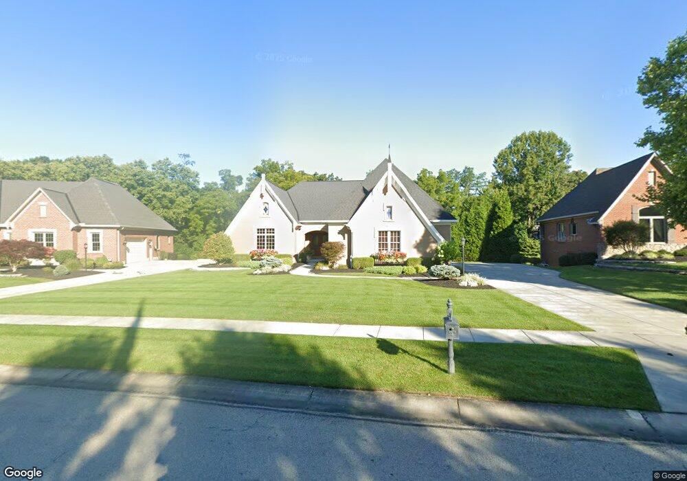
1461 Davids Way Cincinnati, OH 45233
Estimated Value: $642,324 - $690,000
2
Beds
4
Baths
2,178
Sq Ft
$308/Sq Ft
Est. Value
About This Home
This home is located at 1461 Davids Way, Cincinnati, OH 45233 and is currently estimated at $670,081, approximately $307 per square foot. 1461 Davids Way is a home with nearby schools including John Foster Dulles Elementary School, Rapid Run Middle School, and Oak Hills High School.
Ownership History
Date
Name
Owned For
Owner Type
Purchase Details
Closed on
Jun 6, 2013
Sold by
The Beechgrove Group Llc
Bought by
Rensing Paul G and Rensing Laurie A Schroeder
Current Estimated Value
Home Financials for this Owner
Home Financials are based on the most recent Mortgage that was taken out on this home.
Original Mortgage
$480,000
Outstanding Balance
$339,766
Interest Rate
3.38%
Mortgage Type
Construction
Estimated Equity
$330,315
Create a Home Valuation Report for This Property
The Home Valuation Report is an in-depth analysis detailing your home's value as well as a comparison with similar homes in the area
Home Values in the Area
Average Home Value in this Area
Purchase History
| Date | Buyer | Sale Price | Title Company |
|---|---|---|---|
| Rensing Paul G | $90,000 | Attorney |
Source: Public Records
Mortgage History
| Date | Status | Borrower | Loan Amount |
|---|---|---|---|
| Open | Rensing Paul G | $480,000 |
Source: Public Records
Tax History Compared to Growth
Tax History
| Year | Tax Paid | Tax Assessment Tax Assessment Total Assessment is a certain percentage of the fair market value that is determined by local assessors to be the total taxable value of land and additions on the property. | Land | Improvement |
|---|---|---|---|---|
| 2024 | $9,697 | $191,314 | $34,230 | $157,084 |
| 2023 | $9,706 | $191,314 | $34,230 | $157,084 |
| 2022 | $10,372 | $173,359 | $38,024 | $135,335 |
| 2021 | $9,311 | $173,359 | $38,024 | $135,335 |
| 2020 | $9,432 | $173,359 | $38,024 | $135,335 |
| 2019 | $9,230 | $154,784 | $33,950 | $120,834 |
| 2018 | $9,243 | $154,784 | $33,950 | $120,834 |
| 2017 | $8,711 | $154,784 | $33,950 | $120,834 |
| 2016 | $8,966 | $159,103 | $31,500 | $127,603 |
| 2015 | $9,043 | $159,103 | $31,500 | $127,603 |
| 2014 | $6,954 | $122,388 | $31,500 | $90,888 |
| 2013 | $1,883 | $33,950 | $33,950 | $0 |
Source: Public Records
Map
Nearby Homes
- 1680 Devils Backbone Rd
- 1696 Devils Backbone Rd Unit 2
- 1676 Devils Backbone Rd
- 1259 Wexford Ln
- 1366 Devils Backbone Rd
- 6278 Gardenlake Ct
- 6419 Timberhill Ct
- 6226 Rapid Run Rd
- 1118 Timbervalley Ct
- 6474 Simon Dr
- 2659 Devils Backbone Rd
- 6006 Quailhill Dr
- 6359 Werk Rd
- 2819 Springwood Ct
- 5685 Sidney Rd
- 5895 Quailhill Dr
- 6942 Cleves Warsaw Pike
- 2223 van Blaricum Rd
- 767 Sundance Dr
- 833 Serben Dr
- 1453 Davids Way
- 1469 Davids Way
- 1445 Davids Way
- 1865 Devils Backbone Rd
- 1 Devils Backbone Rd
- 1440 Davids Way
- 1842 Devils Backbone Rd
- 1437 Davids Way
- 6220 Kincora Ct
- 1858 Devils Backbone Rd
- 1828 Devils Backbone Rd
- 1777 Devils Backbone Rd
- 6222 Kincora Ct
- 1897 Devils Backbone Rd
- 1838 Devils Backbone Rd
- 1848 Devils Backbone Rd
- 1429 Davids Way
- 6221 Kincora Ct
- 1818 Devils Backbone Rd
- 1893 Devils Backbone Rd