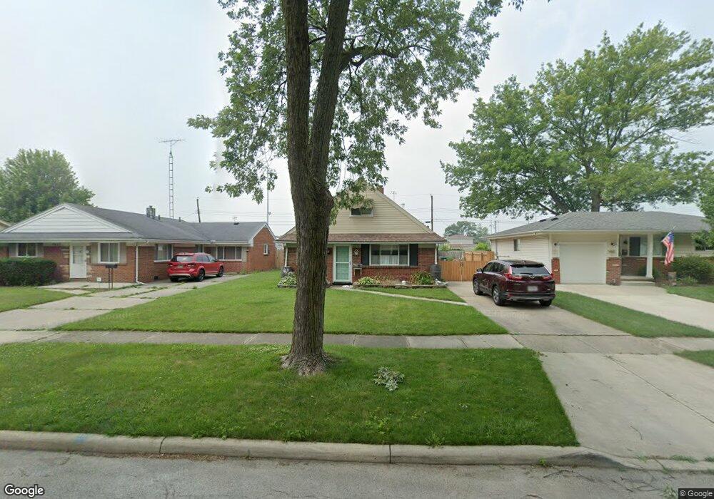
1461 Wilderness Dr Maumee, OH 43537
Estimated Value: $207,000 - $240,000
4
Beds
2
Baths
1,741
Sq Ft
$127/Sq Ft
Est. Value
About This Home
This home is located at 1461 Wilderness Dr, Maumee, OH 43537 and is currently estimated at $221,876, approximately $127 per square foot. 1461 Wilderness Dr is a home located in Lucas County with nearby schools including Maumee Intermediate School, Fort Miami Elementary School, and Maumee Middle School.
Ownership History
Date
Name
Owned For
Owner Type
Purchase Details
Closed on
Sep 5, 2018
Sold by
Sanders Anthony F and Sanders Kathleen A
Bought by
Bond Andrea F
Current Estimated Value
Home Financials for this Owner
Home Financials are based on the most recent Mortgage that was taken out on this home.
Original Mortgage
$96,800
Outstanding Balance
$84,241
Interest Rate
4.5%
Mortgage Type
New Conventional
Estimated Equity
$137,635
Purchase Details
Closed on
Sep 22, 2007
Sold by
Sanders Anthony F and Sanders Kathleen A
Bought by
Sanders Anthony F and Sanders Kathleen A
Purchase Details
Closed on
May 26, 2004
Sold by
Hohner Michael J and Hohner Mary Ann
Bought by
Sanders Anthony F and Sanders Kathleen A
Home Financials for this Owner
Home Financials are based on the most recent Mortgage that was taken out on this home.
Original Mortgage
$126,100
Interest Rate
6.06%
Mortgage Type
Purchase Money Mortgage
Create a Home Valuation Report for This Property
The Home Valuation Report is an in-depth analysis detailing your home's value as well as a comparison with similar homes in the area
Home Values in the Area
Average Home Value in this Area
Purchase History
| Date | Buyer | Sale Price | Title Company |
|---|---|---|---|
| Bond Andrea F | $121,000 | None Available | |
| Sanders Anthony F | -- | Attorney | |
| Sanders Anthony F | $127,500 | -- |
Source: Public Records
Mortgage History
| Date | Status | Borrower | Loan Amount |
|---|---|---|---|
| Open | Bond Andrea F | $96,800 | |
| Previous Owner | Sanders Anthony F | $126,100 |
Source: Public Records
Tax History Compared to Growth
Tax History
| Year | Tax Paid | Tax Assessment Tax Assessment Total Assessment is a certain percentage of the fair market value that is determined by local assessors to be the total taxable value of land and additions on the property. | Land | Improvement |
|---|---|---|---|---|
| 2024 | $1,812 | $56,140 | $12,950 | $43,190 |
| 2023 | $3,387 | $44,765 | $10,605 | $34,160 |
| 2022 | $3,013 | $44,765 | $10,605 | $34,160 |
| 2021 | $3,181 | $44,765 | $10,605 | $34,160 |
| 2020 | $3,290 | $41,265 | $8,365 | $32,900 |
| 2019 | $3,208 | $41,265 | $8,365 | $32,900 |
| 2018 | $2,632 | $41,265 | $8,365 | $32,900 |
| 2017 | $2,629 | $40,355 | $8,190 | $32,165 |
| 2016 | $2,606 | $115,300 | $23,400 | $91,900 |
| 2015 | $2,599 | $115,300 | $23,400 | $91,900 |
| 2014 | $2,258 | $39,560 | $8,020 | $31,540 |
| 2013 | $2,258 | $39,560 | $8,020 | $31,540 |
Source: Public Records
Map
Nearby Homes
- 1466 Wilderness Dr
- 1181 Craig Rd
- 632 Brahier Ln
- 4237 Brogan Dr
- 1220 Birch Ave
- 4035 Greencrest Ln
- 1206 Fort St
- 649 Midfield Dr
- 5125 Stengel Ave
- 1057 Keeler St
- 5022 Stengel Ave
- 504 Fairfield Park Dr
- 3044 Villa Dr
- 4522 Heathercove Place
- 1036 River Rd
- 525 Orchard View Dr
- 54 Homestead Place Unit 54
- 855 Lamonde Dr
- 1038 River Rd
- 1034 River Rd
- 1457 Wilderness Dr
- 1453 Wilderness Dr
- 1469 Wilderness Dr
- 1449 Wilderness Dr
- 1473 Wilderness Dr
- 1462 Wilderness Dr
- 1458 Wilderness Dr
- 1454 Wilderness Dr
- 1501 Wilderness Dr
- 1445 Wilderness Dr
- 1301 Chantilly Dr
- 1450 Wilderness Dr
- 1505 Wilderness Dr
- 1441 Wilderness Dr
- 1446 Wilderness Dr
- 1461 Appomattox Dr
- 1457 Appomattox Dr
- 1465 Appomattox Dr
- 1453 Appomattox Dr
- 1442 Wilderness Dr