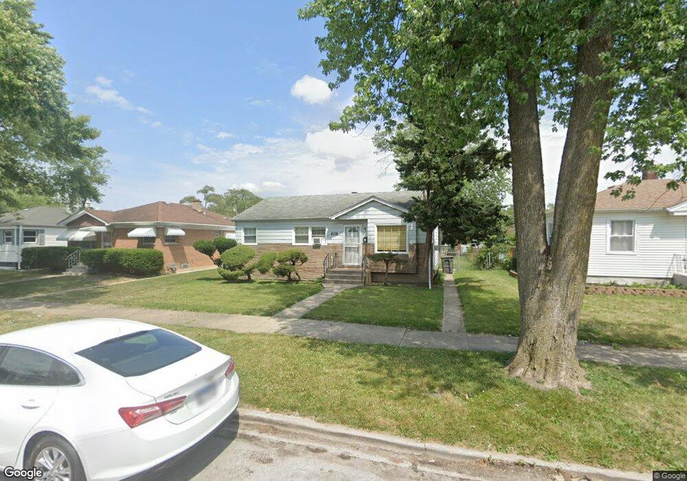
14611 Peoria St Harvey, IL 60426
Estimated Value: $101,397 - $125,000
3
Beds
1
Bath
936
Sq Ft
$118/Sq Ft
Est. Value
About This Home
This home is located at 14611 Peoria St, Harvey, IL 60426 and is currently estimated at $110,349, approximately $117 per square foot. 14611 Peoria St is a home located in Cook County with nearby schools including Bryant Elementary School, Brooks Middle School, and Thornton Township High School.
Ownership History
Date
Name
Owned For
Owner Type
Purchase Details
Closed on
Jul 27, 1995
Sold by
Rogers John C
Bought by
Banks Williams Laverne
Current Estimated Value
Home Financials for this Owner
Home Financials are based on the most recent Mortgage that was taken out on this home.
Original Mortgage
$49,350
Interest Rate
7.59%
Mortgage Type
FHA
Create a Home Valuation Report for This Property
The Home Valuation Report is an in-depth analysis detailing your home's value as well as a comparison with similar homes in the area
Home Values in the Area
Average Home Value in this Area
Purchase History
| Date | Buyer | Sale Price | Title Company |
|---|---|---|---|
| Banks Williams Laverne | $49,000 | -- |
Source: Public Records
Mortgage History
| Date | Status | Borrower | Loan Amount |
|---|---|---|---|
| Closed | Banks Williams Laverne | $49,350 |
Source: Public Records
Tax History Compared to Growth
Tax History
| Year | Tax Paid | Tax Assessment Tax Assessment Total Assessment is a certain percentage of the fair market value that is determined by local assessors to be the total taxable value of land and additions on the property. | Land | Improvement |
|---|---|---|---|---|
| 2024 | $1,694 | $4,250 | $1,094 | $3,156 |
| 2023 | $616 | $4,250 | $1,094 | $3,156 |
| 2022 | $616 | $2,468 | $938 | $1,530 |
| 2021 | $630 | $2,467 | $937 | $1,530 |
| 2020 | $739 | $2,467 | $937 | $1,530 |
| 2019 | $1,080 | $3,106 | $859 | $2,247 |
| 2018 | $1,051 | $3,106 | $859 | $2,247 |
| 2017 | $1,049 | $3,106 | $859 | $2,247 |
| 2016 | $1,206 | $3,111 | $781 | $2,330 |
| 2015 | $1,119 | $3,111 | $781 | $2,330 |
| 2014 | $564 | $3,111 | $781 | $2,330 |
| 2013 | $1,237 | $3,349 | $781 | $2,568 |
Source: Public Records
Map
Nearby Homes
- 14631 Vincennes Rd
- 14637 Vincennes Rd
- 14622 Vincennes Rd
- 14637 Center Ave
- 14508 Des Plaines St
- 14601 Des Plaines St
- 14725 Turlington Ave
- 238 Calumet Blvd
- 14502 Kentucky Ave
- 14519 Harvey Ave
- 210 Calumet Blvd
- 14455 Des Plaines St
- 14601 Jefferson St
- 14443 Des Plaines St
- 14523 Lexington Ave
- 296 E 148th St
- 306 Calumet Blvd
- 380 Calumet Blvd
- 14803 Madison Ave
- 345 Calumet Blvd
- 14611 Peoria St
- 14615 Peoria St
- 14615 Peoria St
- 14605 Peoria St
- 14605 Peoria St
- 226 E 146th St
- 14623 Peoria St
- 14623 Peoria St
- 226 Peoria St
- 14625 Peoria St
- 14625 Peoria St
- 14612 Green St
- 14612 Green St
- 14608 Green St
- 14614 Green St
- 14614 Green St
- 14618 Green St
- 14627 Peoria St
- 14612 Peoria St
- 14614 Peoria St