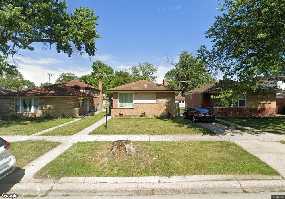
14613 Kimbark Ave Dolton, IL 60419
Estimated Value: $143,000 - $151,000
3
Beds
2
Baths
1,091
Sq Ft
$133/Sq Ft
Est. Value
About This Home
This home is located at 14613 Kimbark Ave, Dolton, IL 60419 and is currently estimated at $145,251, approximately $133 per square foot. 14613 Kimbark Ave is a home located in Cook County with nearby schools including Berger-Vandenberg Elementary School, Creative Communications Academy, and School Of Fine Arts Academy.
Ownership History
Date
Name
Owned For
Owner Type
Purchase Details
Closed on
Jul 3, 1997
Sold by
Fairbrother Joan M
Bought by
Collins James and Collins Girtha M
Current Estimated Value
Home Financials for this Owner
Home Financials are based on the most recent Mortgage that was taken out on this home.
Original Mortgage
$62,000
Interest Rate
7.57%
Purchase Details
Closed on
Nov 12, 1996
Sold by
Fairbrother John J
Bought by
Fairbrother Joan M and The Fairbrother Family Trust
Create a Home Valuation Report for This Property
The Home Valuation Report is an in-depth analysis detailing your home's value as well as a comparison with similar homes in the area
Home Values in the Area
Average Home Value in this Area
Purchase History
| Date | Buyer | Sale Price | Title Company |
|---|---|---|---|
| Collins James | $51,666 | Attorneys Natl Title Network | |
| Fairbrother Joan M | -- | -- |
Source: Public Records
Mortgage History
| Date | Status | Borrower | Loan Amount |
|---|---|---|---|
| Previous Owner | Collins James | $62,000 |
Source: Public Records
Tax History Compared to Growth
Tax History
| Year | Tax Paid | Tax Assessment Tax Assessment Total Assessment is a certain percentage of the fair market value that is determined by local assessors to be the total taxable value of land and additions on the property. | Land | Improvement |
|---|---|---|---|---|
| 2024 | -- | $10,000 | $2,091 | $7,909 |
| 2023 | -- | $10,000 | $2,091 | $7,909 |
| 2022 | $0 | $8,683 | $1,845 | $6,838 |
| 2021 | $1,356 | $8,682 | $1,845 | $6,837 |
| 2020 | $1,356 | $8,682 | $1,845 | $6,837 |
| 2019 | $0 | $7,563 | $1,722 | $5,841 |
| 2018 | $0 | $7,563 | $1,722 | $5,841 |
| 2017 | $0 | $7,563 | $1,722 | $5,841 |
| 2016 | $1,356 | $6,732 | $1,599 | $5,133 |
| 2015 | $2,530 | $6,732 | $1,599 | $5,133 |
| 2014 | $2,532 | $6,732 | $1,599 | $5,133 |
| 2013 | $2,762 | $7,472 | $1,599 | $5,873 |
Source: Public Records
Map
Nearby Homes
- 14622 Kenwood Ave
- 14634 Kenwood Ave
- 14637 Kenwood Ave
- 14519 Kenwood Ave
- 14635 Woodlawn Ave
- 14700 Avalon Ave
- 14728 Kenwood Ave
- 14534 Woodlawn Ave
- 14613 Dante Ave
- 1425 Kasten Dr
- 14737 Kimbark Ave
- 1429 Kasten Dr
- 14720 Shepard Dr
- 14708 Shepard Dr
- 14447 University Ave
- 14619 Minerva Ave
- 14761 Lincoln Ave
- 14409 Kimbark Ave
- 14428 Dante Ave
- 14441 Dante Ave
- 14609 Kimbark Ave
- 14605 Kimbark Ave
- 14621 Kimbark Ave
- 14623 Kimbark Ave
- 14603 Kimbark Ave
- 14612 Kenwood Ave
- 14616 Kenwood Ave
- 14610 Kenwood Ave
- 14618 Kenwood Ave
- 14604 Kenwood Ave
- 14612 Kimbark Ave
- 14610 Kimbark Ave
- 14608 Kimbark Ave
- 14618 Kimbark Ave
- 14626 Kenwood Ave
- 14622 Kimbark Ave
- 14604 Kimbark Ave
- 14545 Kimbark Ave