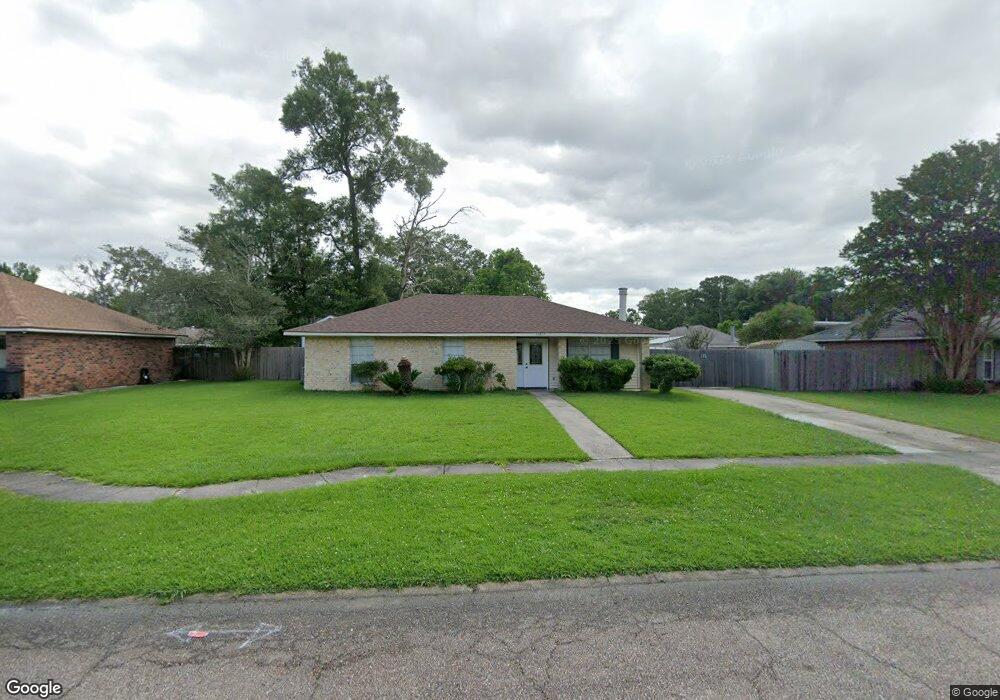
14614 Colonel Allen Ct Baton Rouge, LA 70816
Shenandoah NeighborhoodEstimated Value: $187,672 - $221,000
3
Beds
2
Baths
1,419
Sq Ft
$140/Sq Ft
Est. Value
About This Home
This home is located at 14614 Colonel Allen Ct, Baton Rouge, LA 70816 and is currently estimated at $198,918, approximately $140 per square foot. 14614 Colonel Allen Ct is a home located in East Baton Rouge Parish with nearby schools including Central Elementary School, Southeast Middle School, and Tara High School.
Ownership History
Date
Name
Owned For
Owner Type
Purchase Details
Closed on
Aug 13, 1998
Sold by
Johnson Johnson Vernet Elton
Bought by
Mayers Gary Michael
Current Estimated Value
Home Financials for this Owner
Home Financials are based on the most recent Mortgage that was taken out on this home.
Original Mortgage
$86,912
Outstanding Balance
$18,179
Interest Rate
6.95%
Mortgage Type
FHA
Estimated Equity
$180,739
Create a Home Valuation Report for This Property
The Home Valuation Report is an in-depth analysis detailing your home's value as well as a comparison with similar homes in the area
Home Values in the Area
Average Home Value in this Area
Purchase History
| Date | Buyer | Sale Price | Title Company |
|---|---|---|---|
| Mayers Gary Michael | $87,000 | -- |
Source: Public Records
Mortgage History
| Date | Status | Borrower | Loan Amount |
|---|---|---|---|
| Open | Mayers Gary Michael | $86,912 |
Source: Public Records
Tax History Compared to Growth
Tax History
| Year | Tax Paid | Tax Assessment Tax Assessment Total Assessment is a certain percentage of the fair market value that is determined by local assessors to be the total taxable value of land and additions on the property. | Land | Improvement |
|---|---|---|---|---|
| 2024 | $1,029 | $14,800 | $1,400 | $13,400 |
| 2023 | $945 | $12,600 | $1,400 | $11,200 |
| 2022 | $1,504 | $12,600 | $1,400 | $11,200 |
| 2021 | $1,470 | $12,600 | $1,400 | $11,200 |
| 2020 | $1,488 | $12,600 | $1,400 | $11,200 |
| 2019 | $1,556 | $12,600 | $1,400 | $11,200 |
| 2018 | $1,538 | $12,600 | $1,400 | $11,200 |
| 2017 | $1,538 | $12,600 | $1,400 | $11,200 |
| 2016 | $704 | $12,600 | $1,400 | $11,200 |
| 2015 | $707 | $12,600 | $1,400 | $11,200 |
| 2014 | $704 | $12,600 | $1,400 | $11,200 |
| 2013 | -- | $12,600 | $1,400 | $11,200 |
Source: Public Records
Map
Nearby Homes
- 14776 Colonel Allen Ct
- 2606 Shadowbrook Dr
- 3226 Woodbrook Dr
- 3352 Millbrook Dr
- 2406 Shadowbrook Dr
- 2413 Shadowbrook Dr
- 3635 Woodland Ridge Blvd
- 15314 Mistybrook Dr
- 2234 Morningbrook Dr
- 3455 Jones Creek Rd
- 3755 Merritt Anne Dr
- 3833 Valentine Rd
- 15861 N King Bradford Dr
- 15222 High Woods Dr
- 13919 Keever Ave
- 3251 King Bradford Dr
- 16023 Derby Ave
- 2924 Oneal Ln
- 2309 Aspenwood Dr
- 3422 & 3 448 King Bradford Dr
- 14624 Colonel Allen Ct
- 14604 Colonel Allen Ct
- 14723 General Prentiss Ave
- 14736 Colonel Allen Ct
- 14644 Colonel Allen Ct
- 14623 Colonel Allen Ct
- 14613 Colonel Allen Ct
- 14756 Colonel Allen Ct
- 14733 General Prentiss Ave
- 14633 Colonel Allen Ct
- 14603 Colonel Allen Ct
- 14766 Colonel Allen Ct
- 14805 General Prentiss Ave
- 14643 Colonel Allen Ct
- 14714 General Prentiss Ave
- 14704 General Prentiss Ave
- 14724 General Prentiss Ave
- 14632 General Prentiss Ave
- 14734 General Prentiss Ave
- 14815 General Prentiss Ave