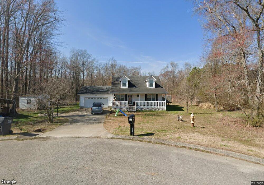
1462 Dustin Dr Dalton, GA 30720
Estimated Value: $188,000 - $292,000
--
Bed
2
Baths
1,152
Sq Ft
$194/Sq Ft
Est. Value
About This Home
This home is located at 1462 Dustin Dr, Dalton, GA 30720 and is currently estimated at $223,530, approximately $194 per square foot. 1462 Dustin Dr is a home located in Whitfield County with nearby schools including New Hope Elementary School, New Hope Middle School, and Northwest Whitfield County High School.
Ownership History
Date
Name
Owned For
Owner Type
Purchase Details
Closed on
Apr 14, 2021
Sold by
Pellom Melissa Leann
Bought by
Hughes Monnie E and Hughes James R
Current Estimated Value
Home Financials for this Owner
Home Financials are based on the most recent Mortgage that was taken out on this home.
Original Mortgage
$132,554
Outstanding Balance
$119,680
Interest Rate
3%
Mortgage Type
FHA
Estimated Equity
$103,850
Purchase Details
Closed on
Mar 11, 2016
Sold by
Myers Melissa
Bought by
Pellom Melissa Leann
Home Financials for this Owner
Home Financials are based on the most recent Mortgage that was taken out on this home.
Original Mortgage
$94,660
Interest Rate
3.87%
Mortgage Type
FHA
Purchase Details
Closed on
Jul 30, 2004
Sold by
Worley Ronald W
Bought by
Myers Melissa
Create a Home Valuation Report for This Property
The Home Valuation Report is an in-depth analysis detailing your home's value as well as a comparison with similar homes in the area
Home Values in the Area
Average Home Value in this Area
Purchase History
| Date | Buyer | Sale Price | Title Company |
|---|---|---|---|
| Hughes Monnie E | $135,000 | -- | |
| Pellom Melissa Leann | -- | -- | |
| Myers Melissa | $117,200 | -- |
Source: Public Records
Mortgage History
| Date | Status | Borrower | Loan Amount |
|---|---|---|---|
| Open | Hughes Monnie E | $132,554 | |
| Previous Owner | Pellom Melissa Leann | $94,660 |
Source: Public Records
Tax History Compared to Growth
Tax History
| Year | Tax Paid | Tax Assessment Tax Assessment Total Assessment is a certain percentage of the fair market value that is determined by local assessors to be the total taxable value of land and additions on the property. | Land | Improvement |
|---|---|---|---|---|
| 2024 | $1,865 | $80,687 | $17,631 | $63,056 |
| 2023 | $1,865 | $58,362 | $13,886 | $44,476 |
| 2022 | $1,555 | $48,854 | $12,192 | $36,662 |
| 2021 | $1,303 | $48,854 | $12,192 | $36,662 |
| 2020 | $1,332 | $48,854 | $12,192 | $36,662 |
| 2019 | $1,347 | $48,854 | $12,192 | $36,662 |
| 2018 | $1,309 | $47,220 | $10,558 | $36,662 |
| 2017 | $1,309 | $47,220 | $10,558 | $36,662 |
| 2016 | $1,168 | $42,550 | $9,205 | $33,345 |
| 2014 | $1,086 | $43,808 | $10,463 | $33,345 |
| 2013 | -- | $43,808 | $10,463 | $33,344 |
Source: Public Records
Map
Nearby Homes
- 1458 Dustin Dr
- 1433 Dustin Dr
- 1359 Dustin Dr
- 1377 Dustin Dr
- 460 Palomino Dr
- 405 Treadstone Dr
- 179 Treadstone Dr
- 463 Treadstone Dr
- 228 Vineyard Dr
- 503 Appaloosa Dr
- 0 Belgian Dr Unit 130344
- 181 Revere Run
- 1200 Percheron Dr NW
- 198 Artimis Dr
- 13 Ac Percheron Dr NW
- 13 acres Percheron Dr NW
- 151 Orion Dr
- 0 Tunnel Hill Varnell Rd
- The Harrington Plan at Varnell Preserve
- The Bradley Plan at Varnell Preserve