1462 Highway 73 Unit 24&25 Iron Station, NC 28080
Estimated Value: $341,000 - $548,000
5
Beds
2
Baths
2,781
Sq Ft
$158/Sq Ft
Est. Value
About This Home
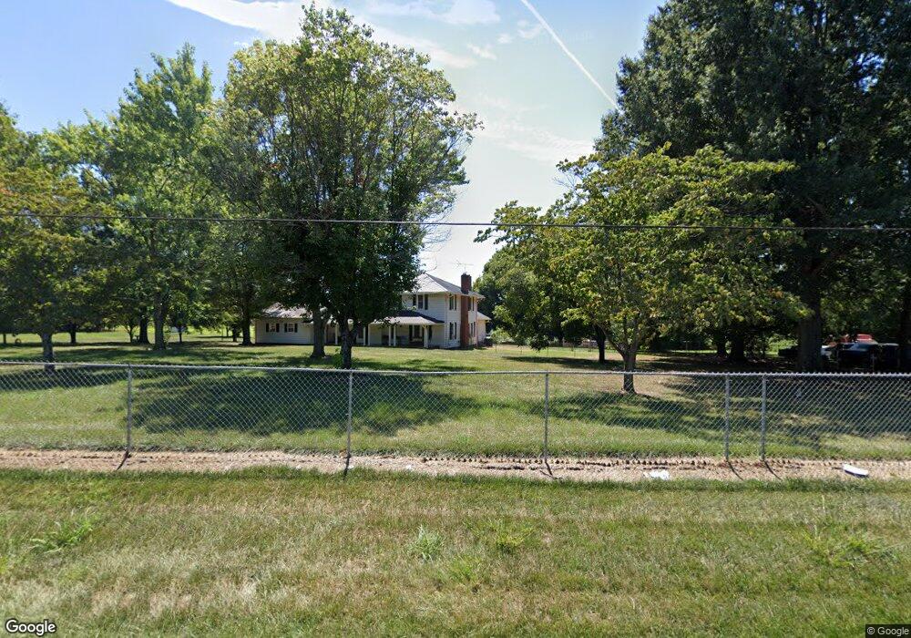
This home is located at 1462 Highway 73 Unit 24&25, Iron Station, NC 28080 and is currently estimated at $440,586, approximately $158 per square foot. 1462 Highway 73 Unit 24&25 is a home located in Lincoln County with nearby schools including Iron Station Elementary School, East Lincoln Middle School, and East Lincoln High School.
Ownership History
Date
Name
Owned For
Owner Type
Purchase Details
Closed on
Jul 31, 2017
Sold by
Mcdowell Betty Jo
Bought by
Overton Dustin E and Overton Sharon A
Current Estimated Value
Home Financials for this Owner
Home Financials are based on the most recent Mortgage that was taken out on this home.
Original Mortgage
$186,558
Outstanding Balance
$156,870
Interest Rate
4.25%
Mortgage Type
FHA
Estimated Equity
$283,716
Create a Home Valuation Report for This Property
The Home Valuation Report is an in-depth analysis detailing your home's value as well as a comparison with similar homes in the area
Home Values in the Area
Average Home Value in this Area
Purchase History
| Date | Buyer | Sale Price | Title Company |
|---|---|---|---|
| Overton Dustin E | $190,000 | None Available |
Source: Public Records
Mortgage History
| Date | Status | Borrower | Loan Amount |
|---|---|---|---|
| Open | Overton Dustin E | $186,558 |
Source: Public Records
Tax History Compared to Growth
Tax History
| Year | Tax Paid | Tax Assessment Tax Assessment Total Assessment is a certain percentage of the fair market value that is determined by local assessors to be the total taxable value of land and additions on the property. | Land | Improvement |
|---|---|---|---|---|
| 2025 | $1,751 | $258,229 | $42,956 | $215,273 |
| 2024 | $1,731 | $258,229 | $42,956 | $215,273 |
| 2023 | $1,726 | $258,229 | $42,956 | $215,273 |
| 2022 | $1,677 | $209,957 | $31,792 | $178,165 |
| 2021 | $1,677 | $209,957 | $31,792 | $178,165 |
| 2020 | $1,520 | $209,957 | $31,792 | $178,165 |
| 2019 | $1,478 | $209,957 | $31,792 | $178,165 |
| 2018 | $1,288 | $165,842 | $30,292 | $135,550 |
| 2017 | $1,179 | $165,842 | $30,292 | $135,550 |
| 2016 | $1,179 | $165,842 | $30,292 | $135,550 |
| 2015 | $1,241 | $165,842 | $30,292 | $135,550 |
| 2014 | $1,315 | $178,486 | $31,580 | $146,906 |
Source: Public Records
Map
Nearby Homes
- 222 McMillian Heights Rd
- 3164 Andrew Link Rd
- 575 Hill Rd
- 00 Southmont Rd
- 370 Sherrill Farm Rd
- 2984 N Carolina 27
- 000 N Carolina 73
- 3132 Fox Den Cir
- 2515 Myra Ln
- 1065 Salem Church Rd
- 1212 Salem Church Rd
- 2546 N Carolina Highway 150
- 2384 Abby Ave
- 1448 Weatherwood Dr
- 2109 Boggs St
- lot 22 Weatherwood Dr
- 1585 Salem Church Rd
- 2914 Weatherfield Dr
- 2415 Heavner Rd
- 2911 Weatherfield Dr
- 1462 Highway 73
- 1490 Highway 73
- 00 Nc Hwy 73 None
- 1502 Highway 73
- 3743 Nc-27
- 3767 E Hwy 27
- 1435 Highway 73
- n/a Hwy 27 Hwy
- 1361 Highway 73
- 1377 Highway 73
- 1501 Highway 73
- 3793 E Highway 27
- 3339 Iredell Heights Rd
- 1421 Highway 73
- 3805 E Highway 27
- 3600 Caldwell Cir
- 3333 Iredell Heights Rd
- 1520 Highway 73
- 3345 Iredell Heights Rd
- 3319 Iredell Heights Rd