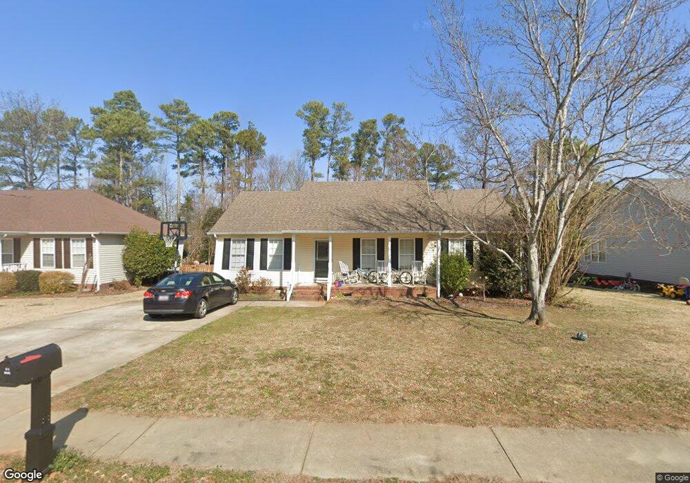
1462 Lowell Trace Unit L88 Rock Hill, SC 29732
Estimated Value: $309,000 - $349,000
3
Beds
2
Baths
1,400
Sq Ft
$234/Sq Ft
Est. Value
About This Home
This home is located at 1462 Lowell Trace Unit L88, Rock Hill, SC 29732 and is currently estimated at $326,936, approximately $233 per square foot. 1462 Lowell Trace Unit L88 is a home located in York County with nearby schools including York Road Elementary School, Rawlinson Road Middle School, and Northwestern High School.
Ownership History
Date
Name
Owned For
Owner Type
Purchase Details
Closed on
Sep 1, 2006
Sold by
Dockery Katherine A
Bought by
Pendley Kevin T and Pendley Krista W
Current Estimated Value
Home Financials for this Owner
Home Financials are based on the most recent Mortgage that was taken out on this home.
Original Mortgage
$52,000
Outstanding Balance
$31,143
Interest Rate
6.62%
Mortgage Type
Adjustable Rate Mortgage/ARM
Estimated Equity
$295,793
Purchase Details
Closed on
Aug 24, 2001
Sold by
Tan Rick Management Llc
Bought by
Dockery Katherine A
Create a Home Valuation Report for This Property
The Home Valuation Report is an in-depth analysis detailing your home's value as well as a comparison with similar homes in the area
Home Values in the Area
Average Home Value in this Area
Purchase History
| Date | Buyer | Sale Price | Title Company |
|---|---|---|---|
| Pendley Kevin T | $152,000 | None Available | |
| Dockery Katherine A | $124,410 | -- |
Source: Public Records
Mortgage History
| Date | Status | Borrower | Loan Amount |
|---|---|---|---|
| Open | Pendley Kevin T | $52,000 |
Source: Public Records
Tax History Compared to Growth
Tax History
| Year | Tax Paid | Tax Assessment Tax Assessment Total Assessment is a certain percentage of the fair market value that is determined by local assessors to be the total taxable value of land and additions on the property. | Land | Improvement |
|---|---|---|---|---|
| 2024 | $1,216 | $5,543 | $1,469 | $4,074 |
| 2023 | $1,219 | $5,543 | $1,469 | $4,074 |
| 2022 | $1,228 | $5,543 | $1,469 | $4,074 |
| 2021 | -- | $5,543 | $1,469 | $4,074 |
| 2020 | $1,231 | $5,543 | $0 | $0 |
| 2019 | $1,104 | $4,820 | $0 | $0 |
| 2018 | $1,102 | $4,820 | $0 | $0 |
| 2017 | $1,062 | $4,820 | $0 | $0 |
| 2016 | $1,052 | $4,820 | $0 | $0 |
| 2014 | $986 | $4,820 | $1,400 | $3,420 |
| 2013 | $986 | $4,740 | $1,400 | $3,340 |
Source: Public Records
Map
Nearby Homes
- 1487 The Crossing
- 1122 Wendy Rd
- 1548 Summit View Dr
- 1593 Worthington Crossing
- 1594 Summit View Dr
- 926 Meadow Lakes Rd
- 1085 Pinecrest Dr
- 2069 Landry Ln Unit 233
- 2076 Landry Ln Unit 232
- 1189 Quiet Acres Rd
- 1545 Patio Point
- 1391 Colwick Ln
- 1183 Quiet Acres Rd
- 1540 Coatsworth Ln
- 2615 Oakhurst Dr
- 1750 Trellis Dr
- 2358 Sparrow Dr
- 2765 Dogwood Cir
- 981 Meadowlark Dr
- 446 Guiness Place
- 1462 Lowell Trace
- 1468 Lowell Trace
- 1456 Lowell Trace
- 1474 Lowell Trace
- 1450 Lowell Trace
- 1461 Lowell Trace
- 1455 Lowell Trace
- 1467 Lowell Trace
- 1449 Lowell Trace
- 1473 Lowell Trace
- 1473 Lowell Trace Unit L85
- 1443 Lowell Trace
- 1438 Lowell Trace
- 1437 Lowell Trace
- 1494 the Crossing
- 1488 the Crossing
- 1488 The Crossing
- 1500 the Crossing
- 1432 Lowell Trace
- 1482 The Crossing