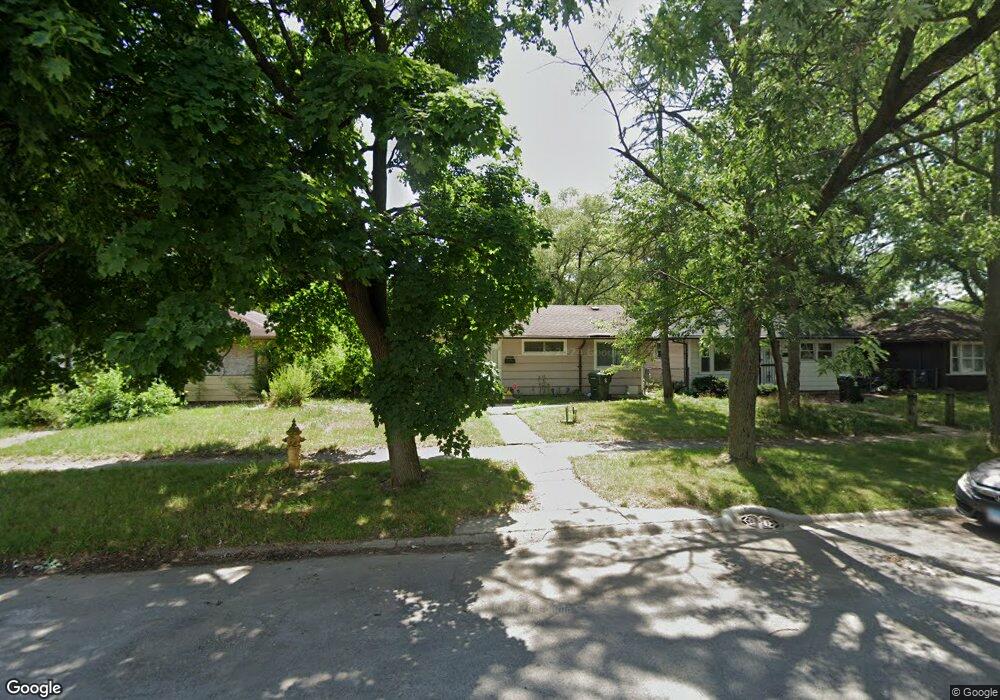
14620 Shepard Dr Dolton, IL 60419
Estimated Value: $108,000 - $204,000
4
Beds
1
Bath
1,560
Sq Ft
$98/Sq Ft
Est. Value
About This Home
This home is located at 14620 Shepard Dr, Dolton, IL 60419 and is currently estimated at $152,501, approximately $97 per square foot. 14620 Shepard Dr is a home located in Cook County with nearby schools including Berger-Vandenberg Elementary School, School Of Fine Arts Academy, and Creative Communications Academy.
Ownership History
Date
Name
Owned For
Owner Type
Purchase Details
Closed on
Oct 13, 1998
Sold by
Prasad Gayatri D
Bought by
Washington George J and Washington Andrea C
Current Estimated Value
Home Financials for this Owner
Home Financials are based on the most recent Mortgage that was taken out on this home.
Original Mortgage
$45,600
Outstanding Balance
$9,829
Interest Rate
6.72%
Estimated Equity
$142,672
Purchase Details
Closed on
Feb 26, 1997
Sold by
Hud
Bought by
Prasad Gayatri D
Create a Home Valuation Report for This Property
The Home Valuation Report is an in-depth analysis detailing your home's value as well as a comparison with similar homes in the area
Home Values in the Area
Average Home Value in this Area
Purchase History
| Date | Buyer | Sale Price | Title Company |
|---|---|---|---|
| Washington George J | $48,000 | -- | |
| Prasad Gayatri D | -- | -- |
Source: Public Records
Mortgage History
| Date | Status | Borrower | Loan Amount |
|---|---|---|---|
| Open | Washington George J | $45,600 |
Source: Public Records
Tax History Compared to Growth
Tax History
| Year | Tax Paid | Tax Assessment Tax Assessment Total Assessment is a certain percentage of the fair market value that is determined by local assessors to be the total taxable value of land and additions on the property. | Land | Improvement |
|---|---|---|---|---|
| 2024 | $2,839 | $11,000 | $2,125 | $8,875 |
| 2023 | $1,887 | $11,000 | $2,125 | $8,875 |
| 2022 | $1,887 | $8,763 | $1,875 | $6,888 |
| 2021 | $1,907 | $8,763 | $1,875 | $6,888 |
| 2020 | $3,642 | $8,763 | $1,875 | $6,888 |
| 2019 | $2,961 | $7,490 | $1,750 | $5,740 |
| 2018 | $2,944 | $7,490 | $1,750 | $5,740 |
| 2017 | $2,827 | $7,490 | $1,750 | $5,740 |
| 2016 | $3,048 | $7,279 | $1,625 | $5,654 |
| 2015 | $2,867 | $7,279 | $1,625 | $5,654 |
| 2014 | $2,864 | $7,279 | $1,625 | $5,654 |
| 2013 | $2,895 | $7,705 | $1,625 | $6,080 |
Source: Public Records
Map
Nearby Homes
- 14619 Minerva Ave
- 14644 Ellis Ave
- 14640 Ingleside Ave
- 14708 Shepard Dr
- 14534 Woodlawn Ave
- 14720 Shepard Dr
- 14508 Ingleside Ave
- 14635 Woodlawn Ave
- 14761 Lincoln Ave
- 14447 University Ave
- 14429 Minerva Ave
- 14700 Avalon Ave
- 14814 Woodlawn Ave
- 14418 Drexel Ave
- 14405 Woodlawn Ave
- 14526 Cottage Grove Ave
- 14622 Kenwood Ave
- 14634 Kenwood Ave
- 14320 Dobson Ave
- 14737 Kimbark Ave
- 14622 Shepard Dr
- 14612 Shepard Dr
- 14628 Shepard Dr
- 14608 Shepard Dr
- 14647 Lincoln Ave
- 14647 Lincoln Ave
- 14641 Lincoln Ave
- 14651 Lincoln Ave
- 14651 Lincoln Ave
- 14606 Shepard Dr
- 14637 Lincoln Ave
- 14637 Lincoln Ave
- 1031 E 146th St
- 14655 Lincoln Ave
- 14655 Lincoln Ave
- 14636 Shepard Dr
- 14602 Shepard Dr
- 1035 E 146th St
- 1035 E 146th St