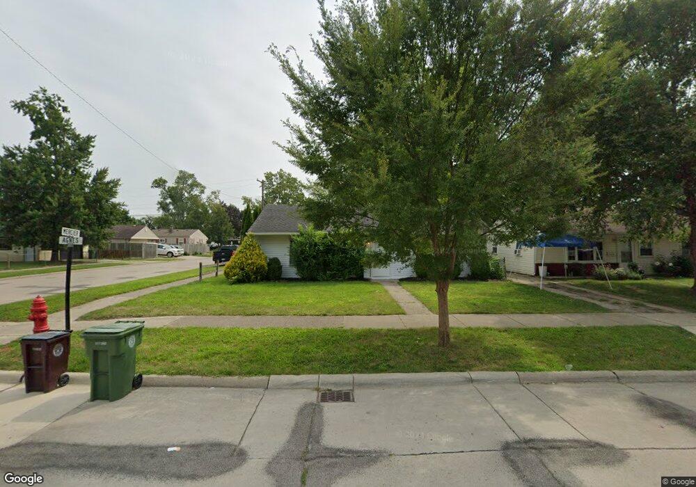
14621 Agnes St Southgate, MI 48195
Estimated Value: $131,000 - $153,000
3
Beds
1
Bath
960
Sq Ft
$151/Sq Ft
Est. Value
About This Home
This home is located at 14621 Agnes St, Southgate, MI 48195 and is currently estimated at $145,333, approximately $151 per square foot. 14621 Agnes St is a home located in Wayne County with nearby schools including Fordline Elementary School, Davidson Middle School, and Southgate Anderson High School.
Ownership History
Date
Name
Owned For
Owner Type
Purchase Details
Closed on
Feb 15, 2018
Sold by
Lachance Linda M
Bought by
Bkf Properties Llc
Current Estimated Value
Purchase Details
Closed on
Aug 11, 2017
Sold by
Reaume Robert C and Reaume Jeanette M
Bought by
Reaume Robert C and Robert C Reaume Revocable Living Trust
Purchase Details
Closed on
Dec 27, 2012
Sold by
Yeary Michael and Graham Vicki
Bought by
Reaume Robert C and Reaume Jeannette M
Purchase Details
Closed on
Nov 16, 2006
Sold by
Yeary Mark L and Yeary Bonita
Bought by
Yeary Mark L
Create a Home Valuation Report for This Property
The Home Valuation Report is an in-depth analysis detailing your home's value as well as a comparison with similar homes in the area
Home Values in the Area
Average Home Value in this Area
Purchase History
| Date | Buyer | Sale Price | Title Company |
|---|---|---|---|
| Bkf Properties Llc | $40,000 | Michigan Title Ins Agcy Inc | |
| Reaume Robert C | -- | None Available | |
| Reaume Robert C | $19,000 | Michigan Title Insurance Age | |
| Yeary Mark L | -- | None Available |
Source: Public Records
Tax History
| Year | Tax Paid | Tax Assessment Tax Assessment Total Assessment is a certain percentage of the fair market value that is determined by local assessors to be the total taxable value of land and additions on the property. | Land | Improvement |
|---|---|---|---|---|
| 2025 | $3,211 | $68,200 | $0 | $0 |
| 2024 | $3,090 | $63,500 | $0 | $0 |
| 2023 | $2,943 | $57,600 | $0 | $0 |
| 2022 | $3,240 | $51,900 | $0 | $0 |
| 2021 | $3,150 | $47,100 | $0 | $0 |
| 2020 | $3,100 | $42,900 | $0 | $0 |
| 2019 | $3,057 | $39,300 | $0 | $0 |
| 2018 | $1,877 | $33,700 | $0 | $0 |
| 2017 | $780 | $31,600 | $0 | $0 |
| 2016 | $2,143 | $30,600 | $0 | $0 |
| 2015 | $2,766 | $29,700 | $0 | $0 |
| 2013 | $2,680 | $27,900 | $0 | $0 |
| 2012 | $2,625 | $26,300 | $6,100 | $20,200 |
Source: Public Records
Map
Nearby Homes
- 14567 Longtin St
- 13820 Catalpa St
- 14420 Trenton Rd
- 14940 Irene St
- 14955 Helen St
- 14370 Pearl St
- 14359 Irene St
- 14618 Fordline St
- 14786 Poplar St
- 14231 Fordline St
- 15142 Fordline St
- 0 Fordline Unit 20261010397
- 15338 Helen St
- 14559 Balsam St
- 14706 Eureka Rd
- 13311 Veronica St
- 14716 Eureka Rd
- 0 Poplar St
- 13226 Catalpa St
- 13680 Agnes St
- 14633 Agnes St
- 14579 Agnes St
- 14649 Agnes St
- 14620 Longtin St
- 14567 Agnes St
- 14667 Agnes St
- 14620 Agnes St
- 14634 Agnes St
- 14578 Longtin St
- 14648 Agnes St
- 14555 Agnes St
- 14566 Longtin St
- 14666 Agnes St
- 14642 Longtin St
- 14554 Longtin St
- 14684 Agnes St
- 14572 Agnes St
- 14541 Agnes St
- 14684 Longtin St
- 14536 Longtin St
Your Personal Tour Guide
Ask me questions while you tour the home.