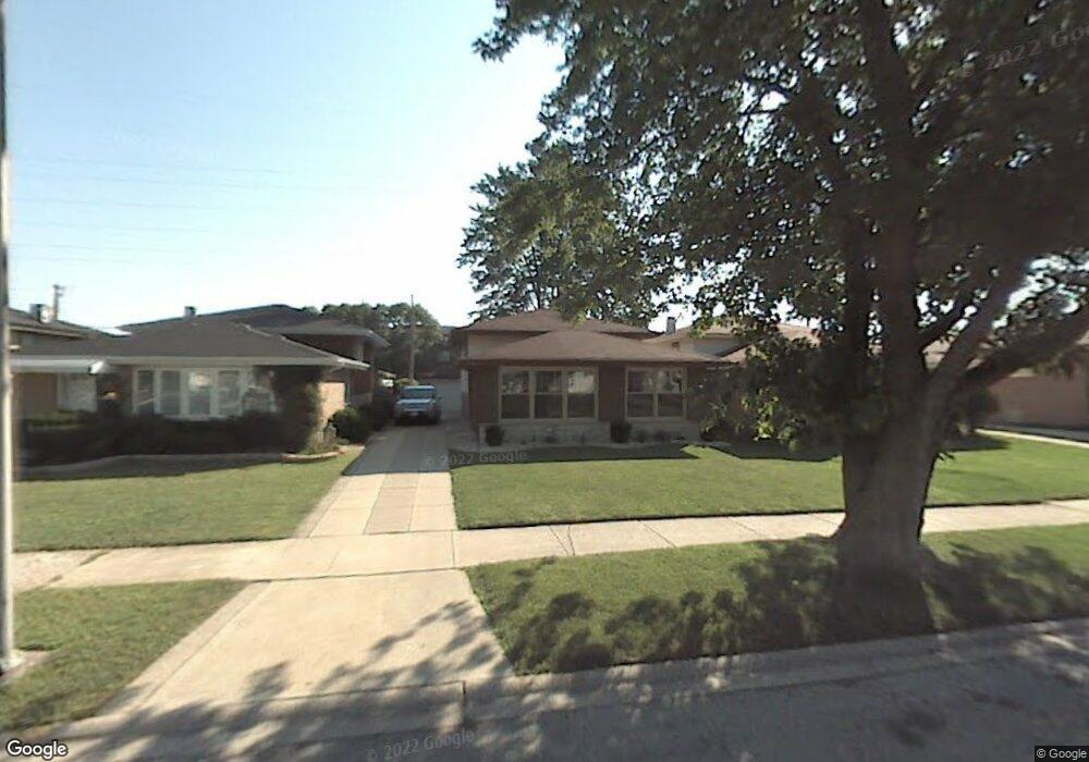
14621 Memorial Dr Dolton, IL 60419
Estimated Value: $140,000 - $209,000
3
Beds
2
Baths
1,058
Sq Ft
$167/Sq Ft
Est. Value
About This Home
This home is located at 14621 Memorial Dr, Dolton, IL 60419 and is currently estimated at $176,814, approximately $167 per square foot. 14621 Memorial Dr is a home located in Cook County with nearby schools including Franklin Elementary School, Lincoln Junior High School, and Thornridge High School.
Ownership History
Date
Name
Owned For
Owner Type
Purchase Details
Closed on
Mar 12, 2001
Sold by
Taylor Rollin
Bought by
Taylor Rollin and Foster Taylor Dawn
Current Estimated Value
Purchase Details
Closed on
May 25, 2000
Sold by
Peterson Ltanya P
Bought by
Taylor Rollin
Home Financials for this Owner
Home Financials are based on the most recent Mortgage that was taken out on this home.
Original Mortgage
$114,200
Outstanding Balance
$40,145
Interest Rate
8.18%
Mortgage Type
VA
Estimated Equity
$136,669
Purchase Details
Closed on
Nov 13, 1995
Sold by
Coleman Reginald R and Coleman Brenda E
Bought by
Peterson Ltanya P
Home Financials for this Owner
Home Financials are based on the most recent Mortgage that was taken out on this home.
Original Mortgage
$86,503
Interest Rate
7.52%
Mortgage Type
FHA
Create a Home Valuation Report for This Property
The Home Valuation Report is an in-depth analysis detailing your home's value as well as a comparison with similar homes in the area
Home Values in the Area
Average Home Value in this Area
Purchase History
| Date | Buyer | Sale Price | Title Company |
|---|---|---|---|
| Taylor Rollin | -- | -- | |
| Taylor Rollin | $112,000 | -- | |
| Peterson Ltanya P | $87,000 | Land Title Group Inc |
Source: Public Records
Mortgage History
| Date | Status | Borrower | Loan Amount |
|---|---|---|---|
| Open | Taylor Rollin | $114,200 | |
| Previous Owner | Peterson Ltanya P | $86,503 |
Source: Public Records
Tax History Compared to Growth
Tax History
| Year | Tax Paid | Tax Assessment Tax Assessment Total Assessment is a certain percentage of the fair market value that is determined by local assessors to be the total taxable value of land and additions on the property. | Land | Improvement |
|---|---|---|---|---|
| 2024 | $6,370 | $13,000 | $2,040 | $10,960 |
| 2023 | $7,043 | $13,000 | $2,040 | $10,960 |
| 2022 | $7,043 | $11,724 | $1,800 | $9,924 |
| 2021 | $7,036 | $11,724 | $1,800 | $9,924 |
| 2020 | $6,829 | $11,724 | $1,800 | $9,924 |
| 2019 | $4,963 | $9,092 | $1,680 | $7,412 |
| 2018 | $4,810 | $9,092 | $1,680 | $7,412 |
| 2017 | $4,575 | $9,092 | $1,680 | $7,412 |
| 2016 | $5,511 | $10,014 | $1,560 | $8,454 |
| 2015 | $5,253 | $10,014 | $1,560 | $8,454 |
| 2014 | $5,251 | $10,014 | $1,560 | $8,454 |
| 2013 | $4,941 | $10,250 | $1,560 | $8,690 |
Source: Public Records
Map
Nearby Homes
- 14647 Irving Ave
- 14640 Memorial Dr
- 14635 Greenwood Rd Unit B103
- 14647 Greenwood Rd Unit A312
- 14502 Irving Ave
- 14526 Cottage Grove Ave
- 14528 Grant St
- 14411 Irving Ave
- 14819 Irving Ave
- 14421 Murray Ave
- 14619 Martin Luther King jr Dr
- 14819 Champlain Ave
- 14408 Lincoln Ave
- 14828 Oak St
- 612 Margaret St
- 14838 Champlain St
- 14806 Grant St
- 14841 Langley Ave
- 14820 Cottage Grove Ave
- 14701 Beachview Terrace
- 14617 Memorial Dr
- 14625 Memorial Dr
- 14613 Memorial Dr
- 14633 Memorial Dr
- 14611 Memorial Dr
- 14620 Memorial Dr
- 14637 Memorial Dr
- 14626 Memorial Dr
- 14615 Irving Ave
- 14609 Memorial Dr
- 14641 Memorial Dr
- 14632 Memorial Dr
- 14623 Irving Ave
- 14636 Memorial Dr
- 14631 Irving Ave
- 14445 Memorial Dr
- 14645 Memorial Dr
- 14607 Memorial Dr
- 14605 Irving Ave