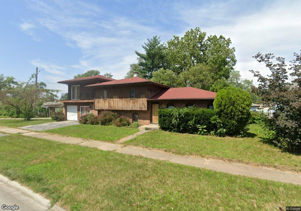
14627 Shepard Dr Dolton, IL 60419
Estimated Value: $181,000 - $208,000
4
Beds
2
Baths
1,594
Sq Ft
$121/Sq Ft
Est. Value
About This Home
This home is located at 14627 Shepard Dr, Dolton, IL 60419 and is currently estimated at $192,686, approximately $120 per square foot. 14627 Shepard Dr is a home located in Cook County with nearby schools including Berger-Vandenberg Elementary School, Creative Communications Academy, and School Of Fine Arts Academy.
Ownership History
Date
Name
Owned For
Owner Type
Purchase Details
Closed on
Apr 28, 2022
Sold by
Village Of Dolton
Bought by
Bp Capital Inc
Current Estimated Value
Purchase Details
Closed on
May 29, 2019
Sold by
Triplett Cha
Bought by
City Of Dolton
Purchase Details
Closed on
Jan 14, 2012
Sold by
Wells Fargo Bank Na
Bought by
Washington Monique
Purchase Details
Closed on
Jun 9, 2010
Sold by
Triplett Charles F and Triplett Charles
Bought by
Wells Fargo Bank Na
Create a Home Valuation Report for This Property
The Home Valuation Report is an in-depth analysis detailing your home's value as well as a comparison with similar homes in the area
Home Values in the Area
Average Home Value in this Area
Purchase History
| Date | Buyer | Sale Price | Title Company |
|---|---|---|---|
| Bp Capital Inc | -- | Chicago Title | |
| City Of Dolton | -- | Accommodation | |
| Washington Monique | $35,000 | Fidelity National Title | |
| Wells Fargo Bank Na | -- | None Available |
Source: Public Records
Tax History Compared to Growth
Tax History
| Year | Tax Paid | Tax Assessment Tax Assessment Total Assessment is a certain percentage of the fair market value that is determined by local assessors to be the total taxable value of land and additions on the property. | Land | Improvement |
|---|---|---|---|---|
| 2024 | $8,462 | $15,000 | $3,066 | $11,934 |
| 2023 | $9,537 | $15,000 | $3,066 | $11,934 |
| 2022 | $9,537 | $13,176 | $2,706 | $10,470 |
| 2021 | $9,073 | $13,174 | $2,705 | $10,469 |
| 2020 | $8,475 | $13,174 | $2,705 | $10,469 |
| 2019 | $9,085 | $12,458 | $2,525 | $9,933 |
| 2018 | $6,552 | $12,458 | $2,525 | $9,933 |
| 2017 | $6,240 | $12,458 | $2,525 | $9,933 |
| 2016 | $6,192 | $12,210 | $2,344 | $9,866 |
| 2015 | $5,903 | $12,210 | $2,344 | $9,866 |
| 2014 | $5,863 | $12,210 | $2,344 | $9,866 |
| 2013 | $6,234 | $13,560 | $2,344 | $11,216 |
Source: Public Records
Map
Nearby Homes
- 14619 Minerva Ave
- 14708 Shepard Dr
- 14534 Woodlawn Ave
- 14644 Ellis Ave
- 14635 Woodlawn Ave
- 14720 Shepard Dr
- 14761 Lincoln Ave
- 14700 Avalon Ave
- 14640 Ingleside Ave
- 14447 University Ave
- 14429 Minerva Ave
- 14508 Ingleside Ave
- 14814 Woodlawn Ave
- 14622 Kenwood Ave
- 14634 Kenwood Ave
- 14405 Woodlawn Ave
- 14737 Kimbark Ave
- 14728 Kenwood Ave
- 14637 Kenwood Ave
- 14418 Drexel Ave
- 14635 Shepard Dr
- 1043 E 146th St
- 1039 E 146th St
- 1039 E 146th St
- 1047 E 146th St
- 1035 E 146th St
- 1035 E 146th St
- 14628 Shepard Dr
- 14636 Shepard Dr
- 14638 Shepard Dr
- 14622 Shepard Dr
- 14640 Shepard Dr
- 1103 E 146th St
- 1103 E 146th St
- 1031 E 146th St
- 14615 Minerva Ave
- 14620 Shepard Dr
- 14644 Shepard Dr
- 14625 Minerva Ave