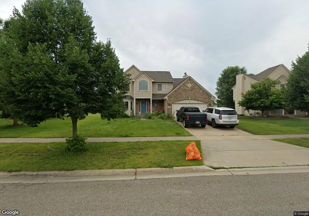
1463 Auston Ln Unit 41 Chelsea, MI 48118
Estimated Value: $454,992 - $501,000
4
Beds
4
Baths
1,916
Sq Ft
$251/Sq Ft
Est. Value
About This Home
This home is located at 1463 Auston Ln Unit 41, Chelsea, MI 48118 and is currently estimated at $480,248, approximately $250 per square foot. 1463 Auston Ln Unit 41 is a home located in Washtenaw County with nearby schools including North Creek Elementary School, South Meadows Elementary School, and Beach Middle School.
Ownership History
Date
Name
Owned For
Owner Type
Purchase Details
Closed on
Apr 11, 2005
Sold by
Cook & Trombley Inc
Bought by
Abramson Joel S and Kane Abramson Ronda A
Current Estimated Value
Home Financials for this Owner
Home Financials are based on the most recent Mortgage that was taken out on this home.
Original Mortgage
$246,800
Outstanding Balance
$118,751
Interest Rate
4.75%
Mortgage Type
Fannie Mae Freddie Mac
Estimated Equity
$361,497
Purchase Details
Closed on
Nov 5, 2004
Sold by
Chelsea Ridge Llc
Bought by
Cook & Trombley Inc
Home Financials for this Owner
Home Financials are based on the most recent Mortgage that was taken out on this home.
Original Mortgage
$8,000,000
Interest Rate
5.82%
Mortgage Type
Unknown
Create a Home Valuation Report for This Property
The Home Valuation Report is an in-depth analysis detailing your home's value as well as a comparison with similar homes in the area
Home Values in the Area
Average Home Value in this Area
Purchase History
| Date | Buyer | Sale Price | Title Company |
|---|---|---|---|
| Abramson Joel S | $314,830 | Liberty Title | |
| Cook & Trombley Inc | -- | Liberty Title Company |
Source: Public Records
Mortgage History
| Date | Status | Borrower | Loan Amount |
|---|---|---|---|
| Open | Abramson Joel S | $246,800 | |
| Previous Owner | Cook & Trombley Inc | $8,000,000 |
Source: Public Records
Tax History Compared to Growth
Tax History
| Year | Tax Paid | Tax Assessment Tax Assessment Total Assessment is a certain percentage of the fair market value that is determined by local assessors to be the total taxable value of land and additions on the property. | Land | Improvement |
|---|---|---|---|---|
| 2025 | $6,549 | $205,700 | $0 | $0 |
| 2024 | $6,740 | $195,900 | $0 | $0 |
| 2023 | $6,740 | $176,700 | $0 | $0 |
| 2022 | $5,908 | $166,700 | $0 | $0 |
| 2021 | $6,301 | $170,600 | $0 | $0 |
| 2020 | $6,223 | $157,300 | $0 | $0 |
| 2019 | $6,075 | $151,300 | $151,300 | $0 |
| 2018 | $5,893 | $142,700 | $0 | $0 |
| 2017 | $0 | $142,000 | $0 | $0 |
| 2016 | $0 | $117,046 | $0 | $0 |
| 2015 | -- | $116,696 | $0 | $0 |
| 2014 | -- | $113,051 | $0 | $0 |
| 2013 | -- | $113,051 | $0 | $0 |
Source: Public Records
Map
Nearby Homes
- 1332 Auston Ln Unit 49
- 1421 Kimlee Ct
- 13440 Meadowview Dr
- 1321 Saint James Place
- 0 N Freer Rd Unit 25015352
- 719 Knollwood Bend
- 684 Countryside Dr
- 660 Countryside Dr
- 707 Knollwood Bend
- 706 Knollwood Bend
- 724 Knollwood Bend
- 651 Countryside Dr
- Brooklyn Plan at Heritage Farms
- Sawyer Plan at Heritage Farms
- Juliet Plan at Heritage Farms
- Peyton Plan at Heritage Farms
- Aubrey Plan at Heritage Farms
- 516 Heritage Farms Blvd
- 725 Knollwood Bend
- 657 Swift Creek Dr
- 1453 Auston Ln
- 1473 Auston Ln Unit 42
- 1442 Carston Ln Unit 18
- 1452 Carston Ln Unit 17
- 1432 Carston Ln Unit 19
- 1483 Auston Ln Unit 43
- 1443 Auston Ln Unit 39
- 1462 Auston Ln Unit 56
- 1422 Carston Ln Unit 20
- 1452 Auston Ln Unit 55
- 1462 Carston Ln Unit 16
- 1472 Auston Ln Unit 57
- 1433 Auston Ln Unit 38
- 1442 Auston Ln Unit 54
- 1472 Carston Ln Unit 45
- 1482 Carston Ln Unit 44
- 1482 Auston Ln Unit 58
- 1412 Carston Ln Unit 21
- 1423 Auston Ln Unit 37
- 1492 Auston Ln Unit 59