Estimated Value: $229,062 - $300,000
2
Beds
1
Bath
1,581
Sq Ft
$158/Sq Ft
Est. Value
About This Home
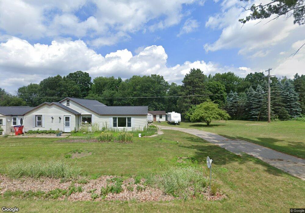
This home is located at 1463 E 120th St, Grant, MI 49327 and is currently estimated at $250,016, approximately $158 per square foot. 1463 E 120th St is a home located in Newaygo County with nearby schools including Grant Primary Center, Grant Elementary School, and Grant Middle School.
Ownership History
Date
Name
Owned For
Owner Type
Purchase Details
Closed on
Apr 16, 2010
Sold by
Ruser Brendon C
Bought by
Ruser Jodi L and Connell Michael J
Current Estimated Value
Home Financials for this Owner
Home Financials are based on the most recent Mortgage that was taken out on this home.
Original Mortgage
$81,498
Outstanding Balance
$54,334
Interest Rate
5.02%
Mortgage Type
Purchase Money Mortgage
Estimated Equity
$195,682
Purchase Details
Closed on
Aug 29, 2001
Sold by
Felkey Neola
Bought by
Ruser Brenden C Et Ux Rachel R
Create a Home Valuation Report for This Property
The Home Valuation Report is an in-depth analysis detailing your home's value as well as a comparison with similar homes in the area
Home Values in the Area
Average Home Value in this Area
Purchase History
| Date | Buyer | Sale Price | Title Company |
|---|---|---|---|
| Ruser Jodi L | $79,900 | -- | |
| Ruser Brenden C Et Ux Rachel R | $95,000 | -- |
Source: Public Records
Mortgage History
| Date | Status | Borrower | Loan Amount |
|---|---|---|---|
| Open | Ruser Jodi L | $81,498 |
Source: Public Records
Tax History Compared to Growth
Tax History
| Year | Tax Paid | Tax Assessment Tax Assessment Total Assessment is a certain percentage of the fair market value that is determined by local assessors to be the total taxable value of land and additions on the property. | Land | Improvement |
|---|---|---|---|---|
| 2025 | $1,430 | $102,100 | $0 | $0 |
| 2024 | $6 | $95,500 | $0 | $0 |
| 2023 | $561 | $81,700 | $0 | $0 |
| 2022 | $1,274 | $75,200 | $0 | $0 |
| 2021 | $1,303 | $70,000 | $0 | $0 |
| 2020 | $1,292 | $62,500 | $0 | $0 |
| 2019 | $1,254 | $56,600 | $0 | $0 |
| 2018 | $1,304 | $48,800 | $0 | $0 |
| 2017 | $1,309 | $45,800 | $0 | $0 |
| 2016 | $1,279 | $45,200 | $0 | $0 |
| 2015 | -- | $44,700 | $0 | $0 |
| 2014 | -- | $41,100 | $0 | $0 |
Source: Public Records
Map
Nearby Homes
- Lot 19 S Elder Ave
- 953 E 136th St
- 151 & 153 Clark St
- 10201 Mason Dr
- 86 W State Rd
- 11298 S Gordon Ave
- 3182 E 128th St
- 1599 E Clearwater St
- 1485 E Hess Lake Dr
- 14074 S Elder Ave
- 1333 E Hess Lake Dr
- 9500 S Annie Ln
- 9680 S Thornapple Ave
- 9310 Benjamin Dr
- 9425 S Benjamin Dr
- 4390 22 Mile Rd NW
- 3500 Northkent Pine Dr
- 10603 Paw Ave
- 2712 E 88th St
- 0 E 88th St Unit 25061606
- 1429 E 120th St
- 1466 E 120th St
- 1421 E 120th St
- 1493 E 120th St
- 1394 E 120th St
- 1450 E 120th St
- 1480 E 120th St
- 1382 E 120th St
- 1315 E 120th St
- 1496 E 120th St
- 1508 E 120th St
- 1343 E 120th St
- 1348 E 120th St
- 1322 E 120th St
- 1545 E 120th St
- 1556 E 120th St
- 1295 E 120th St
- 1310 E 120th St
- 1266 E 120th St
- 12081 Walnut Ave