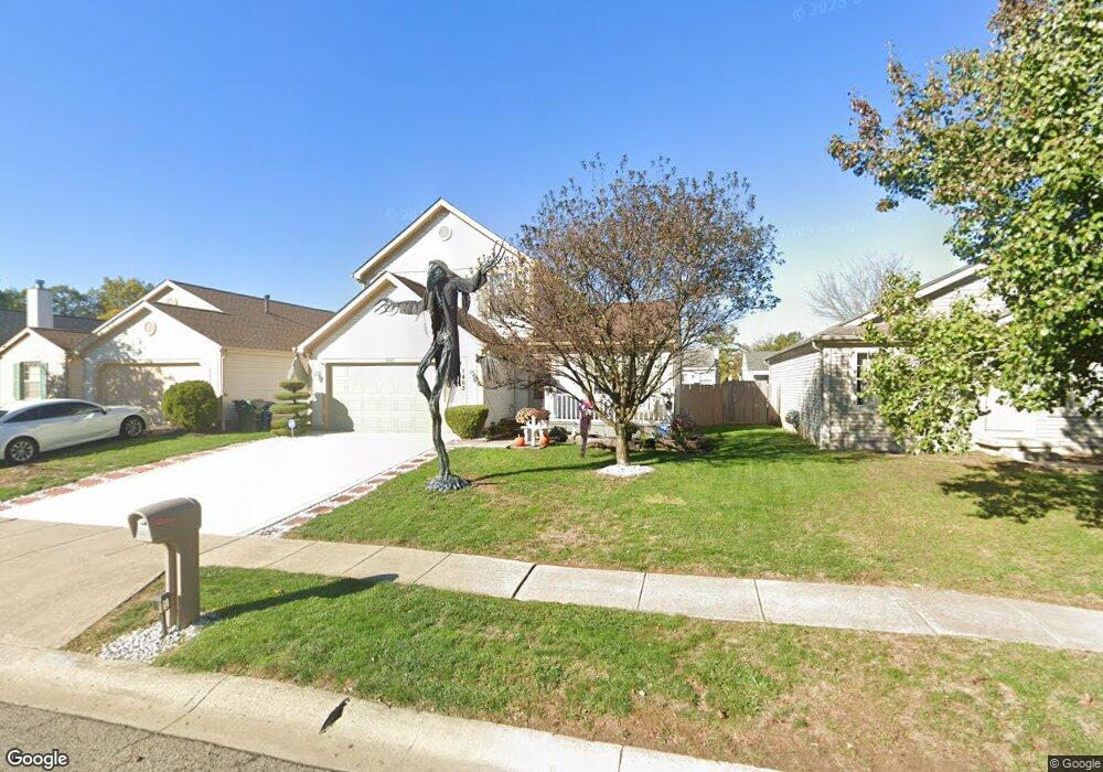
1463 Pinehurst Ct Columbus, OH 43223
Estimated Value: $260,000 - $290,000
3
Beds
3
Baths
1,696
Sq Ft
$162/Sq Ft
Est. Value
About This Home
This home is located at 1463 Pinehurst Ct, Columbus, OH 43223 and is currently estimated at $275,326, approximately $162 per square foot. 1463 Pinehurst Ct is a home located in Franklin County with nearby schools including Finland Elementary School, Franklin Woods Intermediate School, and Finland Middle School.
Ownership History
Date
Name
Owned For
Owner Type
Purchase Details
Closed on
Jul 30, 1997
Sold by
M/I Schottenstein Homes Inc
Bought by
Littler Alan S and Littler Lisa G
Current Estimated Value
Home Financials for this Owner
Home Financials are based on the most recent Mortgage that was taken out on this home.
Original Mortgage
$109,401
Outstanding Balance
$13,922
Interest Rate
7.71%
Mortgage Type
FHA
Estimated Equity
$261,404
Purchase Details
Closed on
Jan 29, 1997
Sold by
Parkmead Corp
Bought by
M/I Schottenstein Homes Inc
Create a Home Valuation Report for This Property
The Home Valuation Report is an in-depth analysis detailing your home's value as well as a comparison with similar homes in the area
Home Values in the Area
Average Home Value in this Area
Purchase History
| Date | Buyer | Sale Price | Title Company |
|---|---|---|---|
| Littler Alan S | $112,100 | Transohio Residential Title | |
| M/I Schottenstein Homes Inc | $82,500 | -- |
Source: Public Records
Mortgage History
| Date | Status | Borrower | Loan Amount |
|---|---|---|---|
| Open | Littler Alan S | $109,401 |
Source: Public Records
Tax History
| Year | Tax Paid | Tax Assessment Tax Assessment Total Assessment is a certain percentage of the fair market value that is determined by local assessors to be the total taxable value of land and additions on the property. | Land | Improvement |
|---|---|---|---|---|
| 2025 | $2,915 | $79,950 | $18,870 | $61,080 |
| 2024 | $2,915 | $79,950 | $18,870 | $61,080 |
| 2023 | $2,863 | $79,940 | $18,865 | $61,075 |
| 2022 | $2,749 | $56,320 | $8,160 | $48,160 |
| 2021 | $2,804 | $56,320 | $8,160 | $48,160 |
| 2020 | $2,788 | $56,320 | $8,160 | $48,160 |
| 2019 | $2,466 | $43,960 | $6,510 | $37,450 |
| 2018 | $2,322 | $43,960 | $6,510 | $37,450 |
| 2017 | $2,317 | $43,960 | $6,510 | $37,450 |
| 2016 | $2,190 | $36,200 | $5,990 | $30,210 |
| 2015 | $2,190 | $36,200 | $5,990 | $30,210 |
| 2014 | $2,192 | $36,200 | $5,990 | $30,210 |
| 2013 | $1,144 | $38,080 | $6,300 | $31,780 |
Source: Public Records
Map
Nearby Homes
- 1834 Saint Lawrence Dr
- 1696 Marsdale Ave
- 1625 Eastfield Dr N
- 1372 Stanwix Ct
- 2072 Asher Ct
- 1640 Butterfly Ct
- 1657 Eastbrook Dr S
- 1543 Red Leaf Ln
- 2210 October Ridge Dr
- 1521 October Ridge Ct
- 1400 Brown Rd
- 1288 Hart Rd
- 1657 Hopkins Ave
- 1122 Harrisburg Pike
- 0 S Central Ave
- 1208 Woodbrook Ln Unit 307
- 2180 Eakin Rd
- 1295 Woodbrook Ln Unit 223
- 2375 Woodbrook Cir N Unit 128
- 1258 Woodbrook Cir W Unit 199
- 1471 Pinehurst Ct
- 1455 Pinehurst Ct
- 1447 Pinehurst Ct
- 1479 Pinehurst Ct
- 1466 Pinestone Dr
- 1472 Pinestone Dr
- 1460 Pinestone Dr
- 1439 Pinehurst Ct
- 1478 Pinestone Dr
- 1454 Pinestone Dr
- 1472 Pinehurst Ct
- 1850 Big Tree Dr
- 1464 Pinehurst Ct
- 1456 Pinehurst Ct
- 1448 Pinestone Dr
- 1431 Pinehurst Ct
- 1448 Pinehurst Ct
- 1842 Big Tree Dr
- 1442 Pinestone Dr
- 1881 Big Tree Dr
Your Personal Tour Guide
Ask me questions while you tour the home.