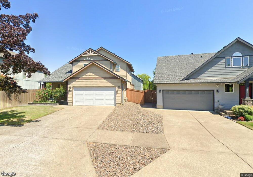
1463 Primrose Ln Forest Grove, OR 97116
Estimated Value: $496,000 - $504,000
3
Beds
7
Baths
1,570
Sq Ft
$318/Sq Ft
Est. Value
About This Home
This home is located at 1463 Primrose Ln, Forest Grove, OR 97116 and is currently estimated at $498,566, approximately $317 per square foot. 1463 Primrose Ln is a home located in Washington County with nearby schools including Harvey Clarke Elementary School, Tom McCall Upper Elementary School, and Neil Armstrong Middle School.
Ownership History
Date
Name
Owned For
Owner Type
Purchase Details
Closed on
Jul 26, 2007
Sold by
Mireles Rudy D and Mireles Mariela
Bought by
Bair Raymond D
Current Estimated Value
Home Financials for this Owner
Home Financials are based on the most recent Mortgage that was taken out on this home.
Original Mortgage
$263,000
Outstanding Balance
$165,579
Interest Rate
6.73%
Mortgage Type
Unknown
Estimated Equity
$332,987
Purchase Details
Closed on
Aug 24, 2001
Sold by
Skyline Development Inc
Bought by
Mireles Rudy D and Mireles Mariela
Home Financials for this Owner
Home Financials are based on the most recent Mortgage that was taken out on this home.
Original Mortgage
$130,300
Interest Rate
7.09%
Mortgage Type
Balloon
Create a Home Valuation Report for This Property
The Home Valuation Report is an in-depth analysis detailing your home's value as well as a comparison with similar homes in the area
Home Values in the Area
Average Home Value in this Area
Purchase History
| Date | Buyer | Sale Price | Title Company |
|---|---|---|---|
| Bair Raymond D | $263,000 | Fidelity Natl Title Co Of Or | |
| Mireles Rudy D | $162,925 | Fidelity National Title |
Source: Public Records
Mortgage History
| Date | Status | Borrower | Loan Amount |
|---|---|---|---|
| Open | Bair Raymond D | $263,000 | |
| Previous Owner | Mireles Rudy D | $130,300 | |
| Closed | Mireles Rudy D | $24,400 |
Source: Public Records
Tax History Compared to Growth
Tax History
| Year | Tax Paid | Tax Assessment Tax Assessment Total Assessment is a certain percentage of the fair market value that is determined by local assessors to be the total taxable value of land and additions on the property. | Land | Improvement |
|---|---|---|---|---|
| 2026 | $4,607 | $258,700 | -- | -- |
| 2025 | $4,607 | $251,170 | -- | -- |
| 2024 | $4,444 | $243,860 | -- | -- |
| 2023 | $4,444 | $236,760 | $0 | $0 |
| 2022 | $3,886 | $236,760 | $0 | $0 |
| 2021 | $3,836 | $223,180 | $0 | $0 |
| 2020 | $3,815 | $216,680 | $0 | $0 |
| 2019 | $3,730 | $210,370 | $0 | $0 |
| 2018 | $3,616 | $204,250 | $0 | $0 |
| 2017 | $3,504 | $198,310 | $0 | $0 |
| 2016 | $3,405 | $192,540 | $0 | $0 |
| 2015 | $3,275 | $186,940 | $0 | $0 |
| 2014 | $3,259 | $181,500 | $0 | $0 |
Source: Public Records
Map
Nearby Homes
- 1224 Alyssum Ave
- 1425 Willamina Ave
- 1611 Camino Dr
- 1104 Magnolia Way
- 1609 Camino Dr
- 922 Rosebud Ct
- 1219 34th Place
- 918 Rosebud Ct
- 1315 Begonia Ave
- 911 Rosebud Ct
- 920 Rosebud Ct
- 924 Rosebud Ct
- 3309 Butte Dr
- 507-FH Plan at Parkview Terrace
- 504-STD Plan at Parkview Terrace
- Poppy - Plan 308C at Parkview Terrace
- 430A Plan at Parkview Terrace
- Plan 400 at Parkview Terrace
- 506-FH Plan at Parkview Terrace
- Plan 325 at Parkview Terrace
- 1471 Primrose Ln
- 1455 Primrose Ln
- 1506 Alyssum Ave
- 1514 Alyssum Ave
- 1440 Alyssum Ave
- 3111 Limpus Ln
- 1507 Snapdragon Ln
- 3119 Limpus Ln
- 1534 Snapdragon Ln
- 1542 Snapdragon Ln
- 1459 Snapdragon Ln
- 1446 Primrose Ln
- 1550 Snapdragon Ln
- 1518 Snapdragon Ln
- 1447 Alyssum Ave
- 1515 Alyssum Ave
- 1558 Snapdragon Ln
- 1451 Snapdragon Ln
- 1510 Snapdragon Ln
- 1431 Primrose Ln