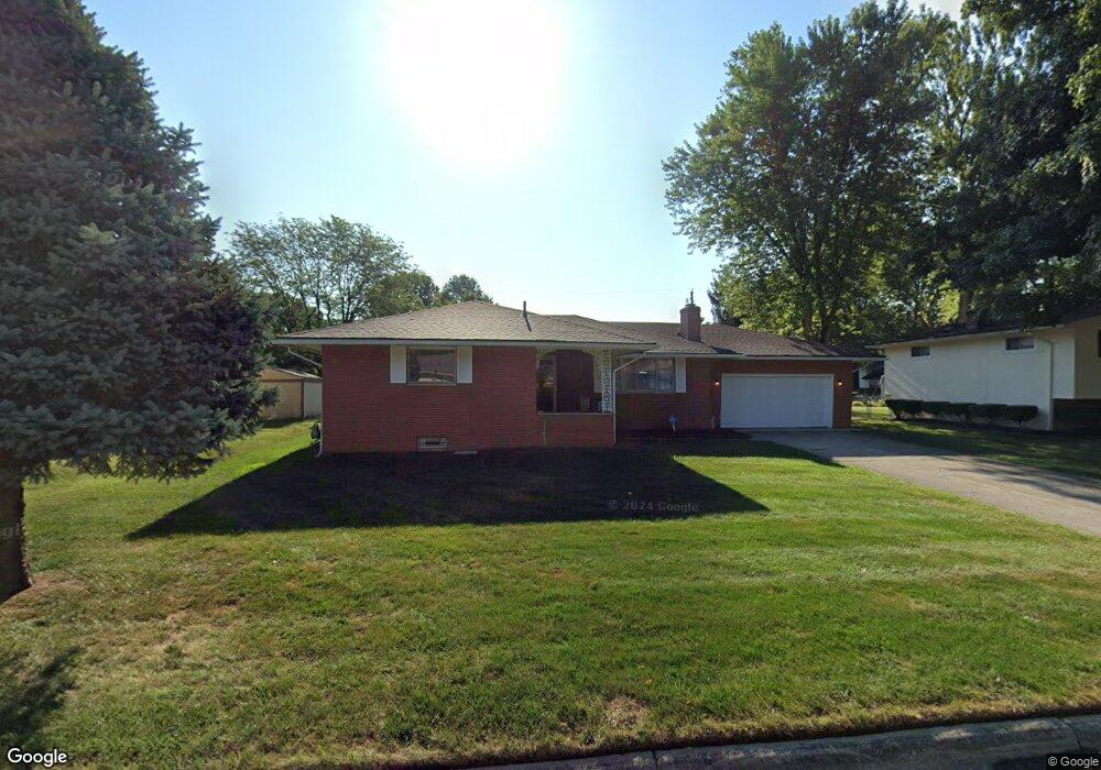
1464 Devonhurst Dr Columbus, OH 43232
Shady Lane NeighborhoodEstimated Value: $229,000 - $318,000
3
Beds
2
Baths
1,452
Sq Ft
$181/Sq Ft
Est. Value
About This Home
This home is located at 1464 Devonhurst Dr, Columbus, OH 43232 and is currently estimated at $262,861, approximately $181 per square foot. 1464 Devonhurst Dr is a home located in Franklin County with nearby schools including Woodcrest Elementary School, Sherwood Middle School, and Walnut Ridge High School.
Ownership History
Date
Name
Owned For
Owner Type
Purchase Details
Closed on
May 1, 1998
Sold by
Wilson Jack
Bought by
Baker Phillip R and Baker Kim L
Current Estimated Value
Home Financials for this Owner
Home Financials are based on the most recent Mortgage that was taken out on this home.
Original Mortgage
$123,400
Outstanding Balance
$21,530
Interest Rate
7.2%
Estimated Equity
$241,331
Purchase Details
Closed on
Sep 2, 1993
Create a Home Valuation Report for This Property
The Home Valuation Report is an in-depth analysis detailing your home's value as well as a comparison with similar homes in the area
Home Values in the Area
Average Home Value in this Area
Purchase History
| Date | Buyer | Sale Price | Title Company |
|---|---|---|---|
| Baker Phillip R | $129,900 | -- | |
| -- | $108,000 | -- |
Source: Public Records
Mortgage History
| Date | Status | Borrower | Loan Amount |
|---|---|---|---|
| Open | Baker Phillip R | $123,400 |
Source: Public Records
Tax History
| Year | Tax Paid | Tax Assessment Tax Assessment Total Assessment is a certain percentage of the fair market value that is determined by local assessors to be the total taxable value of land and additions on the property. | Land | Improvement |
|---|---|---|---|---|
| 2025 | $3,734 | $83,200 | $16,380 | $66,820 |
| 2024 | $3,734 | $83,200 | $16,380 | $66,820 |
| 2023 | $3,686 | $83,195 | $16,380 | $66,815 |
| 2022 | $2,739 | $52,820 | $7,630 | $45,190 |
| 2021 | $2,744 | $52,820 | $7,630 | $45,190 |
| 2020 | $2,748 | $52,820 | $7,630 | $45,190 |
| 2019 | $2,565 | $42,290 | $6,130 | $36,160 |
| 2018 | $2,491 | $42,290 | $6,130 | $36,160 |
| 2017 | $2,616 | $42,290 | $6,130 | $36,160 |
| 2016 | $2,669 | $40,290 | $7,670 | $32,620 |
| 2015 | $2,423 | $40,290 | $7,670 | $32,620 |
| 2014 | $2,429 | $40,290 | $7,670 | $32,620 |
| 2013 | $1,331 | $44,765 | $8,505 | $36,260 |
Source: Public Records
Map
Nearby Homes
- 5368 Yorkshire Village Ln Unit B23
- 5762 Hallridge Cir
- 5778 Lucinda Ct Unit 5778
- 1759 Lonsdale Rd
- 5337 Ivyhurst Dr
- 1590 Jacqueline Ct
- 1591 Stephanie Ct Unit 15912
- 1470 Efner Dr
- 1797 Quarry Ridge Dr Unit A
- 1314 Yorkland Rd Unit C
- 1472 Blaine Dr
- 1963 Birkdale Dr
- 5207 Kornwal Dr
- 1310 Manfeld Dr
- 4859 Folger Dr
- 4991 Justin Rd
- 1905 Woodcrest Rd
- 1945 Riverdale Rd
- 1260 Country Club Rd
- 931 Antwerp Rd
- 1476 Devonhurst Dr
- 1456 Devonhurst Dr
- 1477 Lonsdale Rd
- 1465 Lonsdale Rd
- 1485 Lonsdale Rd
- 1484 Devonhurst Dr
- 1444 Devonhurst Dr
- 1459 Devonhurst Dr
- 1471 Devonhurst Dr
- 1451 Devonhurst Dr
- 1453 Lonsdale Rd
- 5418 York Ln S
- 1479 Devonhurst Dr
- 5402 York Ln S
- 1432 Devonhurst Dr
- 1439 Devonhurst Dr
- 5430 York Ln S
- 1445 Lonsdale Rd
- 5378 York Ln S
- 1478 Lonsdale Rd
Your Personal Tour Guide
Ask me questions while you tour the home.