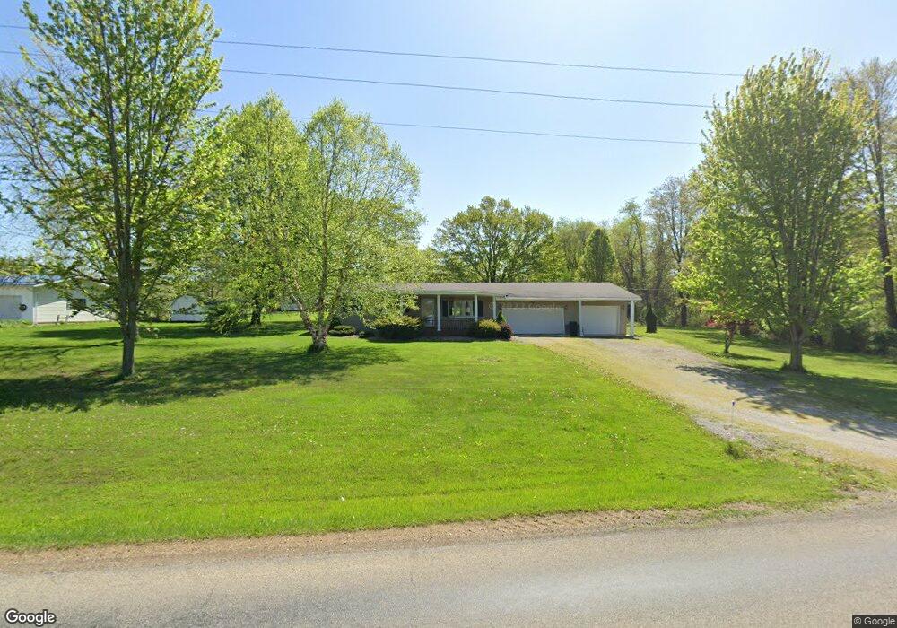
14640 Old Mansfield Rd Mount Vernon, OH 43050
Estimated Value: $228,000 - $322,000
3
Beds
2
Baths
1,568
Sq Ft
$182/Sq Ft
Est. Value
About This Home
This home is located at 14640 Old Mansfield Rd, Mount Vernon, OH 43050 and is currently estimated at $284,762, approximately $181 per square foot. 14640 Old Mansfield Rd is a home located in Knox County with nearby schools including Mount Vernon High School, St. Vincent de Paul School, and Ruscel Montessori Childrens House.
Ownership History
Date
Name
Owned For
Owner Type
Purchase Details
Closed on
Apr 22, 2025
Sold by
Israel Billy J
Bought by
Billy Joe Israel Irrevocable Trust and Presley
Current Estimated Value
Purchase Details
Closed on
Dec 13, 1994
Sold by
Lafever Richard N and Lafever Patri
Bought by
Israel Billy J
Purchase Details
Closed on
Feb 29, 1988
Sold by
Wagner John A and Wagner Rosemar
Bought by
Lafever Richard N and Lafever Patri
Create a Home Valuation Report for This Property
The Home Valuation Report is an in-depth analysis detailing your home's value as well as a comparison with similar homes in the area
Home Values in the Area
Average Home Value in this Area
Purchase History
| Date | Buyer | Sale Price | Title Company |
|---|---|---|---|
| Billy Joe Israel Irrevocable Trust | -- | None Listed On Document | |
| Billy Joe Israel Irrevocable Trust | -- | None Listed On Document | |
| Israel Billy J | $67,500 | -- | |
| Lafever Richard N | $48,000 | -- |
Source: Public Records
Tax History Compared to Growth
Tax History
| Year | Tax Paid | Tax Assessment Tax Assessment Total Assessment is a certain percentage of the fair market value that is determined by local assessors to be the total taxable value of land and additions on the property. | Land | Improvement |
|---|---|---|---|---|
| 2024 | $2,418 | $68,800 | $14,010 | $54,790 |
| 2023 | $2,418 | $68,800 | $14,010 | $54,790 |
| 2022 | $1,878 | $50,210 | $10,220 | $39,990 |
| 2021 | $1,878 | $50,210 | $10,220 | $39,990 |
| 2020 | $1,832 | $50,210 | $10,220 | $39,990 |
| 2019 | $1,853 | $47,650 | $10,300 | $37,350 |
| 2018 | $1,853 | $47,650 | $10,300 | $37,350 |
| 2017 | $1,823 | $47,650 | $10,300 | $37,350 |
| 2016 | $1,622 | $44,120 | $9,540 | $34,580 |
| 2015 | $1,628 | $44,120 | $9,540 | $34,580 |
| 2014 | $1,636 | $44,120 | $9,540 | $34,580 |
| 2013 | $1,724 | $44,150 | $8,970 | $35,180 |
Source: Public Records
Map
Nearby Homes
- 0 Crooked St
- 0 Crooked Street Land Split 2
- 14021 Old Mansfield Rd
- 14133 Beckley Rd
- 13919 Upper Fredericktown Rd
- 13219 Old Mansfield Rd
- 13683 Upper Fredericktown Rd
- 14835 Indian Hills Rd
- 0 Indian Hills Rd
- 14914 N Liberty Rd
- 12567 Upper Fredericktown Rd
- 15745 Lower Fredericktown Amity Rd
- 33 Longitude Dr
- 13999 Wooster Rd
- 200 Mansfield Rd
- 0 N Liberty Rd
- 14499 Wooster Rd
- 107 Northridge Dr
- 109 Northridge Dr
- 14668 Old Mansfield Rd
- 14560 Crooked St
- 14909 Crooked St
- 13782 Crooked St
- 14665 Old Mansfield Rd
- 14600 Crooked St
- 14550 Old Mansfield Rd
- 14638 Crooked St
- 14761 Old Mansfield Rd
- 14666 Crooked St
- 14500 Old Mansfield Rd
- 14756 Crooked St
- 14819 Old Mansfield Rd
- 14477 Old Mansfield Rd
- 14361 Crooked St
- 14720 Crooked St
- 14720 Crooked St
- 14448 Old Mansfield Rd
- 14439 Old Mansfield Rd
- 14863 Old Mansfield Rd