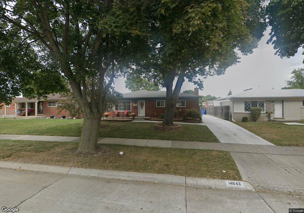
14643 Murthum Ave Warren, MI 48088
Northeast Warren NeighborhoodEstimated Value: $240,885 - $281,000
--
Bed
2
Baths
1,387
Sq Ft
$191/Sq Ft
Est. Value
About This Home
This home is located at 14643 Murthum Ave, Warren, MI 48088 and is currently estimated at $265,471, approximately $191 per square foot. 14643 Murthum Ave is a home located in Macomb County with nearby schools including Wilde Elementary School, Carter Middle School, and Paul K. Cousino High School.
Ownership History
Date
Name
Owned For
Owner Type
Purchase Details
Closed on
Sep 17, 2015
Sold by
Scott Gena M and Deforest Gena M
Bought by
Cagle Lisa L
Current Estimated Value
Purchase Details
Closed on
Jan 9, 2008
Sold by
Deforest Michael E
Bought by
Deforest Gena M
Home Financials for this Owner
Home Financials are based on the most recent Mortgage that was taken out on this home.
Original Mortgage
$127,000
Interest Rate
5.95%
Mortgage Type
Purchase Money Mortgage
Create a Home Valuation Report for This Property
The Home Valuation Report is an in-depth analysis detailing your home's value as well as a comparison with similar homes in the area
Home Values in the Area
Average Home Value in this Area
Purchase History
| Date | Buyer | Sale Price | Title Company |
|---|---|---|---|
| Cagle Lisa L | $125,000 | Chirco Title Agency Inc | |
| Deforest Gena M | -- | Nova Title Agency |
Source: Public Records
Mortgage History
| Date | Status | Borrower | Loan Amount |
|---|---|---|---|
| Previous Owner | Deforest Gena M | $127,000 |
Source: Public Records
Tax History Compared to Growth
Tax History
| Year | Tax Paid | Tax Assessment Tax Assessment Total Assessment is a certain percentage of the fair market value that is determined by local assessors to be the total taxable value of land and additions on the property. | Land | Improvement |
|---|---|---|---|---|
| 2025 | $4,286 | $126,260 | $0 | $0 |
| 2024 | $4,164 | $116,570 | $0 | $0 |
| 2023 | $3,947 | $105,600 | $0 | $0 |
| 2022 | $3,814 | $92,410 | $0 | $0 |
| 2021 | $3,881 | $87,340 | $0 | $0 |
| 2020 | $3,742 | $84,240 | $0 | $0 |
| 2019 | $3,608 | $78,890 | $0 | $0 |
| 2018 | $3,665 | $70,150 | $0 | $0 |
| 2017 | $3,618 | $64,330 | $10,270 | $54,060 |
| 2016 | $3,614 | $64,330 | $0 | $0 |
| 2015 | -- | $56,570 | $0 | $0 |
| 2013 | $5,034 | $45,680 | $0 | $0 |
Source: Public Records
Map
Nearby Homes
- 14646 Murthum Ave
- 14717 Colpaert Dr
- 32334 Gloede Dr
- 31707 Gloede Dr
- 32717 Beechwood Dr
- 14514 Peck Dr
- 13842 Jenny Dr
- 31341 Hayes Rd
- 13863 Colpaert Dr
- 31263 Hayes Rd
- 13738 Jenny Dr
- 33333 Groth Dr
- 33042 Mccoy Dr
- 33076 Mccoy Dr
- 15621 Lauren
- 31070 Hayes Rd
- 15668 Masonic
- 33555 Groth Dr
- 33511 Swan Dr
- 15085 Kara Ln
- 14631 Murthum Ave
- 14655 Murthum Ave
- 14703 Murthum Ave
- 14619 Murthum Ave
- 14606 Jenny Dr
- 32243 Beechwood Dr
- 14715 Murthum Ave
- 14618 Jenny Dr
- 32228 Columbus Dr
- 14607 Murthum Ave
- 14634 Murthum Ave
- 32240 Columbus Dr
- 14658 Murthum Ave
- 14622 Murthum Ave
- 14630 Jenny Dr
- 14727 Murthum Ave
- 14706 Murthum Ave
- 32255 Beechwood Dr
- 14610 Murthum Ave
- 32252 Columbus Dr