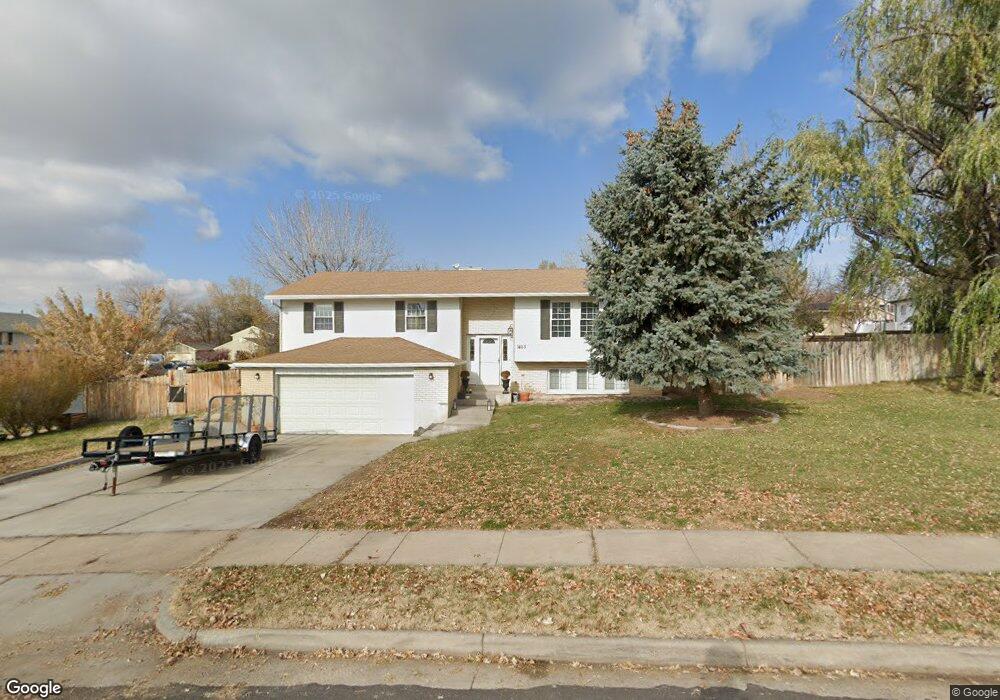
1465 Balsam Dr Layton, UT 84040
Estimated Value: $522,000 - $554,000
4
Beds
3
Baths
1,425
Sq Ft
$376/Sq Ft
Est. Value
About This Home
This home is located at 1465 Balsam Dr, Layton, UT 84040 and is currently estimated at $536,422, approximately $376 per square foot. 1465 Balsam Dr is a home located in Davis County with nearby schools including East Layton Elementary School, Central Davis Junior High School, and Layton High School.
Ownership History
Date
Name
Owned For
Owner Type
Purchase Details
Closed on
Sep 9, 2022
Sold by
Purcell Scott H
Bought by
Barzin Chris
Current Estimated Value
Home Financials for this Owner
Home Financials are based on the most recent Mortgage that was taken out on this home.
Original Mortgage
$402,550
Outstanding Balance
$384,207
Interest Rate
5.3%
Mortgage Type
New Conventional
Estimated Equity
$152,215
Purchase Details
Closed on
Dec 11, 2020
Sold by
Purcell Kathleen C
Bought by
Scott Purcell and Scott Kathleen C
Purchase Details
Closed on
Dec 4, 2013
Sold by
Purcell Scott H and Purcell Kathleen C
Bought by
Purcell Scott and Purcell Kathleen C
Create a Home Valuation Report for This Property
The Home Valuation Report is an in-depth analysis detailing your home's value as well as a comparison with similar homes in the area
Home Values in the Area
Average Home Value in this Area
Purchase History
| Date | Buyer | Sale Price | Title Company |
|---|---|---|---|
| Barzin Chris | -- | Us Title | |
| Scott Purcell | -- | -- | |
| Purcell Scott H | -- | Us Title Company Of Utah | |
| Purcell Scott | -- | None Available |
Source: Public Records
Mortgage History
| Date | Status | Borrower | Loan Amount |
|---|---|---|---|
| Open | Barzin Chris | $402,550 |
Source: Public Records
Tax History
| Year | Tax Paid | Tax Assessment Tax Assessment Total Assessment is a certain percentage of the fair market value that is determined by local assessors to be the total taxable value of land and additions on the property. | Land | Improvement |
|---|---|---|---|---|
| 2025 | $2,583 | $271,150 | $126,524 | $144,626 |
| 2024 | $2,460 | $260,151 | $150,002 | $110,149 |
| 2023 | $2,420 | $451,000 | $201,486 | $249,514 |
| 2022 | $2,559 | $471,000 | $196,625 | $274,375 |
| 2021 | $2,345 | $354,000 | $164,692 | $189,308 |
| 2020 | $2,051 | $297,000 | $133,778 | $163,222 |
| 2019 | $2,038 | $289,000 | $119,412 | $169,588 |
| 2018 | $1,840 | $262,000 | $93,287 | $168,713 |
| 2016 | $1,583 | $116,270 | $49,032 | $67,238 |
| 2015 | $1,517 | $105,820 | $49,032 | $56,788 |
| 2014 | $1,435 | $102,304 | $49,032 | $53,272 |
| 2013 | -- | $94,522 | $22,748 | $71,774 |
Source: Public Records
Map
Nearby Homes
- 1156 Cherrywood Dr
- 1545 E 975 N
- 1258 E North Lisa St
- 1048 E Cherry Ln
- 1033 E 825 N
- 1350 Kays Creek Dr
- 997 E 825 N
- 1503 E 530 N
- 1340 E Hollyhock Way
- 1354 E Hollyhock Way
- 1975 E 1425 N
- 2113 E 1200 N
- 1476 Kays Creek Dr
- 1266 E Larkspur Way
- 479 N 1375 E
- 1305 E Larkspur Way
- 1843 Hayes Dr
- 2124 E Cherry Ln
- 1690 E Gentile St
- 2203 E 1200 N
- 1162 Ash Dr
- 1483 Balsam Dr
- 1466 Oakridge Dr
- 1472 Balsam Dr
- 1133 Ash Dr
- 1115 Ash Dr
- 1157 Ash Dr
- 1498 Balsam Dr
- 1488 Oakridge Dr
- 1501 Balsam Dr
- 1481 Pinewood Cir
- 1126 Sunflower Cir
- 1512 Oakridge Dr
- 1112 Sunflower Cir
- 1445 Oakridge Dr
- 1520 Balsam Dr
- 1510 E Oakridge Dr
- 1138 Sunflower Cir
- 1087 Ash Dr
- 1529 Balsam Dr
Your Personal Tour Guide
Ask me questions while you tour the home.