Estimated Value: $279,000 - $290,000
3
Beds
2
Baths
1,818
Sq Ft
$156/Sq Ft
Est. Value
About This Home
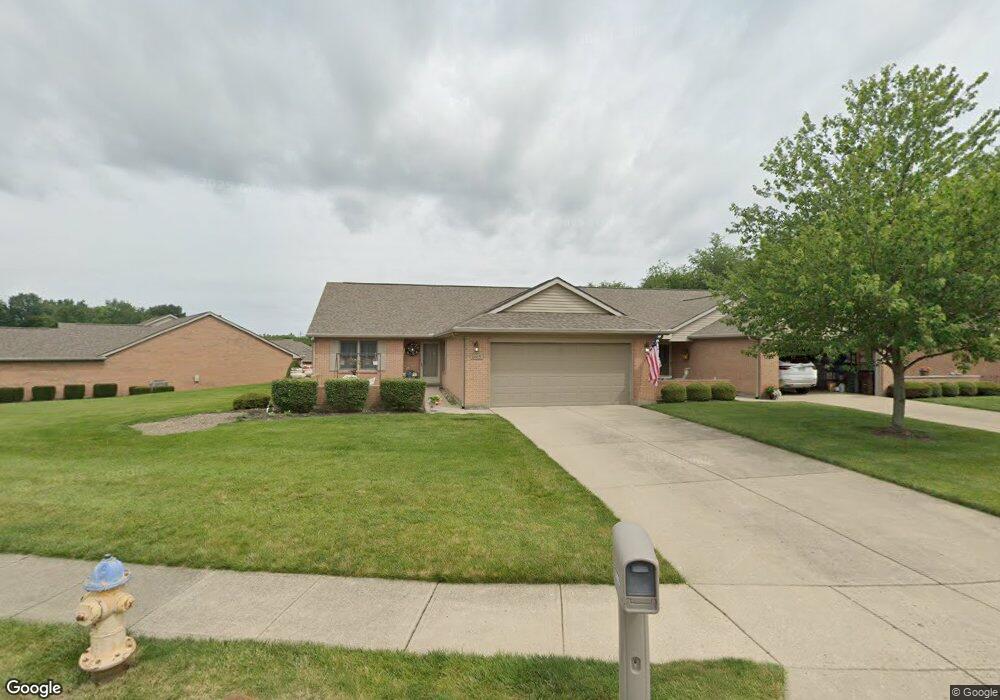
This home is located at 1465 Dee Anne Dr, Xenia, OH 45385 and is currently estimated at $283,194, approximately $155 per square foot. 1465 Dee Anne Dr is a home located in Greene County with nearby schools including Xenia High School and Legacy Christian Academy.
Ownership History
Date
Name
Owned For
Owner Type
Purchase Details
Closed on
May 25, 2004
Sold by
Gingrich Marjean L
Bought by
Pitstick Gloria H
Current Estimated Value
Home Financials for this Owner
Home Financials are based on the most recent Mortgage that was taken out on this home.
Original Mortgage
$70,000
Interest Rate
5.99%
Mortgage Type
Unknown
Purchase Details
Closed on
Mar 25, 1997
Sold by
Martin David A
Bought by
Gingrich Marjean L
Home Financials for this Owner
Home Financials are based on the most recent Mortgage that was taken out on this home.
Original Mortgage
$76,000
Interest Rate
7.82%
Mortgage Type
New Conventional
Create a Home Valuation Report for This Property
The Home Valuation Report is an in-depth analysis detailing your home's value as well as a comparison with similar homes in the area
Home Values in the Area
Average Home Value in this Area
Purchase History
| Date | Buyer | Sale Price | Title Company |
|---|---|---|---|
| Pitstick Gloria H | $170,000 | -- | |
| Gingrich Marjean L | $149,914 | -- |
Source: Public Records
Mortgage History
| Date | Status | Borrower | Loan Amount |
|---|---|---|---|
| Previous Owner | Pitstick Gloria H | $70,000 | |
| Previous Owner | Gingrich Marjean L | $76,000 |
Source: Public Records
Tax History Compared to Growth
Tax History
| Year | Tax Paid | Tax Assessment Tax Assessment Total Assessment is a certain percentage of the fair market value that is determined by local assessors to be the total taxable value of land and additions on the property. | Land | Improvement |
|---|---|---|---|---|
| 2024 | $3,447 | $80,560 | $8,750 | $71,810 |
| 2023 | $3,447 | $80,560 | $8,750 | $71,810 |
| 2022 | $2,815 | $66,320 | $8,750 | $57,570 |
| 2021 | $2,854 | $66,320 | $8,750 | $57,570 |
| 2020 | $2,731 | $66,320 | $8,750 | $57,570 |
| 2019 | $1,992 | $48,270 | $8,750 | $39,520 |
| 2018 | $1,999 | $48,270 | $8,750 | $39,520 |
| 2017 | $2,091 | $48,270 | $8,750 | $39,520 |
| 2016 | $2,092 | $49,340 | $8,750 | $40,590 |
| 2015 | $2,097 | $49,340 | $8,750 | $40,590 |
| 2014 | $2,006 | $49,340 | $8,750 | $40,590 |
Source: Public Records
Map
Nearby Homes
- 1171 N Detroit St
- 1038 Frederick Dr
- 1359 Eagles Way
- 1311 Eagles Way
- 902 N Detroit St
- 2018 Tahoe Dr
- 878 N Detroit St
- 965 Oak Dale Dr
- 1815 Promenade Ln
- 15 Sexton Dr
- 493 Hollywood Blvd
- 499 Hollywood Blvd
- 2094 Malibu Trail
- 1968 El Camino Dr
- 1872 Harris Ln
- 513 Redbud Ln
- 1791 Palmer Ct
- 508 Marshall Dr
- 659 N King St
- 1796 Palmer Ct
- 1463 Dee Anne Dr
- 1461 Dee Anne Dr
- 1501 Dee Anne Dr
- 1503 Dee Anne Dr
- 1521 Dee Anne Dr
- 1460 Dee Anne Dr
- 1464 Dee Anne Dr
- 1444 Dee Anne Dr
- 1442 Dee Anne Dr
- 1523 Dee Anne Dr
- 1440 Dee Anne Dr
- 1525 Dee Anne Dr
- 1500 Dee Anne Dr
- 1502 Dee Anne Dr
- 1504 Dee Anne Dr
- 1520 Dee Anne Dr
- 1522 Dee Anne Dr
- 1522 Dee Anne Dr Unit 30
- 1524 Dee Anne Dr
- 274 Country Club Dr