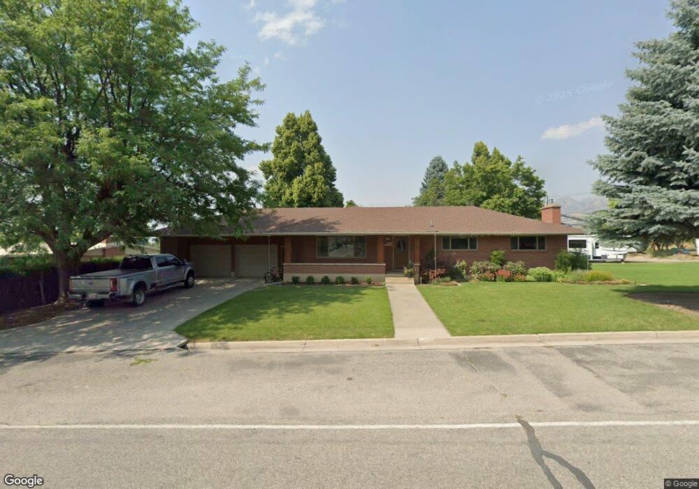
1465 E 2100 N North Logan, UT 84341
Estimated Value: $534,000 - $768,000
5
Beds
3
Baths
3,078
Sq Ft
$207/Sq Ft
Est. Value
About This Home
This home is located at 1465 E 2100 N, North Logan, UT 84341 and is currently estimated at $637,682, approximately $207 per square foot. 1465 E 2100 N is a home located in Cache County with nearby schools including Greenville School, Cedar Ridge School, and Cedar Ridge Middle School.
Ownership History
Date
Name
Owned For
Owner Type
Purchase Details
Closed on
Dec 28, 2022
Sold by
Olaveson Kurt and Olaveson Michelle
Bought by
Shepard Michael B
Current Estimated Value
Home Financials for this Owner
Home Financials are based on the most recent Mortgage that was taken out on this home.
Original Mortgage
$574,750
Outstanding Balance
$555,177
Interest Rate
6.61%
Mortgage Type
New Conventional
Estimated Equity
$82,505
Purchase Details
Closed on
Jan 19, 2021
Sold by
Olaveson Kurt and Olaveson Michelle
Bought by
Olaveson Kurt and Olaveson Michelle
Home Financials for this Owner
Home Financials are based on the most recent Mortgage that was taken out on this home.
Original Mortgage
$290,500
Interest Rate
2.71%
Mortgage Type
New Conventional
Purchase Details
Closed on
May 17, 2017
Sold by
Olaveson Kurt
Bought by
Olaveson Kurt and Olaveson Michelle
Home Financials for this Owner
Home Financials are based on the most recent Mortgage that was taken out on this home.
Original Mortgage
$301,150
Interest Rate
3.97%
Mortgage Type
New Conventional
Purchase Details
Closed on
Apr 11, 2014
Sold by
Harten Janice Allred
Bought by
Allred Keith Reid
Purchase Details
Closed on
Mar 28, 2014
Sold by
Allred Geddes Beth Ann
Bought by
Allred Keith Reid
Purchase Details
Closed on
Mar 27, 2014
Sold by
Blackham Elaine Allred
Bought by
Allred Keith Reid
Purchase Details
Closed on
Mar 25, 2014
Sold by
Herd Karen Allred
Bought by
Allred Keith Reid
Purchase Details
Closed on
Mar 24, 2014
Sold by
Allred Howard Keith
Bought by
Allred Keith Reid
Purchase Details
Closed on
Mar 12, 2014
Sold by
Allred Keith R and Allred Keith Reid
Bought by
Allred Keith Reid
Purchase Details
Closed on
Apr 20, 2010
Sold by
Allred Keith Reid
Bought by
Allred Keith Reid and Allred Howard Keith
Home Financials for this Owner
Home Financials are based on the most recent Mortgage that was taken out on this home.
Original Mortgage
$67,000
Interest Rate
4.92%
Mortgage Type
New Conventional
Create a Home Valuation Report for This Property
The Home Valuation Report is an in-depth analysis detailing your home's value as well as a comparison with similar homes in the area
Home Values in the Area
Average Home Value in this Area
Purchase History
| Date | Buyer | Sale Price | Title Company |
|---|---|---|---|
| Shepard Michael B | -- | Pinnacle Title | |
| Olaveson Kurt | -- | Land Title | |
| Olaveson Kurt | -- | Pinnacle Title | |
| Olaveson Kurt | -- | Pinnacle Title | |
| Allred Keith Reid | -- | None Available | |
| Allred Keith Reid | -- | None Available | |
| Allred Keith Reid | -- | None Available | |
| Allred Keith Reid | -- | None Available | |
| Allred Keith Reid | -- | None Available | |
| Allred Keith Reid | -- | None Available | |
| Allred Keith Reid | -- | None Available | |
| Allred Keith Reid | -- | Northern Title Company | |
| Allred Keith Reid | -- | Northern Title Company |
Source: Public Records
Mortgage History
| Date | Status | Borrower | Loan Amount |
|---|---|---|---|
| Open | Shepard Michael B | $574,750 | |
| Previous Owner | Olaveson Kurt | $290,500 | |
| Previous Owner | Olaveson Kurt | $301,150 | |
| Previous Owner | Allred Keith Reid | $67,000 |
Source: Public Records
Tax History Compared to Growth
Tax History
| Year | Tax Paid | Tax Assessment Tax Assessment Total Assessment is a certain percentage of the fair market value that is determined by local assessors to be the total taxable value of land and additions on the property. | Land | Improvement |
|---|---|---|---|---|
| 2025 | $4,070 | $569,735 | $0 | $0 |
| 2024 | $2,534 | $330,060 | $0 | $0 |
| 2023 | $2,359 | $287,595 | $0 | $0 |
| 2022 | $2,469 | $287,600 | $0 | $0 |
| 2021 | $2,363 | $412,880 | $137,800 | $275,080 |
| 2020 | $2,145 | $349,400 | $137,800 | $211,600 |
| 2019 | $2,246 | $349,400 | $137,800 | $211,600 |
| 2018 | $1,567 | $236,488 | $98,840 | $137,648 |
| 2017 | $1,540 | $127,060 | $0 | $0 |
| 2016 | $1,564 | $127,060 | $0 | $0 |
| 2015 | $1,569 | $127,060 | $0 | $0 |
| 2014 | $1,532 | $127,060 | $0 | $0 |
| 2013 | -- | $110,850 | $0 | $0 |
Source: Public Records
Map
Nearby Homes
- 2025 N 1550 E
- 1901 N 1380 E
- 1491 E 2300 N
- 1495 E 2300 N
- 1335 E 2300 N
- 945 N 1600 E
- 1593 N 110 W Unit 201
- 611 E 2450 N Unit 1
- 1593 N 110 W Unit 202
- 1593 N 110 W Unit 204
- 1593 N 110 W Unit 203
- 1200 W 1400 N
- 2950 N Mahogony Valley Rd E Unit 7
- 1598 N Sharptail Cir
- 1000 W 2500 N
- 3057 N 1200 E
- 3073 N 1200 E Unit 3
- 1963 N 1000 E
- 1872 N 1850 E
- 1285 E 1600 N