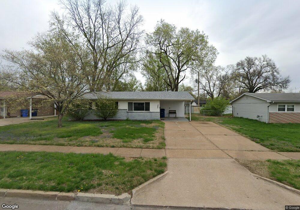
1465 Mullanphy Rd Florissant, MO 63031
Estimated Value: $96,000 - $162,000
3
Beds
1
Bath
1,152
Sq Ft
$118/Sq Ft
Est. Value
About This Home
This home is located at 1465 Mullanphy Rd, Florissant, MO 63031 and is currently estimated at $136,491, approximately $118 per square foot. 1465 Mullanphy Rd is a home located in St. Louis County with nearby schools including McCurdy Elementary School, Northwest Middle School, and Hazelwood West High School.
Ownership History
Date
Name
Owned For
Owner Type
Purchase Details
Closed on
Dec 19, 2019
Sold by
Aaron Michael B and 1465 Mullanphy Rd Trust
Bought by
Jokerst Phillip Michael
Current Estimated Value
Home Financials for this Owner
Home Financials are based on the most recent Mortgage that was taken out on this home.
Original Mortgage
$62,000
Outstanding Balance
$54,769
Interest Rate
3.7%
Mortgage Type
Future Advance Clause Open End Mortgage
Estimated Equity
$81,722
Purchase Details
Closed on
Mar 9, 2018
Sold by
Thompson Elizabeth L
Bought by
1465 Mullanphy Rd Trust
Home Financials for this Owner
Home Financials are based on the most recent Mortgage that was taken out on this home.
Original Mortgage
$74,025
Interest Rate
4.15%
Mortgage Type
Unknown
Purchase Details
Closed on
Jun 4, 2008
Sold by
Thompson Elizabeth L
Bought by
Thompson Elizabeth L and Elizabeth L Thompson Revocable Living Tr
Create a Home Valuation Report for This Property
The Home Valuation Report is an in-depth analysis detailing your home's value as well as a comparison with similar homes in the area
Home Values in the Area
Average Home Value in this Area
Purchase History
| Date | Buyer | Sale Price | Title Company |
|---|---|---|---|
| Jokerst Phillip Michael | $60,000 | Title Partners Agency Llc | |
| 1465 Mullanphy Rd Trust | $50,000 | Title Experts Llc | |
| Thompson Elizabeth L | -- | None Available |
Source: Public Records
Mortgage History
| Date | Status | Borrower | Loan Amount |
|---|---|---|---|
| Open | Jokerst Phillip Michael | $62,000 | |
| Previous Owner | 1465 Mullanphy Rd Trust | $74,025 |
Source: Public Records
Tax History Compared to Growth
Tax History
| Year | Tax Paid | Tax Assessment Tax Assessment Total Assessment is a certain percentage of the fair market value that is determined by local assessors to be the total taxable value of land and additions on the property. | Land | Improvement |
|---|---|---|---|---|
| 2025 | $1,816 | $24,150 | $4,640 | $19,510 |
| 2024 | $1,816 | $20,140 | $3,100 | $17,040 |
| 2023 | $1,813 | $20,140 | $3,100 | $17,040 |
| 2022 | $1,688 | $16,700 | $3,100 | $13,600 |
| 2021 | $1,645 | $16,700 | $3,100 | $13,600 |
| 2020 | $1,417 | $13,550 | $3,100 | $10,450 |
| 2019 | $1,396 | $13,550 | $3,100 | $10,450 |
| 2018 | $1,342 | $11,970 | $2,810 | $9,160 |
| 2017 | $1,340 | $11,970 | $2,810 | $9,160 |
| 2016 | $1,248 | $10,980 | $2,050 | $8,930 |
| 2015 | $1,222 | $10,980 | $2,050 | $8,930 |
| 2014 | $1,227 | $11,360 | $3,020 | $8,340 |
Source: Public Records
Map
Nearby Homes
- 1415 Boulder Dr
- 1505 Swallow Ln
- 1395 Bluebird Dr
- 1155 Mullanphy Rd
- 200 Francisca Dr
- 1825 Swallow Ln
- 1120 Bluebird Dr
- 1150 Verlene Dr
- 6 Charlotte Dr
- 25 Francisca Dr
- 890 Tyson Dr
- 1270 Bobolink Dr
- 2040 Splendor Dr
- 915 Iris Dr
- 1380 Thrush Ln
- 1290 Jackson Ln
- 25 Hammes Dr
- 1405 Miller Dr
- 2048 New Sun Dr
- 185 Eldorado Dr
- 1445 Mullanphy Rd
- 1485 Mullanphy Rd
- 1460 Flicker Dr
- 1440 Flicker Dr
- 1425 Mullanphy Rd
- 1495 Mullanphy Rd
- 1460 Mullanphy Rd
- 1470 Mullanphy Rd
- 1420 Flicker Dr
- 1490 Flicker Dr
- 1440 Mullanphy Rd
- 1480 Mullanphy Rd
- 1490 Mullanphy Rd
- 1420 Mullanphy Rd
- 1505 Mullanphy Rd
- 1405 Mullanphy Rd
- 1400 Flicker Dr
- 1500 Flicker Dr
- 1465 Flicker Dr
- 1445 Flicker Dr