Estimated Value: $561,000 - $657,000
4
Beds
3
Baths
1,300
Sq Ft
$471/Sq Ft
Est. Value
About This Home
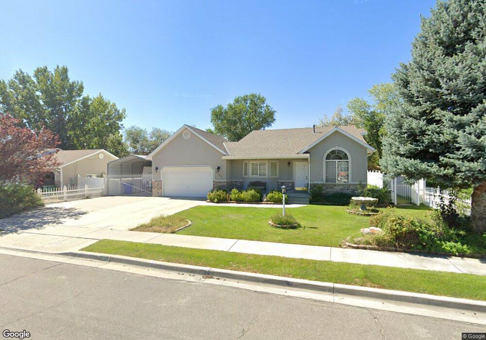
This home is located at 1465 N 250 W, Lehi, UT 84043 and is currently estimated at $612,251, approximately $470 per square foot. 1465 N 250 W is a home located in Utah County with nearby schools including Sego Lily Elementary School, Lehi Junior High School, and Skyridge High School.
Ownership History
Date
Name
Owned For
Owner Type
Purchase Details
Closed on
Oct 13, 2025
Sold by
Hone Austin and Hone Camron
Bought by
Hone Austin and Hone Darcie Sue
Current Estimated Value
Purchase Details
Closed on
May 6, 2024
Sold by
M Eric Grant Trust and Eric Grant M
Bought by
Hone Austin and Hone Camron
Purchase Details
Closed on
Jul 27, 1999
Sold by
Csr Enterprises Llc
Bought by
Grant M Eric
Purchase Details
Closed on
Feb 17, 1999
Sold by
Hi Valley Development Corp
Bought by
Grant M Eric
Home Financials for this Owner
Home Financials are based on the most recent Mortgage that was taken out on this home.
Original Mortgage
$127,200
Interest Rate
6.77%
Mortgage Type
Construction
Create a Home Valuation Report for This Property
The Home Valuation Report is an in-depth analysis detailing your home's value as well as a comparison with similar homes in the area
Home Values in the Area
Average Home Value in this Area
Purchase History
| Date | Buyer | Sale Price | Title Company |
|---|---|---|---|
| Hone Austin | -- | Meridian Title Company | |
| Hone Austin | -- | Meridian Title Company | |
| Grant M Eric | -- | Mountain West Title Company | |
| Grant M Eric | -- | Mountain West Title Co |
Source: Public Records
Mortgage History
| Date | Status | Borrower | Loan Amount |
|---|---|---|---|
| Previous Owner | Grant M Eric | $127,200 |
Source: Public Records
Tax History Compared to Growth
Tax History
| Year | Tax Paid | Tax Assessment Tax Assessment Total Assessment is a certain percentage of the fair market value that is determined by local assessors to be the total taxable value of land and additions on the property. | Land | Improvement |
|---|---|---|---|---|
| 2025 | $2,241 | $296,340 | $232,700 | $306,100 |
| 2024 | $2,241 | $262,240 | $0 | $0 |
| 2023 | $2,038 | $258,995 | $0 | $0 |
| 2022 | $2,341 | $288,310 | $0 | $0 |
| 2021 | $2,074 | $386,300 | $134,700 | $251,600 |
| 2020 | $1,955 | $359,800 | $124,700 | $235,100 |
| 2019 | $1,720 | $329,100 | $124,700 | $204,400 |
| 2018 | $1,733 | $313,500 | $109,100 | $204,400 |
| 2017 | $1,670 | $160,655 | $0 | $0 |
| 2016 | $1,620 | $144,540 | $0 | $0 |
| 2015 | -- | $129,030 | $0 | $0 |
| 2014 | $1,466 | $123,475 | $0 | $0 |
Source: Public Records
Map
Nearby Homes
- 1755 N 250 W
- 1150 N 200 W Unit 6
- 1329 N 100 E Unit 21
- 1295 N 190 E
- 996 N 200 W
- 155 W State St Unit TRLR 3
- 4333 N Baiken Ridge Dr Unit 1020
- 68 W State St
- 902 W 1500 N
- 1817 W Bad Rock Cir
- 1301 N 900 W Unit 12
- 7 E State St
- 443 W 820 N
- 497 W 2200 N
- 1011 W Mountain Way Unit 316
- 1094 W 1425 N
- 1610 N 1125 W
- 497 W 2280 N
- 192 E 2200 N
- 705 N 400 E
- 1465 N 250 W Unit 42
- 1447 N 250 W
- 1447 N 250 W Unit 41
- 1483 N 250 W
- 1483 N 250 W Unit 43
- 1457 N 250 W
- 1429 N 250 W
- 1429 N 250 W Unit 40
- 1466 N 250 W
- 1466 N 250 W Unit 31
- 1505 N 250 W
- 1448 N 250 W
- 1448 N 250 W Unit 32
- 1484 N 250 W
- 1484 N 250 W Unit 30
- 1411 N 250 W
- 1411 N 250 W Unit 39
- 1430 N 250 W
- 1430 N 250 W Unit 33
- 1519 N 250 W