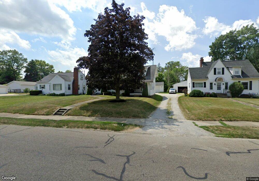
1465 Parkway Blvd Alliance, OH 44601
Estimated Value: $117,000 - $190,000
4
Beds
2
Baths
1,960
Sq Ft
$73/Sq Ft
Est. Value
About This Home
This home is located at 1465 Parkway Blvd, Alliance, OH 44601 and is currently estimated at $143,651, approximately $73 per square foot. 1465 Parkway Blvd is a home located in Stark County with nearby schools including Alliance Early Learning School, Alliance Intermediate School at Northside, and Alliance Middle School.
Ownership History
Date
Name
Owned For
Owner Type
Purchase Details
Closed on
Jun 10, 2025
Sold by
Walker Jeffrey S
Bought by
Walker Jeffrey S and Walker Patricia L
Current Estimated Value
Purchase Details
Closed on
Jul 14, 1994
Sold by
Palmenter Joseph P
Bought by
Walker Jeffrey S
Home Financials for this Owner
Home Financials are based on the most recent Mortgage that was taken out on this home.
Original Mortgage
$61,500
Interest Rate
8.6%
Mortgage Type
New Conventional
Create a Home Valuation Report for This Property
The Home Valuation Report is an in-depth analysis detailing your home's value as well as a comparison with similar homes in the area
Home Values in the Area
Average Home Value in this Area
Purchase History
| Date | Buyer | Sale Price | Title Company |
|---|---|---|---|
| Walker Jeffrey S | -- | None Listed On Document | |
| Walker Jeffrey S | $65,000 | -- |
Source: Public Records
Mortgage History
| Date | Status | Borrower | Loan Amount |
|---|---|---|---|
| Previous Owner | Walker Jeffrey S | $61,500 |
Source: Public Records
Tax History Compared to Growth
Tax History
| Year | Tax Paid | Tax Assessment Tax Assessment Total Assessment is a certain percentage of the fair market value that is determined by local assessors to be the total taxable value of land and additions on the property. | Land | Improvement |
|---|---|---|---|---|
| 2025 | -- | $42,140 | $10,920 | $31,220 |
| 2024 | -- | $42,140 | $10,920 | $31,220 |
| 2023 | $1,377 | $33,460 | $9,590 | $23,870 |
| 2022 | $830 | $33,460 | $9,590 | $23,870 |
| 2021 | $834 | $33,460 | $9,590 | $23,870 |
| 2020 | $1,325 | $29,790 | $8,330 | $21,460 |
| 2019 | $251 | $29,790 | $8,330 | $21,460 |
| 2018 | $1,313 | $29,790 | $8,330 | $21,460 |
| 2017 | $1,177 | $26,220 | $6,970 | $19,250 |
| 2016 | $1,174 | $25,940 | $6,970 | $18,970 |
| 2015 | $1,184 | $25,940 | $6,970 | $18,970 |
| 2014 | $1,103 | $23,000 | $6,160 | $16,840 |
| 2013 | $550 | $23,000 | $6,160 | $16,840 |
Source: Public Records
Map
Nearby Homes
- 1515 S Rockhill Ave
- 1321 Parkway Blvd
- 884 W College Rd
- 738 Kingsway St
- 970 Kingsway St
- 1038 Fairview Place
- 896 Parkway Blvd
- 1201 Overlook Dr
- 734 Parkway Blvd
- 203 Glamorgan St
- 725 W Summit St
- 645 W Summit St
- 2050 Federal Ave
- 2112 Blenheim Ave
- 1475 Chatauqua Ct
- 112 E College St
- 140 W Summit St
- 807 S Union Ave
- 565 W Broadway St
- 2220 Western Ave
- 1467 Parkway Blvd
- 1453 Parkway Blvd
- 917 Cornell Dr
- 1445 Parkway Blvd
- 927 Cornell Dr
- 1481 Parkway Blvd
- 928 Glenwood Dr
- 1458 Parkway Blvd
- 1450 Parkway Blvd
- 941 Cornell Dr
- 938 Glenwood Dr
- 1489 Parkway Blvd
- 1444 Parkway Blvd
- 1429 Parkway Blvd
- 918 Cornell Dr
- 951 Cornell Dr
- 1495 Parkway Blvd
- 1430 Parkway Blvd
- 954 Glenwood Dr
- 1419 Parkway Blvd