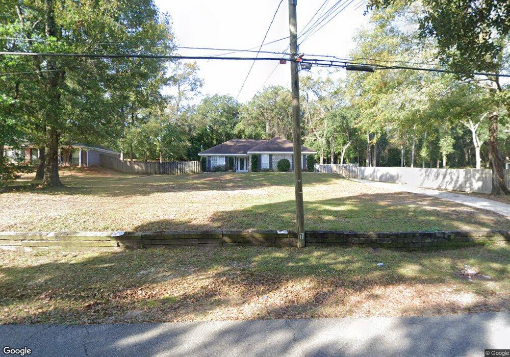
1465 Wilkins Rd Mobile, AL 36618
Autumndale NeighborhoodEstimated Value: $133,000 - $184,000
3
Beds
2
Baths
1,404
Sq Ft
$116/Sq Ft
Est. Value
About This Home
This home is located at 1465 Wilkins Rd, Mobile, AL 36618 and is currently estimated at $162,840, approximately $115 per square foot. 1465 Wilkins Rd is a home located in Mobile County with nearby schools including Forest Hill Elementary School, CL Scarborough Middle School, and Mattie T Blount High School.
Ownership History
Date
Name
Owned For
Owner Type
Purchase Details
Closed on
Apr 7, 2023
Sold by
Hill Alethea
Bought by
Watts Raymond E
Current Estimated Value
Purchase Details
Closed on
Apr 25, 2003
Sold by
Brown Demetrius and Brown Sonya
Bought by
Hill Alethea
Home Financials for this Owner
Home Financials are based on the most recent Mortgage that was taken out on this home.
Original Mortgage
$74,400
Interest Rate
5.79%
Mortgage Type
Construction
Create a Home Valuation Report for This Property
The Home Valuation Report is an in-depth analysis detailing your home's value as well as a comparison with similar homes in the area
Home Values in the Area
Average Home Value in this Area
Purchase History
| Date | Buyer | Sale Price | Title Company |
|---|---|---|---|
| Watts Raymond E | $170,000 | None Listed On Document | |
| Hill Alethea | $9,600 | -- |
Source: Public Records
Mortgage History
| Date | Status | Borrower | Loan Amount |
|---|---|---|---|
| Previous Owner | Hill Alethea | $74,400 |
Source: Public Records
Tax History
| Year | Tax Paid | Tax Assessment Tax Assessment Total Assessment is a certain percentage of the fair market value that is determined by local assessors to be the total taxable value of land and additions on the property. | Land | Improvement |
|---|---|---|---|---|
| 2025 | $715 | $22,160 | $2,500 | $19,660 |
| 2024 | $715 | $20,920 | $2,500 | $18,420 |
| 2023 | $496 | $8,850 | $1,250 | $7,600 |
| 2022 | $482 | $8,620 | $1,250 | $7,370 |
| 2021 | $459 | $8,270 | $1,000 | $7,270 |
| 2020 | $449 | $8,110 | $750 | $7,360 |
| 2019 | $442 | $8,020 | $0 | $0 |
| 2018 | $447 | $8,100 | $0 | $0 |
| 2017 | $493 | $8,820 | $0 | $0 |
| 2016 | $618 | $10,780 | $0 | $0 |
| 2013 | $595 | $10,340 | $0 | $0 |
Source: Public Records
Map
Nearby Homes
- 1209 Jean Dr
- 1758 La Pine Dr
- 1757 Le Grande Dr
- 4409 Eastview Dr
- 1553 Phillips Ln
- 1121 Stevens Ln
- 1561 Phillips Ln
- 1557 Phillips Ln
- 1701 Phillips Ln
- 1930 Le Jeune Dr
- 559 Brawood Dr
- 1100 Bristol Ct
- 2004 Beau Terra Dr W
- 305 Springwood Dr N
- 4636 Saint Charles Ct
- 506 Mann Dr
- 1312 Forest Cove Dr
- 1124 Forest Glen Dr N
- 11 Provident Ln
- 21 Provident Ln
- 1461 Wilkins Rd
- 3912 Pringle Dr
- 1455 Wilkins Rd
- 1471 Wilkins Rd
- 1466 Wilkins Rd
- 1462 Wilkins Rd
- 1470 Wilkins Rd
- 1458 Wilkins Rd
- 3916 Pringle Dr
- 3855 Autumndale Dr
- 1507 Wilkins Rd
- 1451 Wilkins Rd
- 1454 Wilkins Rd
- 3911 Pringle Dr
- 3913 Pringle Dr
- 3853 Autumndale Dr
- 1450 Wilkins Rd
- 1418 Pine Grove Ave
- 1461 Mamie Dr
- 1465 Mamie Dr
Your Personal Tour Guide
Ask me questions while you tour the home.