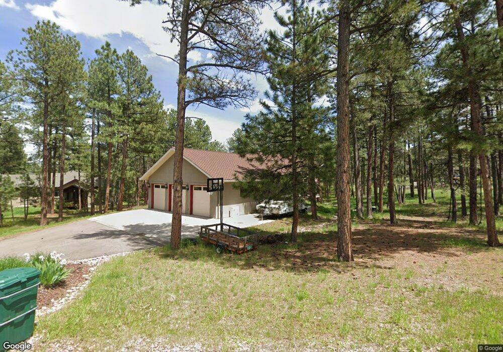
1466 Gore Cir Larkspur, CO 80118
Estimated Value: $1,129,000 - $1,328,000
5
Beds
5
Baths
5,378
Sq Ft
$222/Sq Ft
Est. Value
About This Home
This home is located at 1466 Gore Cir, Larkspur, CO 80118 and is currently estimated at $1,193,656, approximately $221 per square foot. 1466 Gore Cir is a home located in Douglas County with nearby schools including Larkspur Elementary School, Castle Rock Middle School, and Castle View High School.
Ownership History
Date
Name
Owned For
Owner Type
Purchase Details
Closed on
Jun 23, 2015
Sold by
Wilson Elizabeth S and Wilson Ii Franklin H
Bought by
Beaumont Timothy J and Beaumont Margaret L
Current Estimated Value
Home Financials for this Owner
Home Financials are based on the most recent Mortgage that was taken out on this home.
Original Mortgage
$512,000
Outstanding Balance
$398,669
Interest Rate
3.9%
Mortgage Type
New Conventional
Estimated Equity
$794,987
Purchase Details
Closed on
Apr 8, 2005
Sold by
Cassou Robert J
Bought by
Wilson Ii Franklin H and Wilson Elizabeth S
Home Financials for this Owner
Home Financials are based on the most recent Mortgage that was taken out on this home.
Original Mortgage
$130,000
Interest Rate
5.75%
Mortgage Type
Credit Line Revolving
Purchase Details
Closed on
Feb 8, 1974
Sold by
Mountain States Land Co
Bought by
Cassou Robert J
Create a Home Valuation Report for This Property
The Home Valuation Report is an in-depth analysis detailing your home's value as well as a comparison with similar homes in the area
Home Values in the Area
Average Home Value in this Area
Purchase History
| Date | Buyer | Sale Price | Title Company |
|---|---|---|---|
| Beaumont Timothy J | $640,000 | Heritage Title Co | |
| Wilson Ii Franklin H | $95,000 | Land Title | |
| Cassou Robert J | $10,500 | -- |
Source: Public Records
Mortgage History
| Date | Status | Borrower | Loan Amount |
|---|---|---|---|
| Open | Beaumont Timothy J | $512,000 | |
| Previous Owner | Wilson Ii Franklin H | $130,000 |
Source: Public Records
Tax History Compared to Growth
Tax History
| Year | Tax Paid | Tax Assessment Tax Assessment Total Assessment is a certain percentage of the fair market value that is determined by local assessors to be the total taxable value of land and additions on the property. | Land | Improvement |
|---|---|---|---|---|
| 2024 | $6,429 | $69,640 | $12,440 | $57,200 |
| 2023 | $6,493 | $69,640 | $12,440 | $57,200 |
| 2022 | $4,814 | $50,820 | $8,500 | $42,320 |
| 2021 | $4,984 | $50,820 | $8,500 | $42,320 |
| 2020 | $4,601 | $47,900 | $7,430 | $40,470 |
| 2019 | $4,617 | $47,900 | $7,430 | $40,470 |
| 2018 | $4,154 | $42,340 | $6,800 | $35,540 |
| 2017 | $3,904 | $42,340 | $6,800 | $35,540 |
| 2016 | $4,013 | $42,810 | $6,530 | $36,280 |
| 2015 | $3,925 | $42,810 | $6,530 | $36,280 |
| 2014 | -- | $36,960 | $4,700 | $32,260 |
Source: Public Records
Map
Nearby Homes
- 1275 Fremont Dr
- 7169 Independence Ct
- 1210 Kenosha Dr
- 1151 Kenosha Dr
- 7317 Fremont Place
- 1653 Gore Dr
- 1805 Senecio Dr
- 7013 Cinque Tail Dr Unit 31
- 1892 Lake Dr
- 1600 Independence Dr Unit 50
- 1065 Independence Dr
- 7076 Boreas Rd
- 7596 Rollins Dr
- 773 Copper Fox Place
- 682 Copper Fox Place
- 720 Copper Fox Place
- 1935 Poncha Ct
- 665 Copper Fox Place
- 648 Copper Fox Place Unit 5
- 1025 Tenderfoot Dr
- 1424 Gore Cir
- 1400 Kenosha Dr
- 0 Gore Cir Unit 6503881
- 1404 Gore Cir
- 1441 Gore Cir
- 1372 Kenosha Dr
- 171 Gore Cir
- 1449 Gore Dr
- 1429 Gore Cir
- 1409 Gore Cir
- 1425 Fremont Dr
- 1338 Kenosha Dr
- 1385 Fremont Dr
- 1455 Gore Cir
- 1470 Kenosha Dr
- 1355 Fremont Dr
- 1395 Gore Cir
- 1320 Kenosha Dr
- 1345 Fremont Dr
- 1500 Kenosha Dr