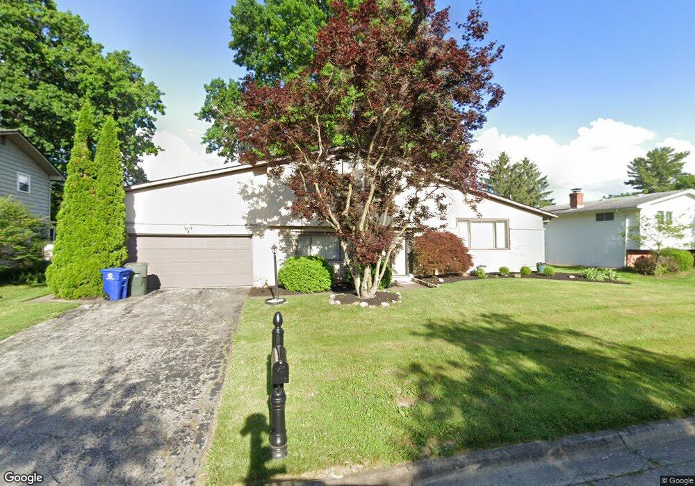
1466 Lonsdale Rd Columbus, OH 43232
Shady Lane NeighborhoodEstimated Value: $242,000 - $288,000
3
Beds
2
Baths
1,818
Sq Ft
$145/Sq Ft
Est. Value
About This Home
This home is located at 1466 Lonsdale Rd, Columbus, OH 43232 and is currently estimated at $263,385, approximately $144 per square foot. 1466 Lonsdale Rd is a home located in Franklin County with nearby schools including Woodcrest Elementary School, Sherwood Middle School, and Walnut Ridge High School.
Ownership History
Date
Name
Owned For
Owner Type
Purchase Details
Closed on
May 20, 2013
Sold by
Hampton Robert W
Bought by
Tinsley Pamela P
Current Estimated Value
Home Financials for this Owner
Home Financials are based on the most recent Mortgage that was taken out on this home.
Original Mortgage
$62,840
Outstanding Balance
$45,065
Interest Rate
3.75%
Mortgage Type
FHA
Estimated Equity
$218,320
Purchase Details
Closed on
Oct 21, 2008
Sold by
Deutsche Bank National Trust Company
Bought by
Hampton Robert W
Home Financials for this Owner
Home Financials are based on the most recent Mortgage that was taken out on this home.
Original Mortgage
$103,533
Interest Rate
6.49%
Mortgage Type
FHA
Purchase Details
Closed on
Aug 26, 2008
Sold by
Tall Souleye and Case #07Cve12 17283
Bought by
Deutsche Bank National Trust Co and First Franklin Mortgage Loan Trust 2005-
Home Financials for this Owner
Home Financials are based on the most recent Mortgage that was taken out on this home.
Original Mortgage
$103,533
Interest Rate
6.49%
Mortgage Type
FHA
Purchase Details
Closed on
Aug 31, 2005
Sold by
Browning Tyronne A and Browning Stacy L
Bought by
Tall Souleye and Dukuly Minnie E
Home Financials for this Owner
Home Financials are based on the most recent Mortgage that was taken out on this home.
Original Mortgage
$159,000
Interest Rate
8.25%
Mortgage Type
Stand Alone First
Purchase Details
Closed on
Feb 24, 2003
Sold by
Browning Tyrone A and Browning Stacy L
Bought by
Browning Tyronne A and Browning Stacy L
Home Financials for this Owner
Home Financials are based on the most recent Mortgage that was taken out on this home.
Original Mortgage
$137,350
Interest Rate
6%
Mortgage Type
Purchase Money Mortgage
Purchase Details
Closed on
Sep 17, 2002
Sold by
Browning Tyronne A and Browning Stacy L
Bought by
Browning Tyronne A and Browning Stacy L
Purchase Details
Closed on
Oct 30, 1997
Sold by
Kursinskis Juris
Bought by
Browning Tyronne A and Browning Stacy L
Create a Home Valuation Report for This Property
The Home Valuation Report is an in-depth analysis detailing your home's value as well as a comparison with similar homes in the area
Home Values in the Area
Average Home Value in this Area
Purchase History
| Date | Buyer | Sale Price | Title Company |
|---|---|---|---|
| Tinsley Pamela P | $64,000 | None Available | |
| Hampton Robert W | $104,900 | Resource T | |
| Deutsche Bank National Trust Co | $108,000 | None Available | |
| Tall Souleye | $159,000 | Arlington T | |
| Browning Tyronne A | -- | Tri-Source Title Agency | |
| Browning Tyronne A | -- | -- | |
| Browning Tyronne A | $117,500 | -- |
Source: Public Records
Mortgage History
| Date | Status | Borrower | Loan Amount |
|---|---|---|---|
| Open | Tinsley Pamela P | $62,840 | |
| Previous Owner | Hampton Robert W | $103,533 | |
| Previous Owner | Tall Souleye | $159,000 | |
| Previous Owner | Browning Tyronne A | $137,350 |
Source: Public Records
Tax History Compared to Growth
Tax History
| Year | Tax Paid | Tax Assessment Tax Assessment Total Assessment is a certain percentage of the fair market value that is determined by local assessors to be the total taxable value of land and additions on the property. | Land | Improvement |
|---|---|---|---|---|
| 2024 | $3,445 | $76,760 | $16,490 | $60,270 |
| 2023 | $3,401 | $76,755 | $16,485 | $60,270 |
| 2022 | $2,620 | $50,510 | $7,840 | $42,670 |
| 2021 | $2,624 | $50,510 | $7,840 | $42,670 |
| 2020 | $2,628 | $50,510 | $7,840 | $42,670 |
| 2019 | $2,453 | $40,430 | $6,270 | $34,160 |
| 2018 | $2,237 | $40,430 | $6,270 | $34,160 |
| 2017 | $2,342 | $40,430 | $6,270 | $34,160 |
| 2016 | $2,233 | $33,710 | $7,840 | $25,870 |
| 2015 | $2,027 | $33,710 | $7,840 | $25,870 |
| 2014 | $2,032 | $33,710 | $7,840 | $25,870 |
| 2013 | $1,146 | $37,450 | $8,715 | $28,735 |
Source: Public Records
Map
Nearby Homes
- 5366 Yorkshire Village Ln Unit B-22
- 5750 Hallridge Cir
- 1624 Coppertree Ln
- 5794 Hallridge Cir
- 5781 Hallridge Cir Unit B
- 1748 Sunapple Way Unit 1748
- 1759 Lonsdale Rd
- 5596 Autumn Chase Dr
- 1481 Riverton Ct E
- 5337 Ivyhurst Dr
- 1603 Hallworth Ct Unit 16038
- 5227 Ivyhurst Dr
- 0 E Main St
- 1859 Woodette Rd
- 1826-1828 Bairsford Dr
- 1486 Efner Dr
- 1815 Woodcrest Rd
- 5046 Connie Ct
- 1120 Fairway Blvd
- 1942 Bairsford Dr Unit 944
- 1454 Lonsdale Rd
- 1478 Lonsdale Rd
- 1477 Yorktown Rd
- 1491 Yorktown Rd
- 1465 Yorktown Rd
- 1446 Lonsdale Rd
- 1499 Yorktown Rd
- 1465 Lonsdale Rd
- 1453 Lonsdale Rd
- 1477 Lonsdale Rd
- 1453 Yorktown Rd
- 1445 Lonsdale Rd
- 1434 Lonsdale Rd
- 1485 Lonsdale Rd
- 1445 Yorktown Rd
- 5430 York Ln S
- 1433 Lonsdale Rd
- 1496 Yorktown Rd
- 1492 Yorktown Rd
- 1456 Devonhurst Dr